Printing this page
If you print this webpage it’s 48 pages at one page per sheet due to all the photos. The number drops to 12 pages if you set in your print setting to have four pages per sheet in Portrait layout, and 6 pages if you print it double-sided. You can access a text-only version of the walk, which printed will only be 9 pages.
Before you start
During the walk I point to boundary markers and other interesting or quirky landmarks between points along the walk. I recommend you skim and see what’s coming up between two points before you continue to the next one so you don’t miss out on anything and find you have to walk back.
Off we go!
Starting point: Manor Road opposite Stoke Newington Station
Section 1 of 5: The North Eastern Boundary (1.47km/0.9mi)
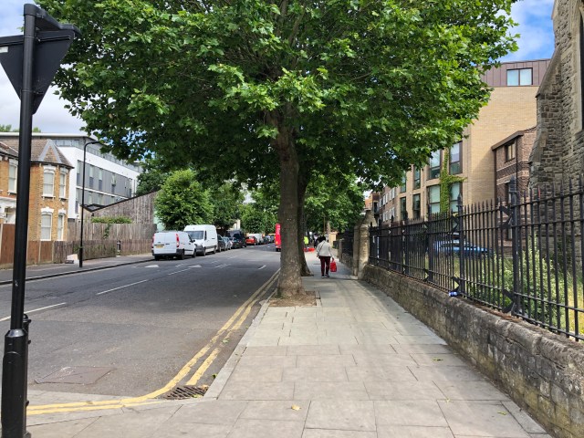
1. Turn LEFT onto Manor Road
430m/1410ft to Bethune Road

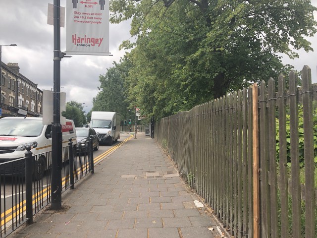
Old gas lamppost
As you walk down Manor Road, you pass a relic of a gas lamppost outside no. 18. It’s very odd that it has survived for this long in that spot and is the only such lonely gas lamppost I’ve seen in the area.

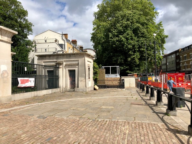
2. Turn RIGHT onto Bethune Road and RIGHT again into Allens Gardens
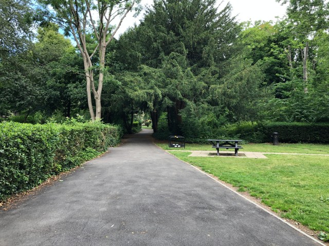
The boundary line ran along where the rail line is now so walking through Allens Gardens is the closest we can get to the old boundary between Stoke Newington and Hackney. If you prefer not to go through Allens Gardens, you can continue straight along Bethune Road instead to Point 6.
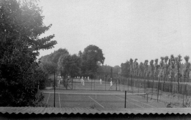
What is now a public garden used to be Allens Estate’s communal garden, tennis courts and croquet lawn seen here in 1937.
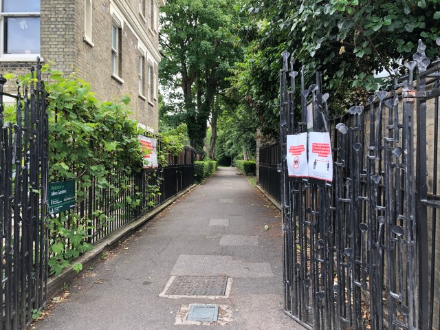
3. Turn LEFT towards Sanford Court
230m/754ft to Sanford Court
4. Continue walking through Sanford Court to Dunsmure Road
Edit (Nov 9th 2020): The carpark of Sanford Court is used as a Coronavirus testing site at the moment so you cannot go through it. If it it is still blocked, you bypass it by turning left and then right back onto Bethune Road, walking the entire length of Bethune Road, which means you skip steps 5 and 6 and continue to follow the direction from step 7 when you reach Amhurst Park.
130m/426ft to Dunsmure Road
5. Turn LEFT onto Dunsmure Road
65m/213ft to Bethune Road
The boundary line was slightly to your right opposite West Bank as you enter Dunsmure Road. St Andrew’s Church, which you’ll pass in a minute was within the borough, but it’s not possible to walk around it so we’ll continue on Dunsmure Road to Bethune Road.
6. Turn RIGHT onto Bethune Road
530m/1738ft to Amhurst Park
Section 2 of 5: The Northern Boundary (2.53km/1.57mi)
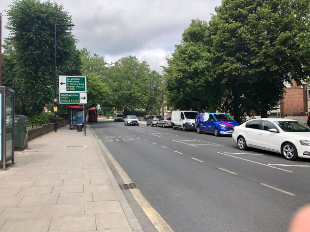
7. Turn LEFT onto Amhurst Park
170m/557ft to Seven Sisters Road
8. Turn RIGHT onto Seven Sisters Road and then cross the road

9. Turn LEFT onto Eade Road
Origin of the street name
The Eade family held the lease to the Manor of Stoke Newington in the late 18th century-mid 19th century. Jonathan Eade was the highest bidder with £13,000 when the manor of Stoke Newington including the Abney estate where Abney Park Cemetery is now was auctioned on the 26th of May 1783.

10. Walk the entire length of Eade Road to Hermitage Road. Keep an eye for a parish boundary marker halfway down the road (Further details below)
810m/2657ft to Hermitage Road
The New River is on the left
The New River is an artificial waterway, which opened in 1613 to supply London with fresh drinking water from Hertfordshire. Until 1946 it ended in New River Head in Sadler’s Wells, Islington. Since 1946 it the New River ends in the East Reservoir in Stoke Newington. The section in Eade Road is part of the New River’s original course.
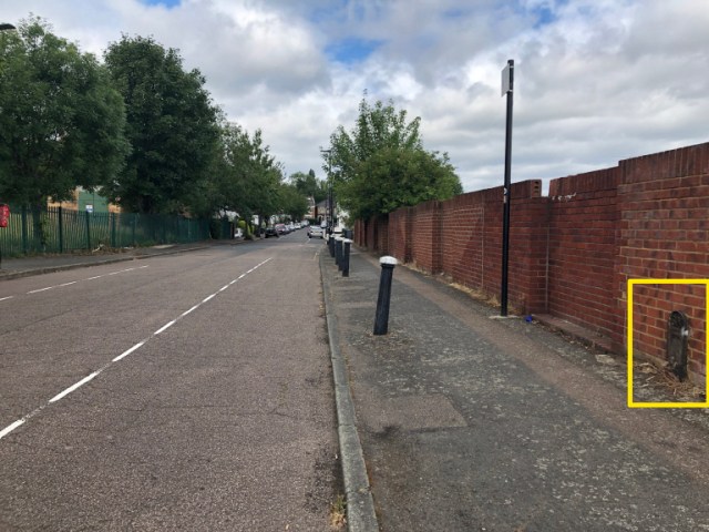
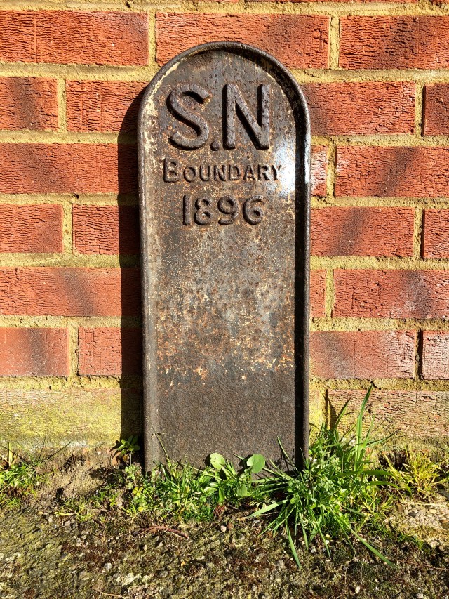
Boundary Marker Alert
Halfway down the very long brick wall shortly after you pass the junction with Linkway and a vehicle barrier, you’ll see on the pavement set against the brick wall a Stoke Newington Parish boundary marker from 1896. It’s the only such Stoke Newington parish boundary marker in the walk. I was very excited to spot it having walked down the Eade Road several times before and not notice any indication of the parish or borough boundary.
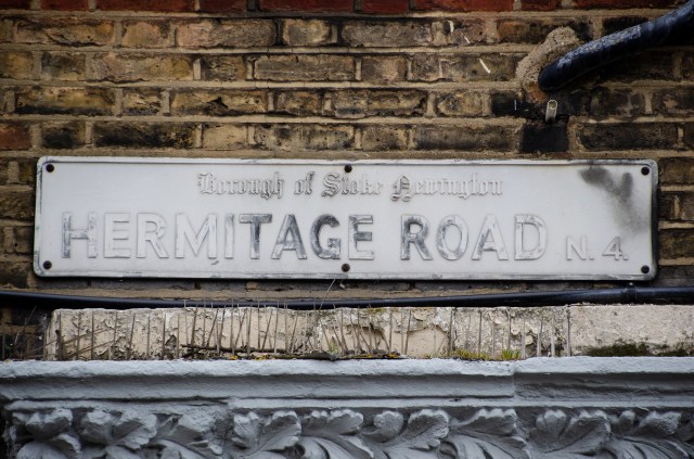
11. Turn LEFT onto Hermitage Road
100m/328ft to Green Lanes
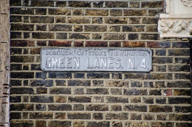
12. Turn RIGHT onto Green Lanes
80m/262ft to crossing
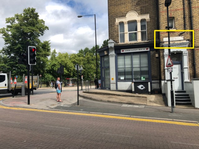
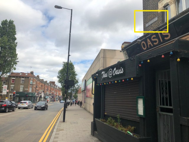
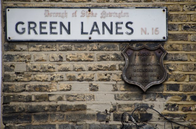
Street Sign Alert
Street sign like this one with ‘Borough of Stoke Newington’ were placed along the boundaries and as such served an informal boundary marker. This one dates back to the early 1960s. There are only 17 such signs left in Stoke Newington.
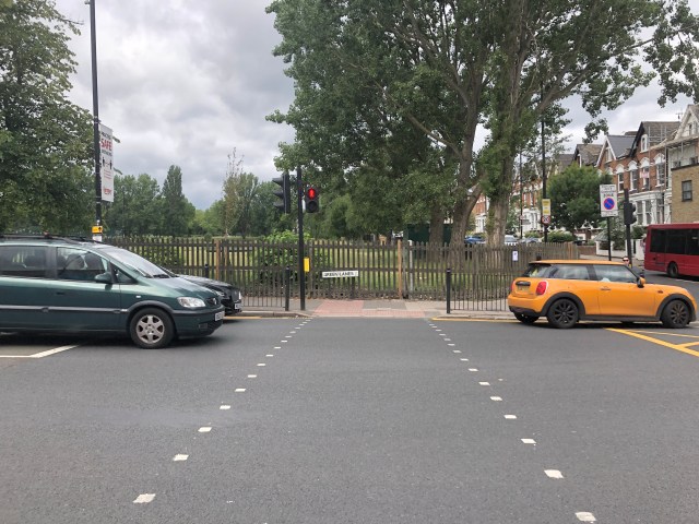
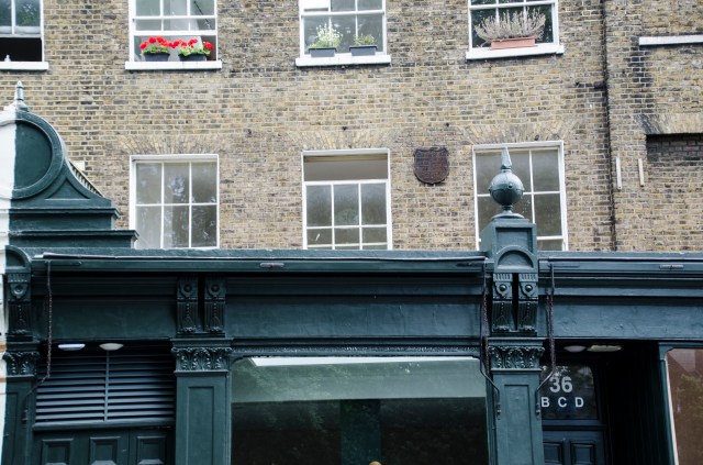
You’ve reached the northmost point of the Borough of Stoke Newington!
Look up to the right at no. 388 and you’ll see a ‘Borough of Stoke Newington’ street sign indicating the borough’s boundary reached this point.
13. Cross the road at the lights and turn LEFT, making a U-Turn and heading back on Green Lanes
14. Walk along Green Lanes to Manor House
500m/1640ft to Manor House
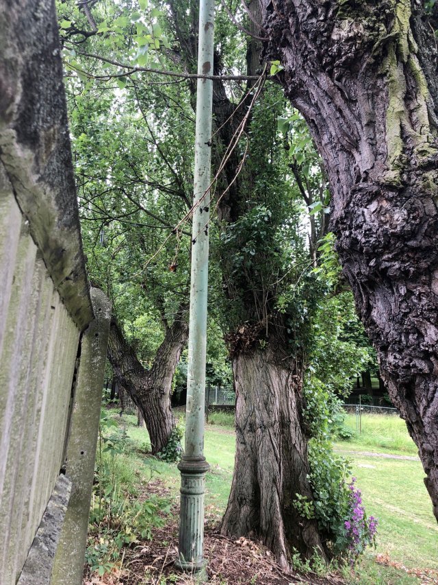
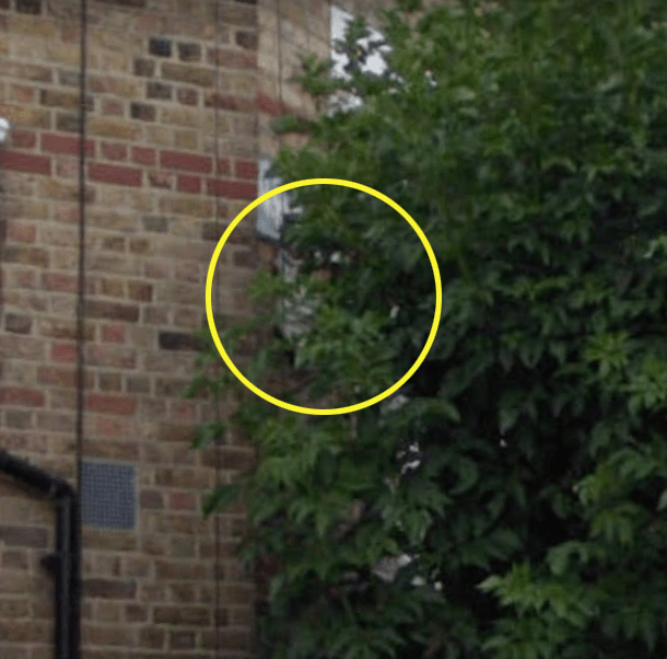
Victorian ‘Stinkpipe’
Opposite no. 360 Green Lanes as you pass the Baseball field not far from the junction you can see behind the fence a Victorian ‘Stinkpipe’. These sewer ventilation pipes can often be mistaken for an old lamppost. They were usually painted green, and this one is very easy to miss as it blends so well with the surrounding trees, which was probably the intention.
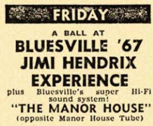
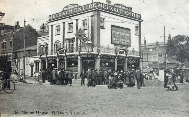
The former Manor House Tavern
In the 1960s, the Manor House Tavern, which is now a supermarket and a greengrocer was a popular music venue. Bands that performed there included: The Who, The Spencer Davis Group, Cream, Jimi Hendrix, Fleetwood Mac, The Rolling Stones, The Yardbirds, The Animals and Fairport Convention.
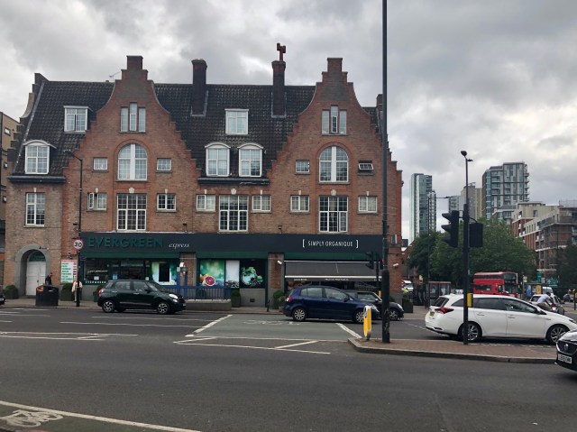
This was the original Victorian pub. It was pulled down and a new was built on the site in 1931 when Manor House Tube Station was built.
15. Turn RIGHT onto Seven Sisters Road
Alternatively, if you prefer a greener route, you can enter Finsbury Park through the gate on the right and walk parallel to Seven Sisters Road till you reach the main gate at the bottom not far from Blackstock Road (Step 17).
880m/2887ft to Blackstock Road

16. Walk down Seven Sisters Road along Finsbury Park towards Blackstock Road
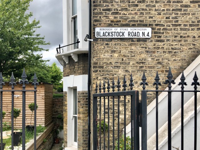
17. Turn LEFT at the main junction onto Blackstock Road
Section 3 of 5: The Western Boundary (2.3km/1.83mi)
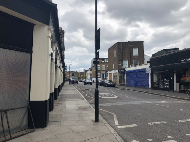
18. Walk along Blackstock Road towards Mountgrove Road
600m/1968ft to Mountgrove Road
Street Sign Alert
The first street on your left as you made way down Blackstock Road is Somerfield Road. On no. 1 Somerfield Road just before no. 51 Blackstock Road you can see a restored ‘Borough of Stoke Newington’ street sign from the 1930s. It was restored a few years ago and looks great now. Sadly, such old signs that aren’t restored by homeowners are at risk of being removed by the council if they are deemed to be no longer fit-for-purpose.
19. Turn LEFT onto Mountgrove Road
350m/1148ft to Riversdale Road
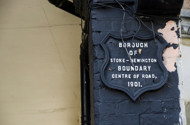
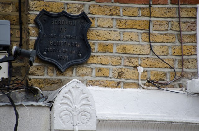
Boundary Marker alert
The Arsenal Tavern on the corner of Blackstock Road/Mountgrove Road has two Borough of Stoke Newington Boundary Markers. These markers were placed along the Borough’s boundaries but only 7 are still around. The others, some of which can be seen in old photos, were removed over the years or lost due to redevelopment.
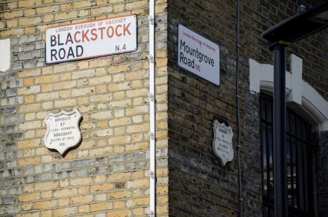
There’s another Borough Boundary Marker in King’s Crescent, about 2-3m walk from Blackstock Road.
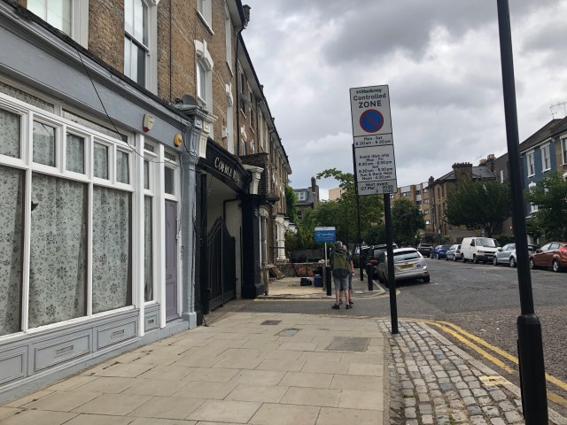
20. Stay on the LEFT and continue with the road as it turns to Riversdale Road
135m/442ft to Green Lanes
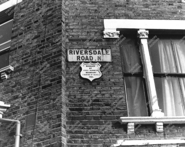
Boundary Marker alert
There’s a Borough of Stoke Newington boundary marker on the corner of Riversdale Road/Mountgrove Road, but it’s very difficult to see it today because it’s completely hidden behind a tree in the front garden. If you are doing the walk in the winter you may be lucky enough to see it. As an extra bonus, it’s right next to a very rare street sign with the pre-1917 ‘N’ postal district. There are only 3 surviving streets signs with ‘N’ within the boundaries of the former borough.
21. Turn RIGHT onto Green Lanes, cross the road to the LEFT and then RIGHT

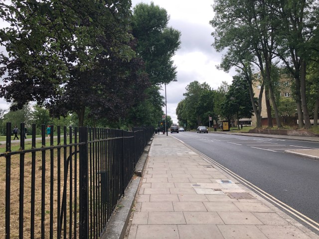
22. Walk along Clissold Park towards Petherton Road
480m/1574ft to Petherton Road
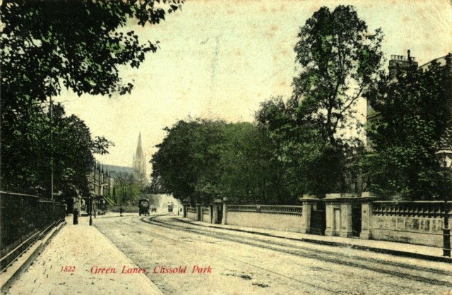
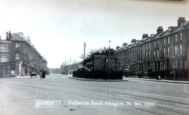
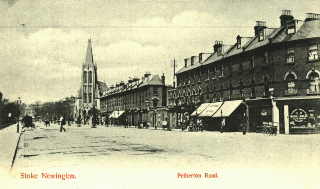
Green Lanes in 1906 looking south with the spire of the Green Lanes Methodist Church in the distance.
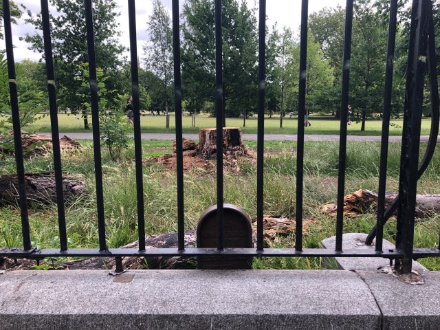
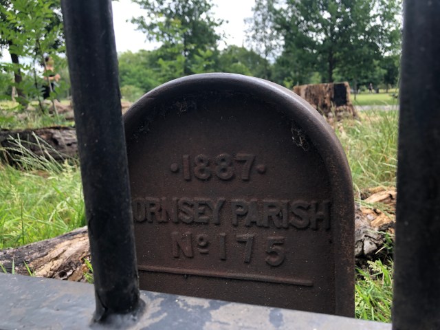
Boundary Marker Alert
Before you get to Stoke Newington Church Street, about 15m before the recycling bins, there’s an 1887 Hornsey Parish boundary marker behind the railings facing Green Lanes. The western side of Clissold Park was originally within Horsney Parish. This section of the park, along with three others parts of South Hornsey were incorporated into the Metropolitan Borough of Stoke Newington when it was created in 1900.

23. Cross Stoke Newington Church Street and continue to Petherton Road
24. Bear RIGHT onto Petherton Road
200m/656ft to Leconfield Road

The central reservation wasn’t created till the 1980s. The reason Petherton Road is so wide is because the New River originally ran in the middle of the road. It was culverted (covered) in the 1860s, and this section was drained in 1946 once the New River ended in the East Reservoir rather than New River Head in Sadler’s Wells in Islington.
25. Turn LEFT onto Leconfield Road
145m/475ft to Green Lanes
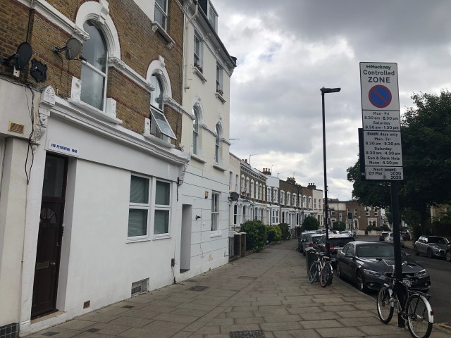
This was the view of Petherton Road with Leconfield Road on the right. The New River was culverted in the 1860s and this section was drained in 1946 when the New River ended in the East Reservoir instead of Islington. The central reservation was created in the 1980s.
Boundary Marker Alert
There’s a Borough Boundary Marker above 108 Petherton Road as you turn onto Leconfield Road
26. Turn LEFT towards Green Lanes
50m/164ft to Green Lanes
Boundary Marker Alert
Straight in front of you as you come from Leconfield Road you’ll see above 78 Green Lanes another Borough Boundary Marker and a 1930’s street sign.
27. Turn RIGHT onto Green Lanes
330m/1082ft to Newington Green

Section 4 of 5: The Southern Boundary (880m/0.54mi)
28. Cross Albion Road and walk along Newington Green to Matthias Road
40m/131ft to Matthias Road
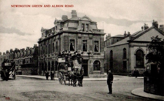
The building on the corner of Albion Road and Newington Green when you cross the road was originally the London And Provincial Bank. It was later Barclays Bank and after the branch closed it was converted to flats.
‘Ghost’ Boundary Marker Alert
There used to be a Borough boundary marker on the corner of Albion Road/Newington Green on the former bank building till a few years ago when the building was renovated.
Boundary Marker Alert
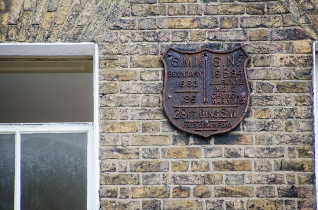
As you walk towards Matthias Road, you’ll see a dual-parish boundary marker on no. 36 Newington Green. The north side of Newington Green was within Stoke Newington and the rest in Islington.
In includes the names of two Stoke Newington Churchwardens: John Johnson Runtz and William Eve. John Johnson Runtz became the first Mayor of Stoke Newington when the borough was created in 1900. His father, also John Runtz, was one of the two chief-campaigners together with Joseph Beck who saved Clissold Park from development in the 1880s. William Eve was Mayor of Stoke Newington in 1901-2. His daughter Carrie Maude Eve was Mayor in 1924-5.
29. Continue straight along Matthias Road
380m/1246ft to Boleyn Road
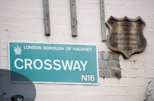
30. Walk straight down Boleyn Road to Crossway
240m/787ft to Crossway
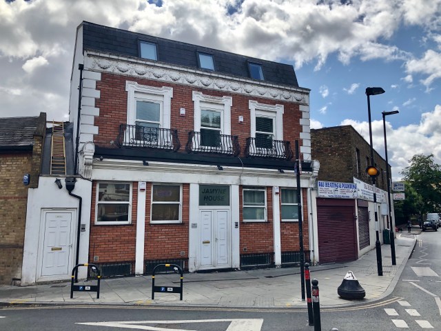
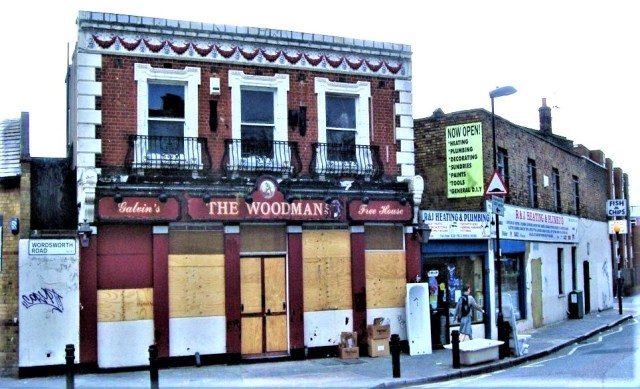
The former Woodman pub
192 Boleyn Road on the corner of Wordsworth Road was the Woodman pub. It is one of 20 Stoke Newington pubs that have closed over the decades.
31. Turn LEFT onto Crossway
210m/688ft to Stoke Newington Road
Boundary Marker Alert
Look up when you get to the junction with Stoke Newington Road and you’ll see a Borough of Stoke Newington Boundary Marker. There’s another one just around the corner on Stoke Newington Road as you turn left at the next point.
Section 5 of 5: The Eastern Boundary (1.5km/0.93mi)
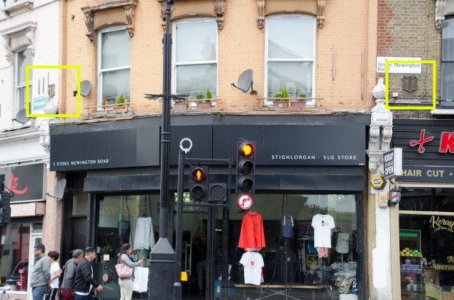
32. Turn LEFT onto Stoke Newington Road
745m/2444ft to Stoke Newington High Street
There are quite a few things to see along Stoke Newington Road as you continue towards Stoke Newington High Street so have a quick look at what’s coming up so you don’t miss anything.
Boundary Marker Alert
The last Boundary Marker of the walk is on no. 3 Stoke Newington Road as you turn onto Stoke Newington Road from Crossway.
Street Sign Alert
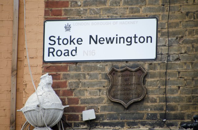
Before continuing, look across the street and you’ll see a pre-1965 ‘Borough of Hackney’ Stoke Newington street sign. The eastern side (even numbers) of the road was within Hackney and the western side (odd numbers) was within Stoke Newington.
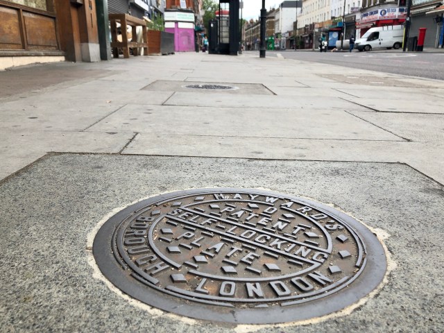
Coalhole Cover
Outside no. 9 Stoke Newington Road not far from the junction, you can see a disused coalhole cover on the pavement. It was cast by Hayward Brothers; a renowned foundry that was based in Borough. Coalhole covers were used to access the coal cellar and allow the coal merchant to deliver coal for heating without needing to go into the property. Coalhole covers came in many varied designs, some very ornate. I’ve documented 101 different ones in Stoke Newington. Haywards’ coalhole covers were popular and are very common. Look for them outside shops and front doors. You’ll be amazed just how many designs exist.
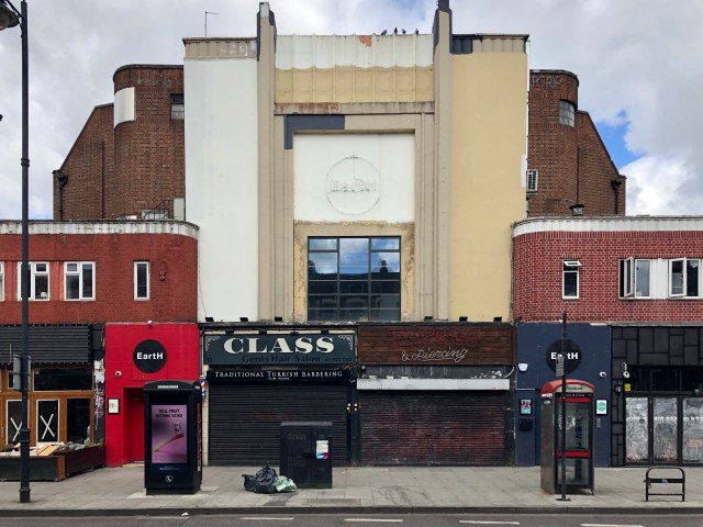
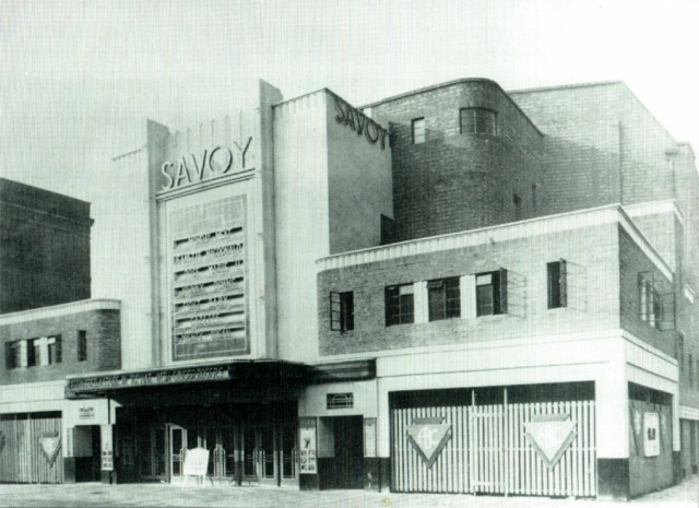
The former Savoy Cinema
17 Stoke Newington Road, now EartH, was originally a cinema. There were a number of cinemas along Stoke Newington Road, which I’ll call out as you walk towards the High Street. Originally named The Savoy, it was built for and operated by Associated British Cinemas (ABC), and was designed by their in-house architect William R. Glen in an Art Deco style. Seating was provided for 1,890 in stalls and balcony levels. It opened in 1936 and closed in 1984.
The Coliseum Cinema (1913-1972, Demolished 2012) wasn’t far at no. 31 where Brewdog is now.
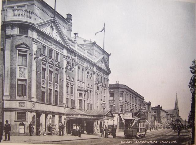
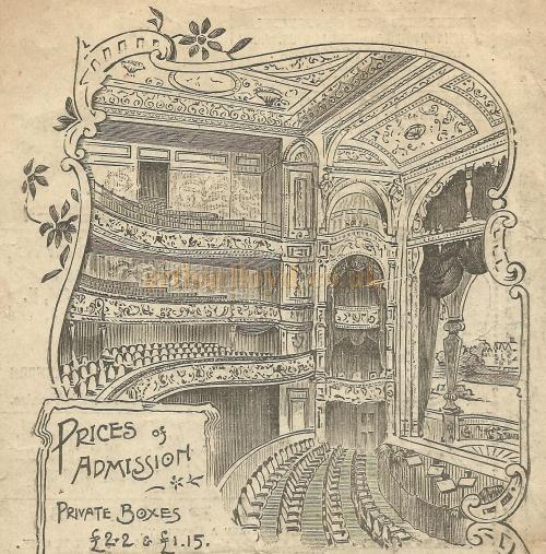
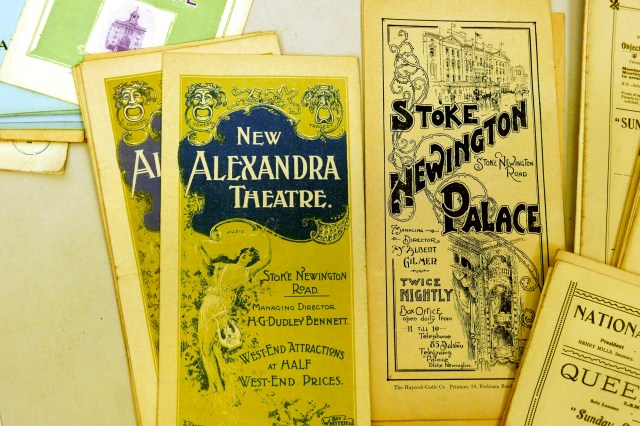
The site of the Alexandra Theatre (Princess May Road/Stoke Newington Road)
The Alexandra Theatre at 65-7 Stoke Newington Road was designed by Frank Matcham (1854-1920) who also designed the Hackney Empire. It was built in 1897 and closed in 1950. It stood derelict till the early 1960s when it was pulled down and Alexandra Court housing block was built on the site.
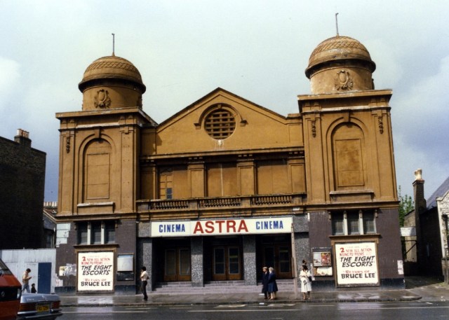
The former Apollo Cinema
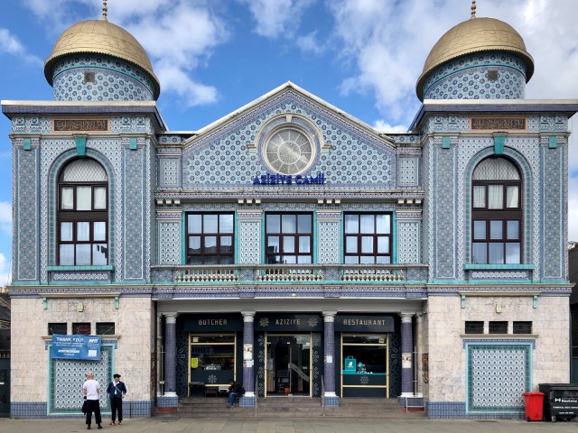
Now Aziziye Mosque and Community Centre, 117 Stoke Newington Road, was originally a cinema. It opened as the Apollo Picture House in 1913. It re-opened as the Ambassador Cinema in 1933. The Ambassador Cinema closed in 1963. After a short while of closure it was into a bingo hall in 1965. It re-opened in 1974 as the Astra Cinema. By 1978 it became a cinema club playing uncensored martial arts movies and soft core sex films, finally closing in 1983.
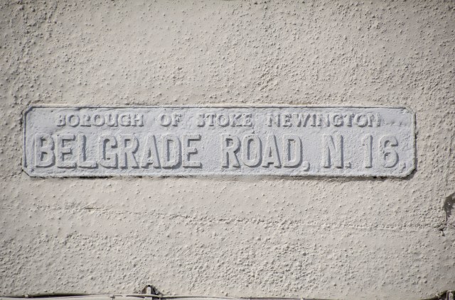
Street Sign Alert
There was a ‘Borough of Stoke Newington’ street sign like this one in every street corner along Stoke Newington Road and Stoke Newington High Street. This one in Belgrade Road is pretty much camouflaged and very easy to miss.
33. Continue straight along Stoke Newington High Street
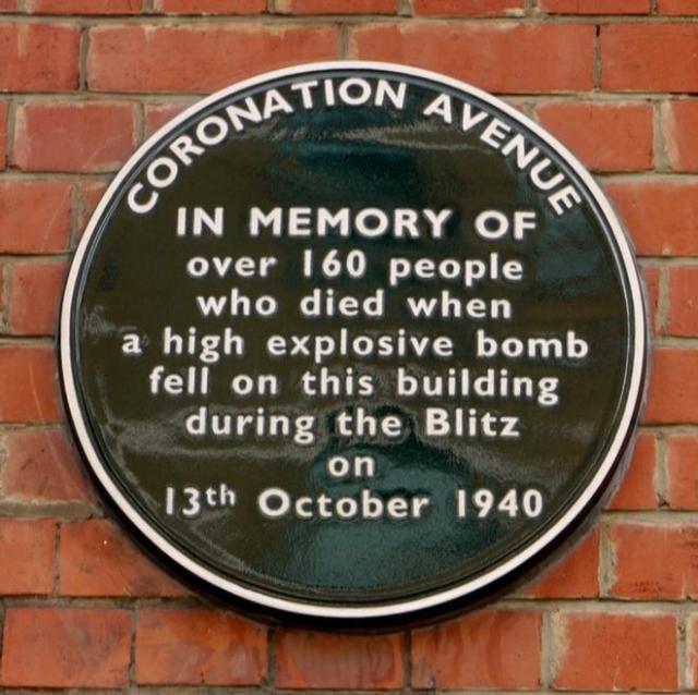
Coronation Avenue Disaster
Before you continue and pass the Police Station, turn into Victorian Road and straight on the left you’ll see a commemorative plaque for 160 people who died on 13th October 1940. A parachute-mine caused an entire block of flats to collapse into the communal shelter underneath. The bomb penetrated into the shelter beneath the building where many of the residents had sought refuge during the night-time air raids.
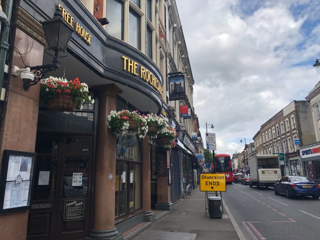
The Rochester Castle, a popular music venue in the 1970s
Acts that played here included: Gary Numan, Bad Manners, The Jam, The Police, XTC, Berlin, Dire Straits, Adam and the ants, Ian Dury, The Damned, Bill Bragg, Sid Vicious and Riff Raff.
34. Cross Stoke Newington Church Street and walk up Stoke Newington High Street to Abney Park Cemetery to complete the walk
220m/721ft to Abney Park Cemetery

Congratulations! You’ve completed the walk!
I hope you enjoyed it and look forward to hear how it went. Do get in touch if you’d like to submit a testimonial, which I’ll include to the walk description without mentioning your name.