Total distance: 6.5km
Section 1 of 2: The Southern Division (4.3km)
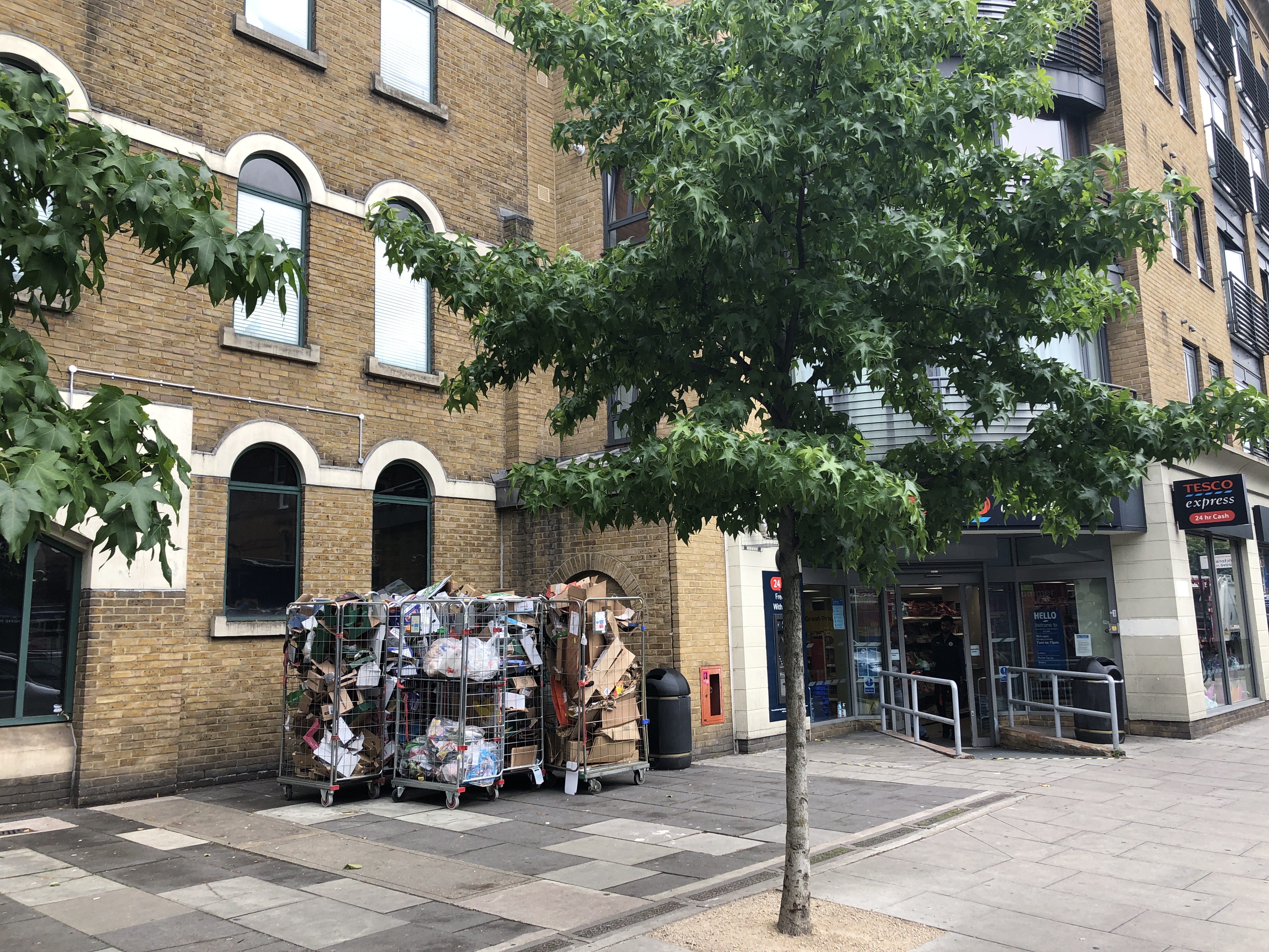
Starting point – Stoke Newington Police Station
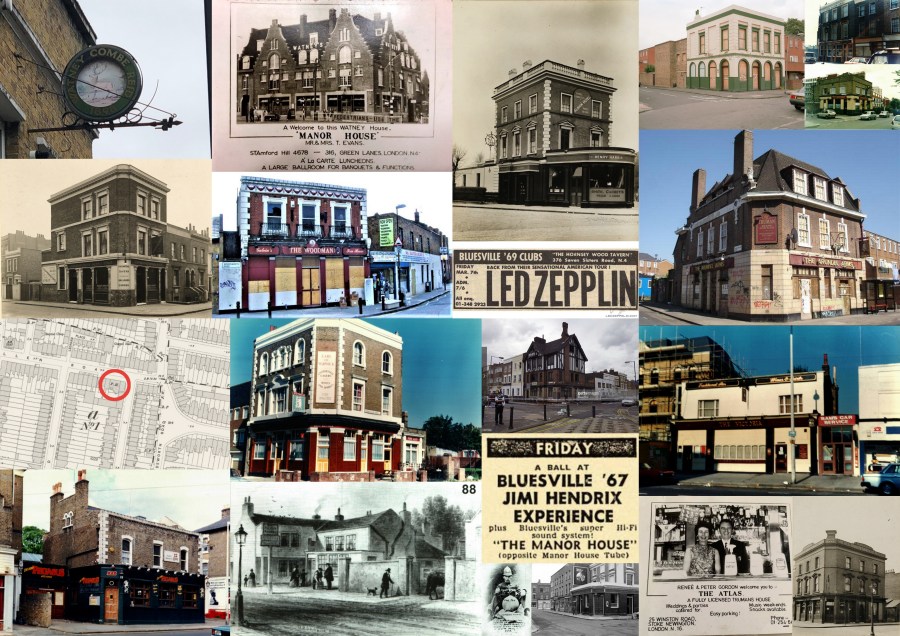
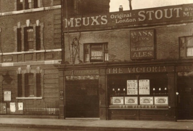
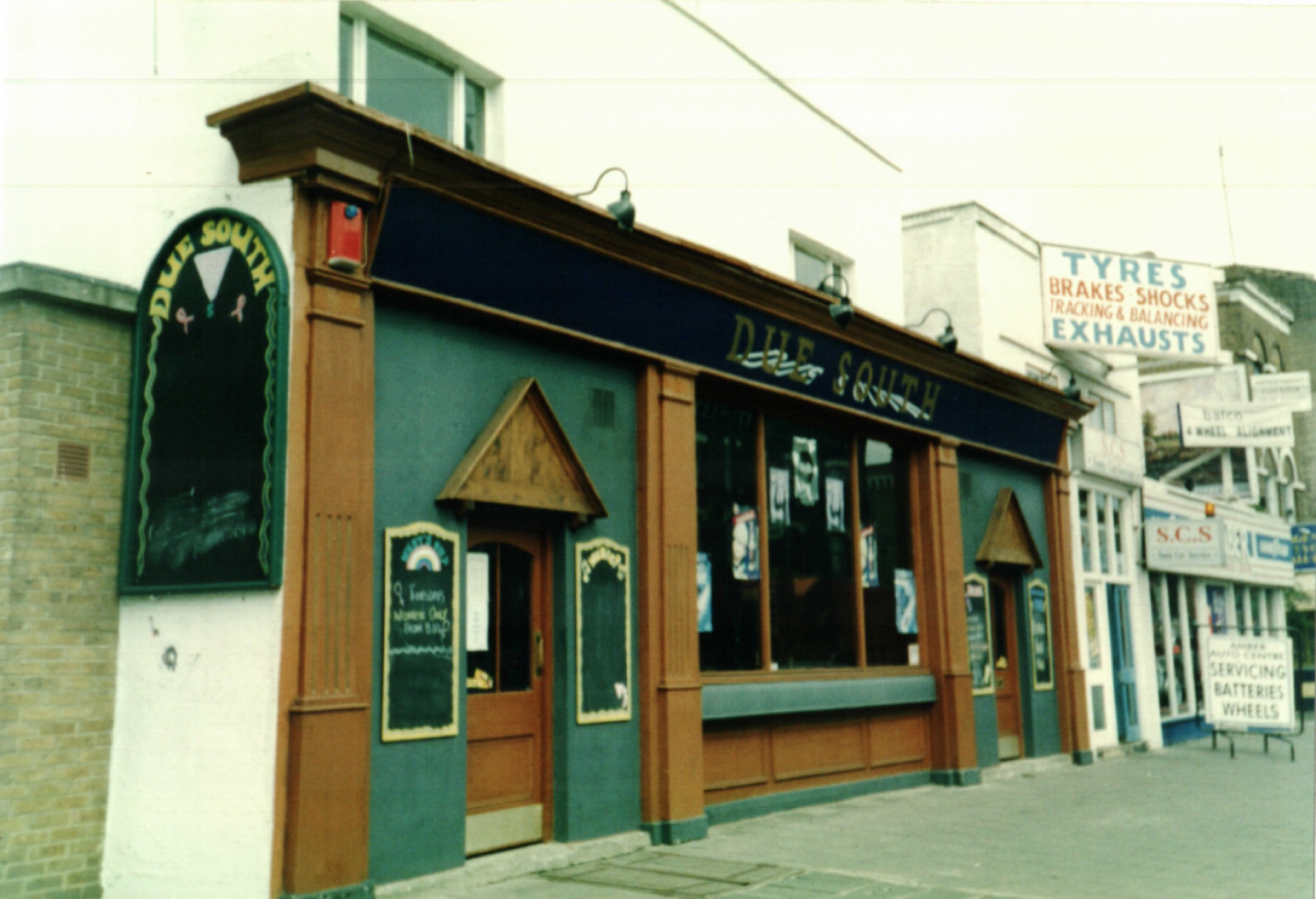
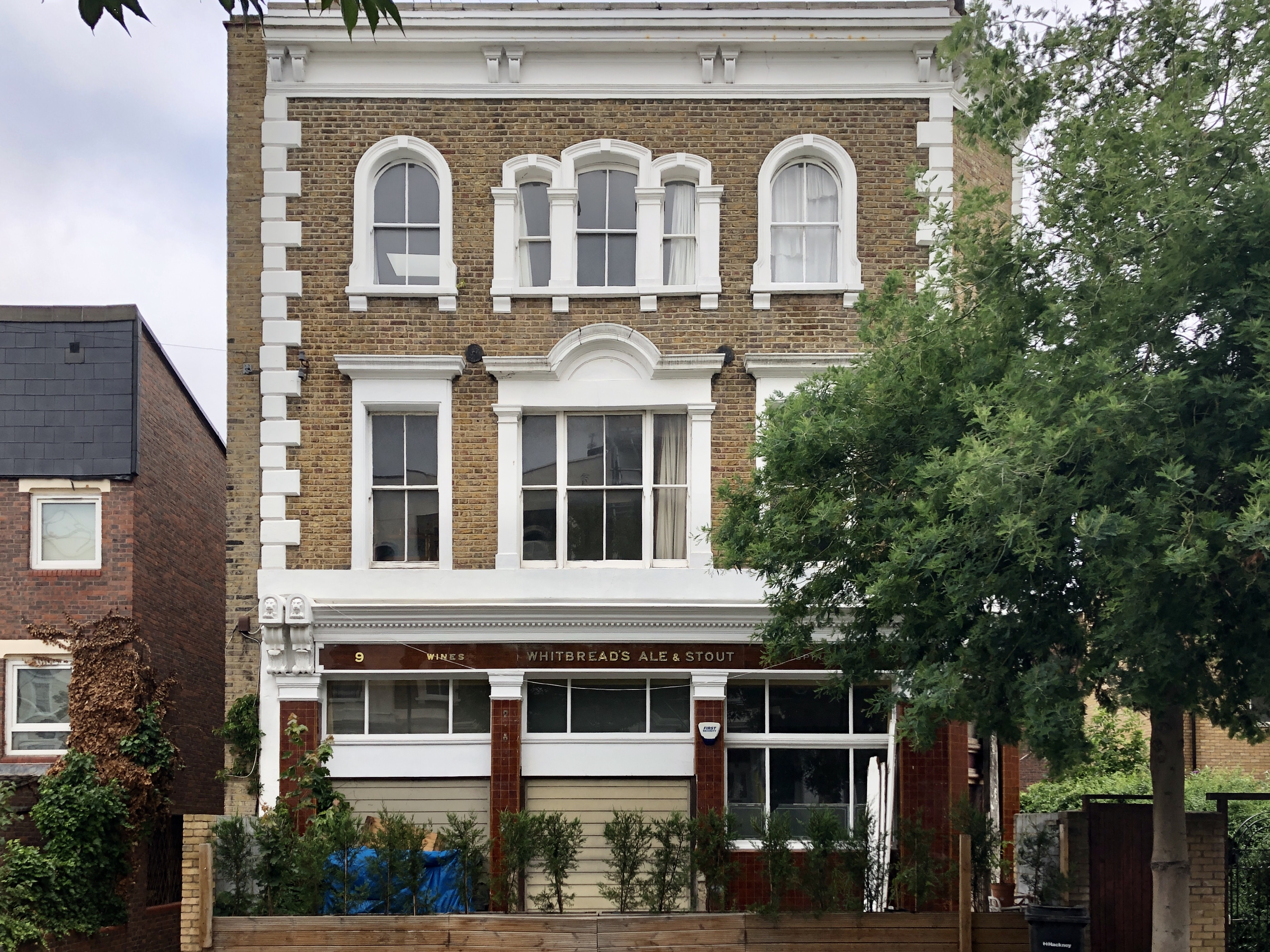
The Victoria, 35 Stoke Newington High Street
Years active: By 1866-at least 1996. Demolished. Other names: Due South.
We begin the walk outside Stoke Newington Police Station where the Victoria pub stood where the entrance to Tesco is now. As you’d imagine, the pub was a ‘police pub’ and it survived till the mid-late 1990s.

Let’s continue: 314m to the Earl of Warwick, 9 Beatty Road
1. Walk south towards Stoke Newington Road
2. Turn right into Beatty Road (2nd right)
Earl of Warwick, 9 Beatty Road
Years active: By 1872-at least 1988. Converted to residential use.
The Earl of Warwick is one of only four pub buildings along the walk, which have survived once the pub closed. All the rest were demolished and there’s no trace they ever existed unfortunately. The original signage is in very good condition and it almost feels like you can walk in and order a pint still.

Let’s continue: 210m to the Prince Albert, 33 Victoria Road
3. Continue down Beatty Road
4. Turn right into Gunstor Road
5. Up the steps on the left at the end of the road
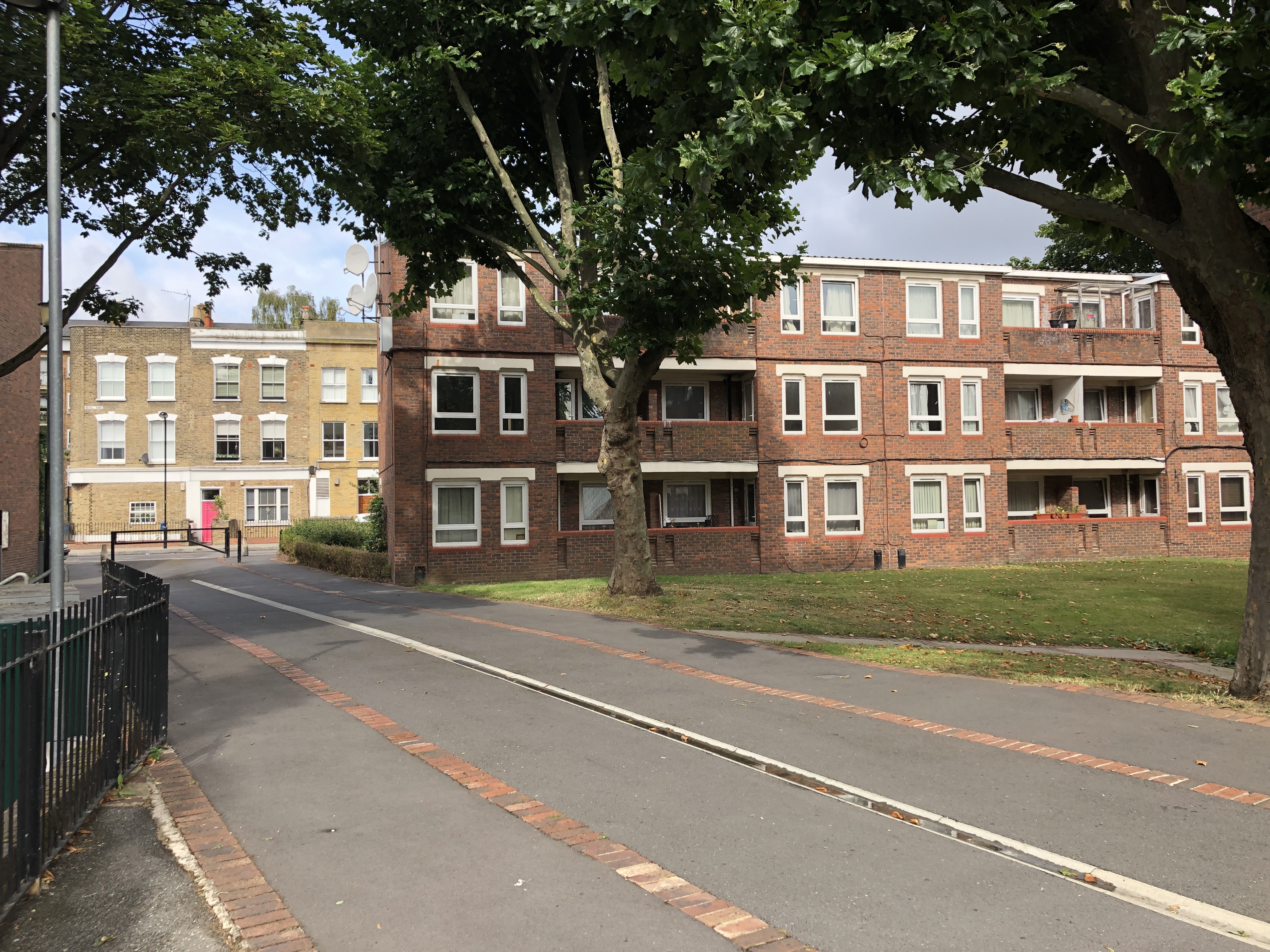
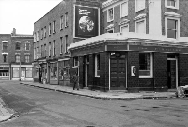
The Prince Albert, 33 Victorian Road
Years active: By 1851-at least 1962. Demolished.
The Prince Albert stood on the corner of Victoria Road and Gunstor Road, where the grass behind the flats is now. The area between Nevill Road and Stoke Newington High Street was transformed dramatically in the late 1970s when Yorkshire South Estate was built on the site of Victorian streets.
Let’s continue: 120m to The Nevill, 31 Nevill Road
6. Turn left towards Nevill Road
7. Turn left into Nevill Road
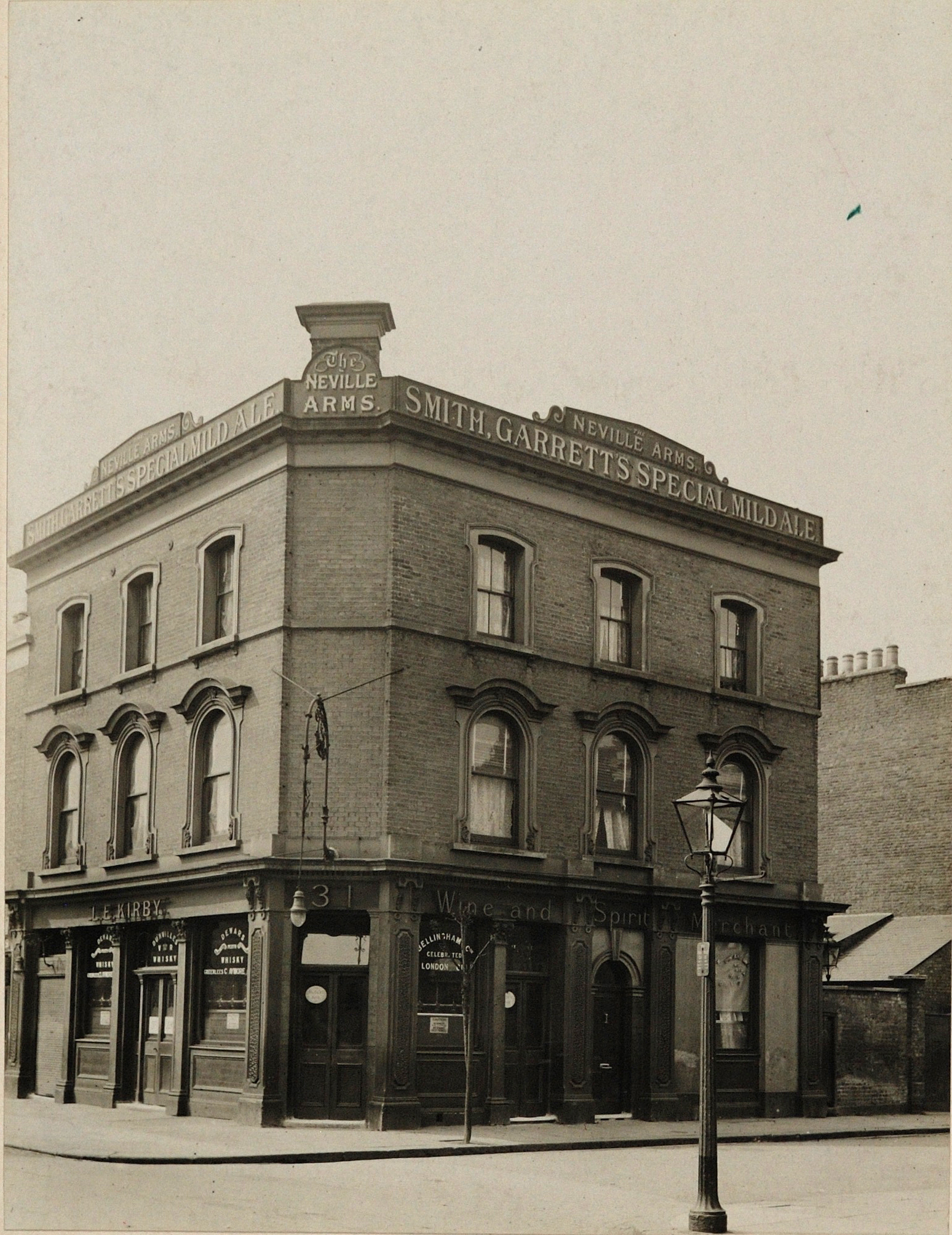
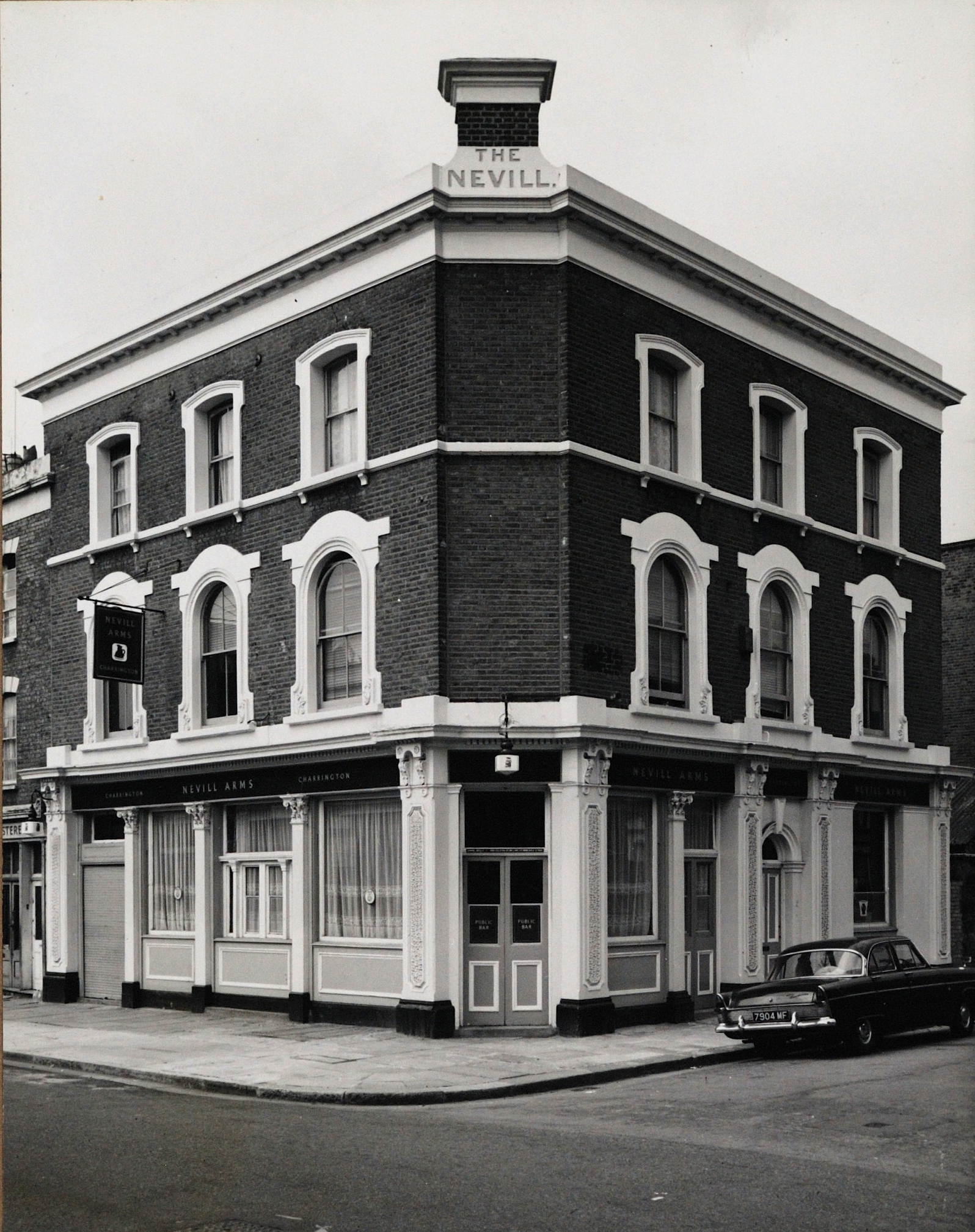
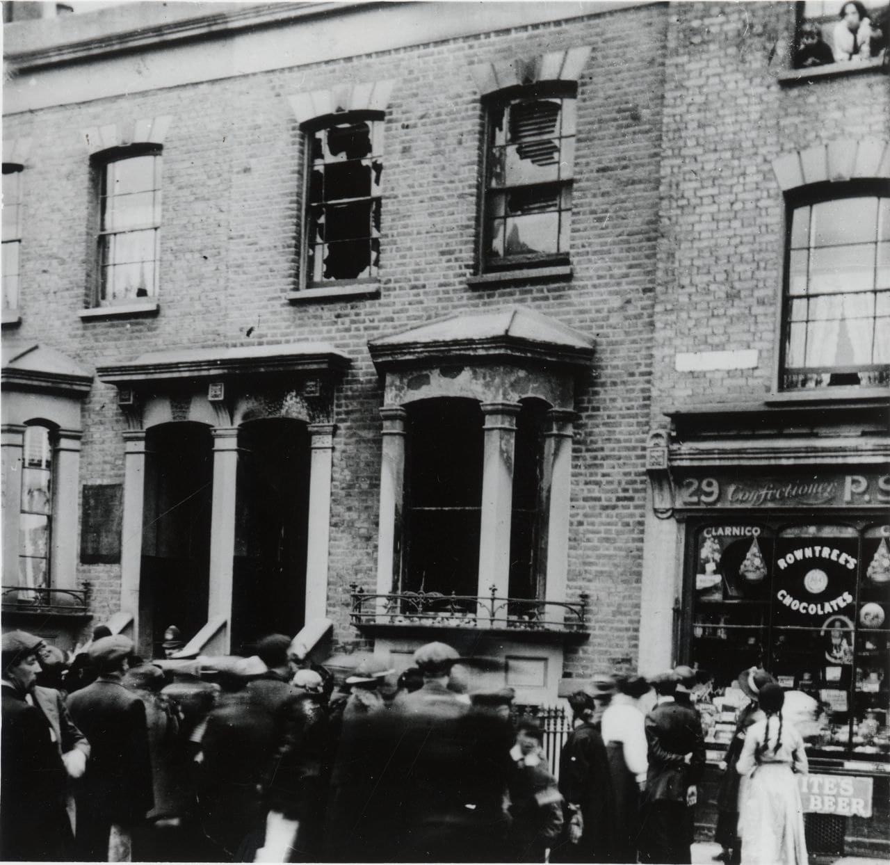
The Nevill, 31 Nevill Road
Years active: By 1874-at least 1984. Converted to residential use.
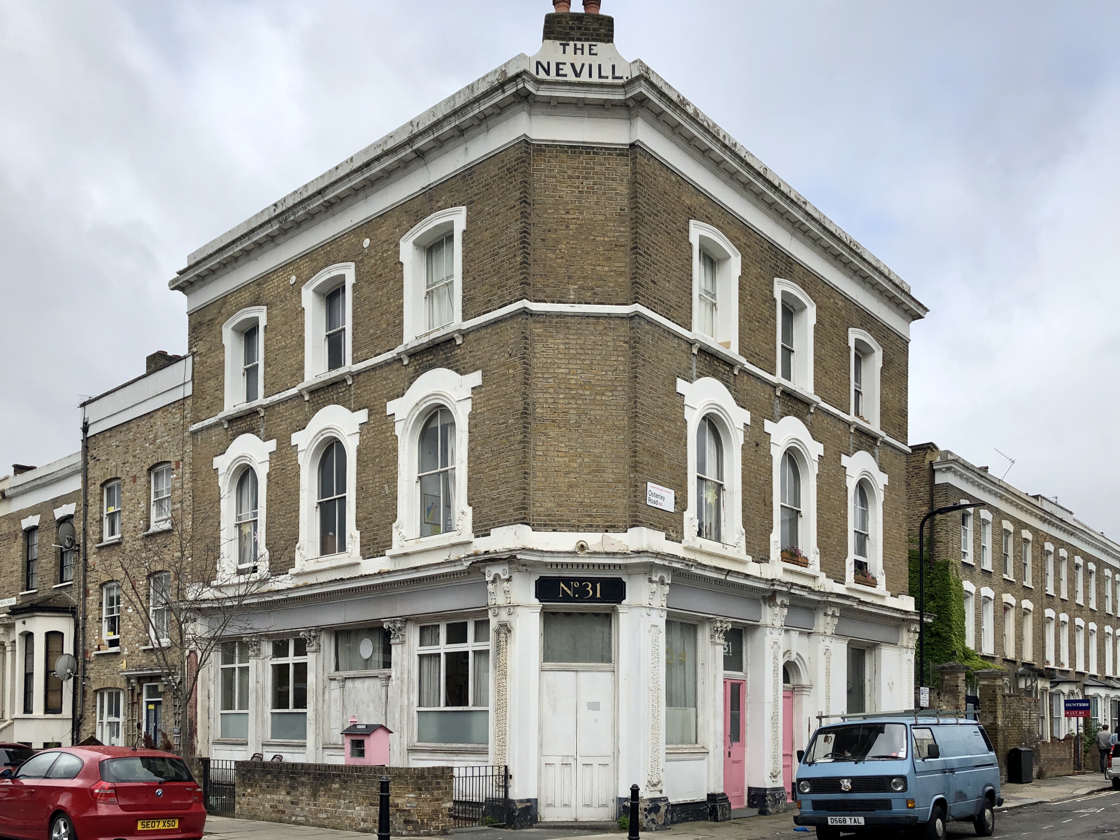
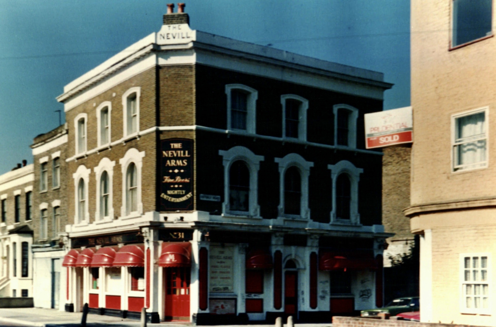
Till earlier this year, the pub sign seen in the photo above was used to block access to the cellar. A sad end.
31st May 1915 – PC Edmund Forbes displaying the unexploded bomb dropped behind the Navill Arms pub during London’s 1st Zeppelin raid.
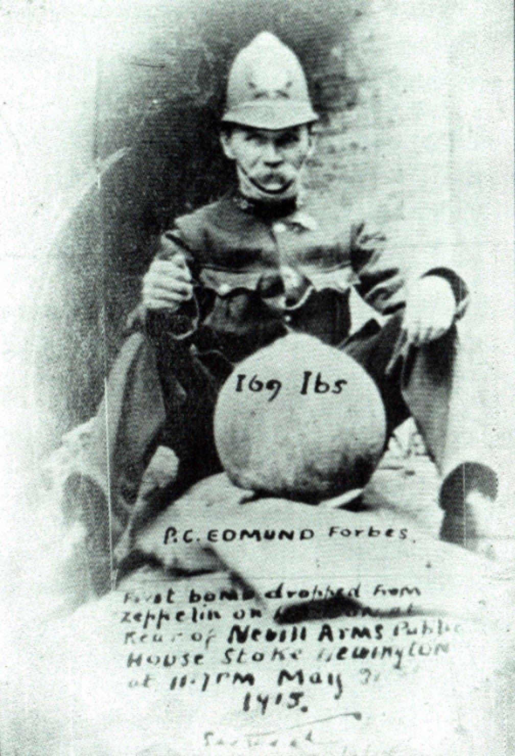
Zeppelin raid expert Ian Castle told me in an email exchange that: “The photo of PC Forbes is incorrect in more ways than one. As we know the first bomb was actually in Alkham Road, but also that is not even the Nevill Arms bomb as the one in the photo is an unexploded high-explosive bomb while the one that fell at the rear of the pub was an incendiary bomb – in appearance they couldn’t be more different. In my opinion the photo of PC Forbes was taken with the high-explosive bomb that fell in the back garden of 15 Lavers Road and which failed to detonate! Really not cleaver to sit on it!!!!”
Let’s continue: 125m to the Prince of Wales, 1 Allen Road
8. Continue south on Nevill Road towards Butterfield Green
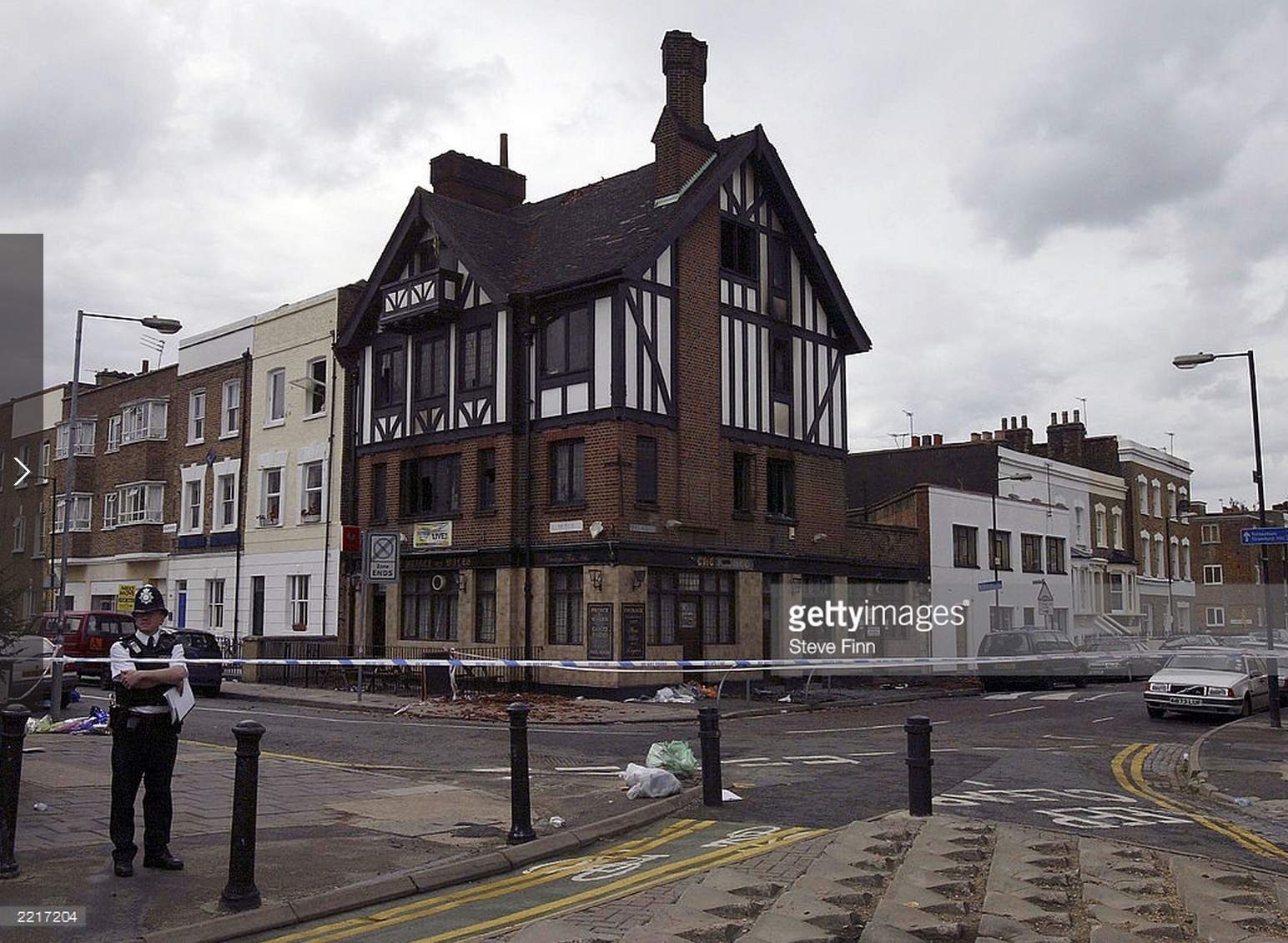
The Prince of Wales, 1 Allen Road
Years active: By 1874. Rebuilt c. 1930. Demolished 2003
On the corner of Allen Road/Nevill Road is the site of the Prince of Wales. A mock Tudor building was built on the site of an early Victorian pub building, likely from the 1850s when the area was developed. The pub was damaged in an arson attack in 2003, in which very tragically two children and a man who ran into the pub to save them died.
Let’s continue: 35m to Allen Arms, 8 Allen Road
9. Turn right into Allen Road
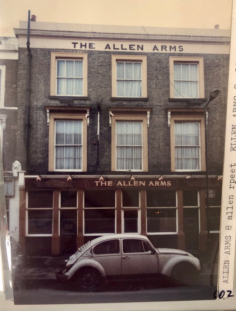
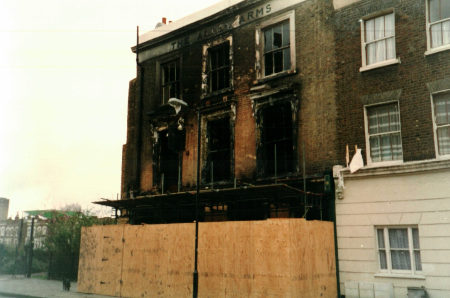
Allen Arms, 8 Allen Road
Years active: By 1866-c1996. Converted to residential use.
The Allen Arms, very close to the Prince of Wales was near the corner of Cowper Road, where Butterfield Green is now. Butterfield Green was built throughout the late 1970s and early 1980s on the site of Victorian houses following compulsory purchase order. It is often assumed by locals that Butterfield Green was built on a WW2 bomb site, but that wasn’t the case.
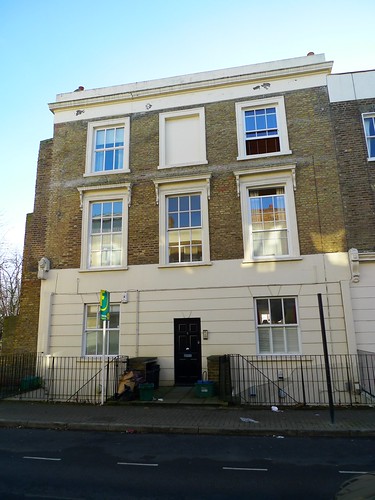

The pub was damaged in a fire in 1996.
Let’s continue: 420m to the Woodman, 190 Bolyen Road
10. Do a U-Turn and walk back towards Nevill Road
11. Turn right into Palatine Road and stay on the right along Butterfield Green
12. The road turns to Wordsworth Road. Continue straight and walk the entire length of Wordsworth Road to Boleyn Road
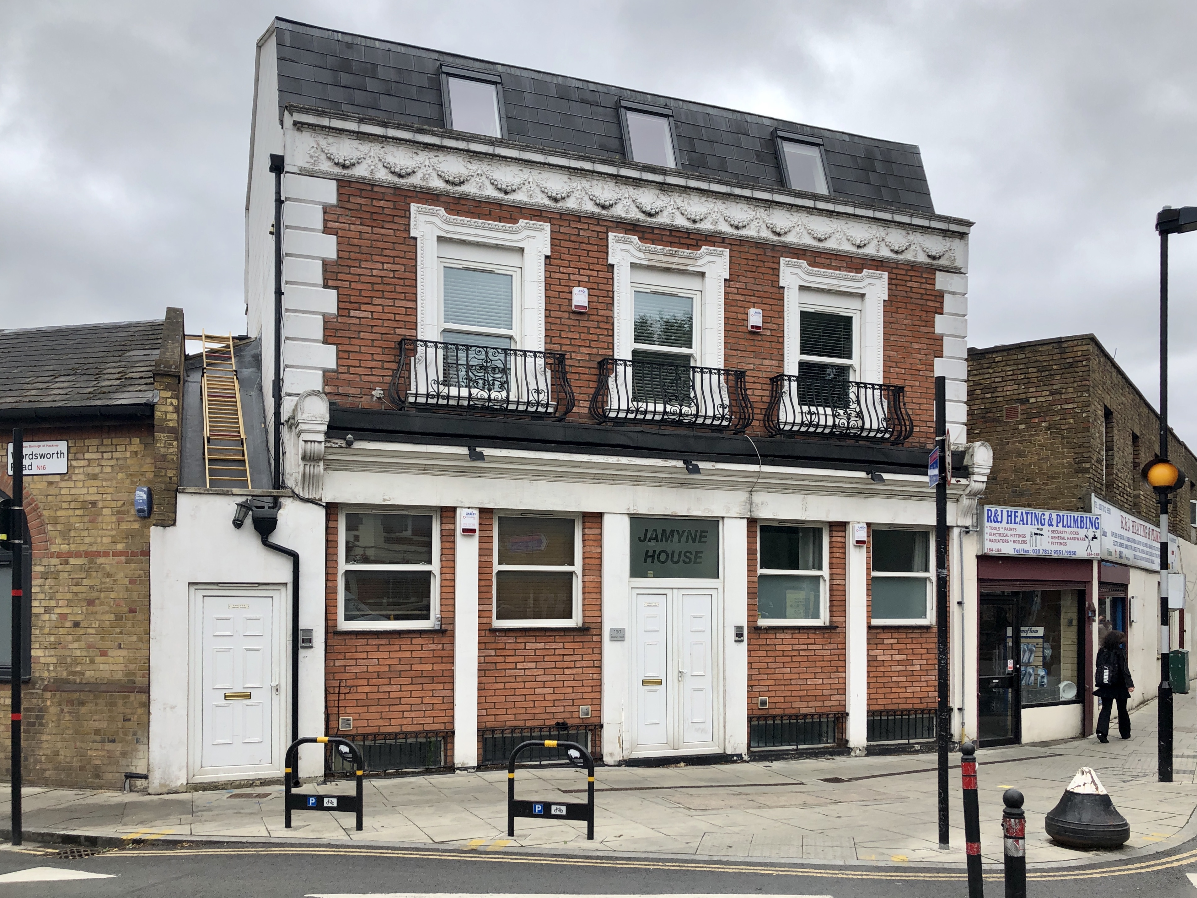
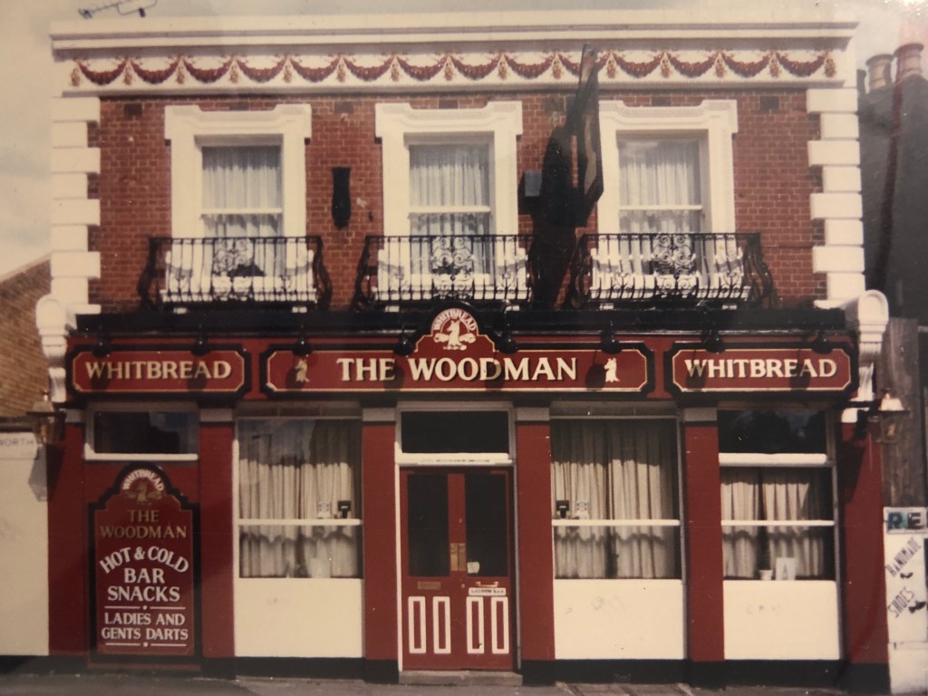
The Woodman, 190 Boleyn Road
Years active: 1866-1984. Converted to residential use.
Let’s continue: 125m to the Arundel Arms
13. Turn left into Boleyn Road
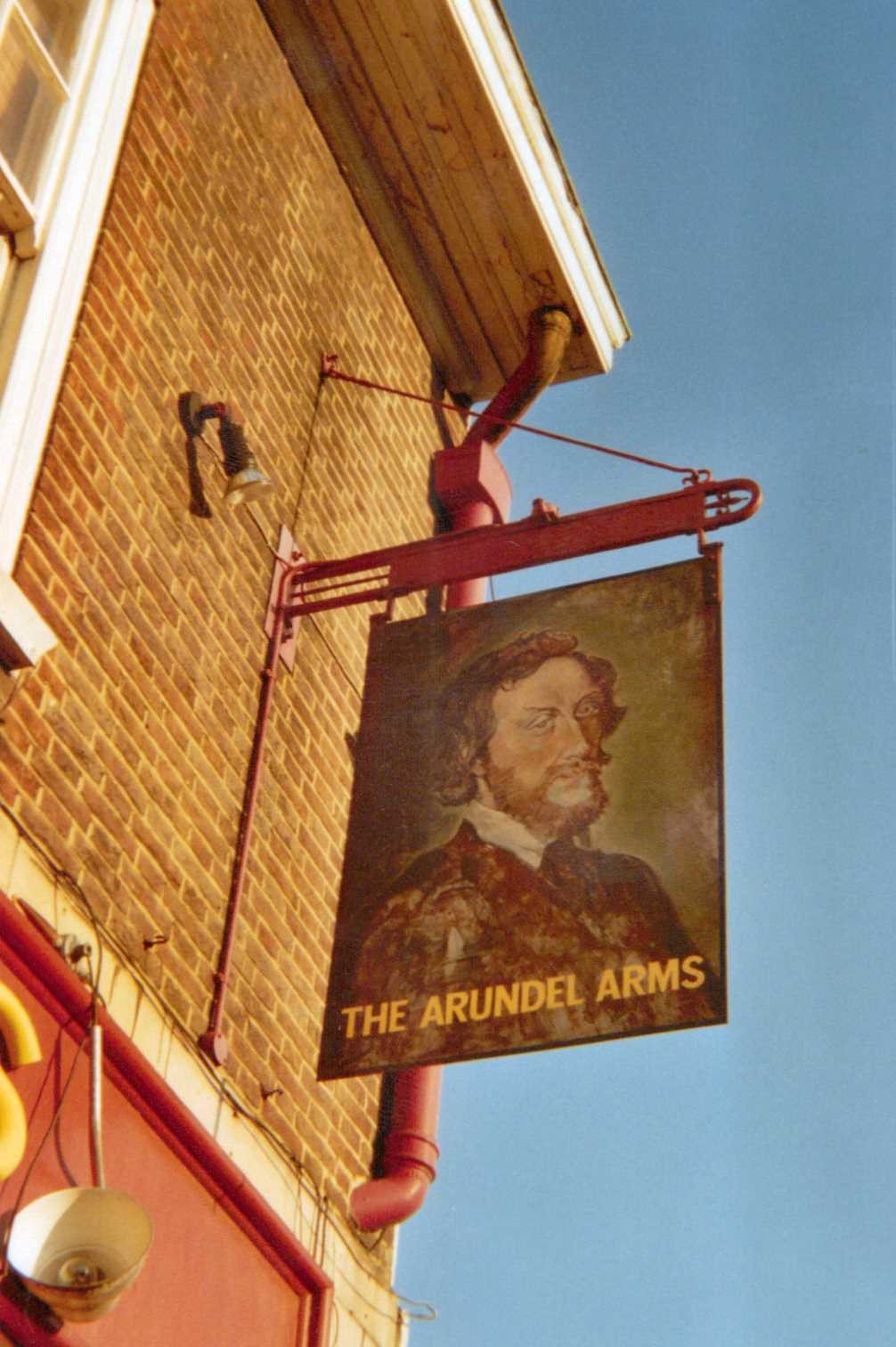
The Arundel Arms, 148 Boleyn Road
Years active: By 1881. Rebuilt c. 1930. Closed c. 2006. Demolished c.2013
The Arundel Arms is southmost pub of the walk. It was likely named after Henry Fitzalan, 12th Earl of Arundel who was a page at the court of King Henry VIII. King Henry VIII had a hunting lodge in nearby Newington Green in the 1500s, which also explains the names Boleyn Road where the pub was situated and King Henry Street not far from it.
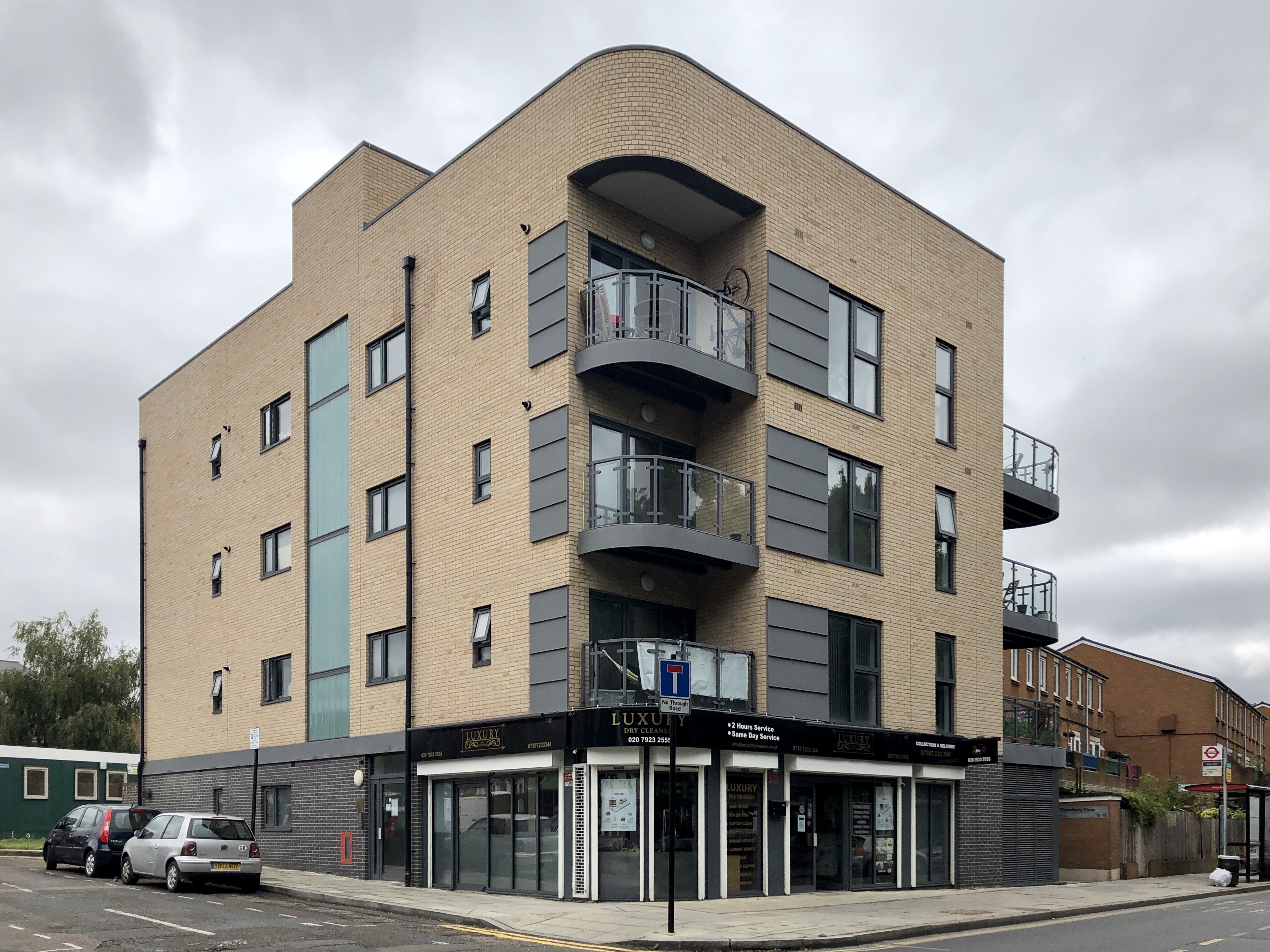
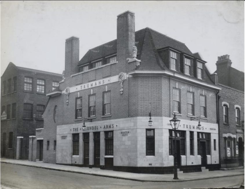
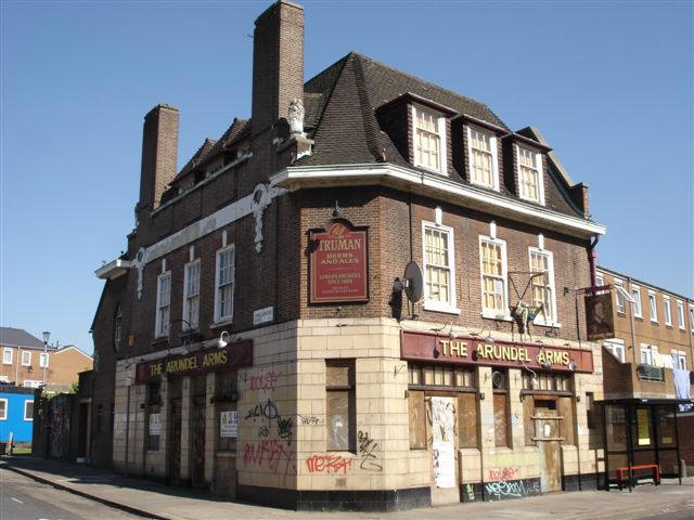
The long-gone pub sign actually had a portrait of Thomas Howard the 14th Earl of Arundel.
Let’s continue: 380m to the Howard Arms, 21 Howard Arms
14. U-turn and walk towards Matthias Road
15. Turn right into Cowper Road
16. Turn left into Howard Road
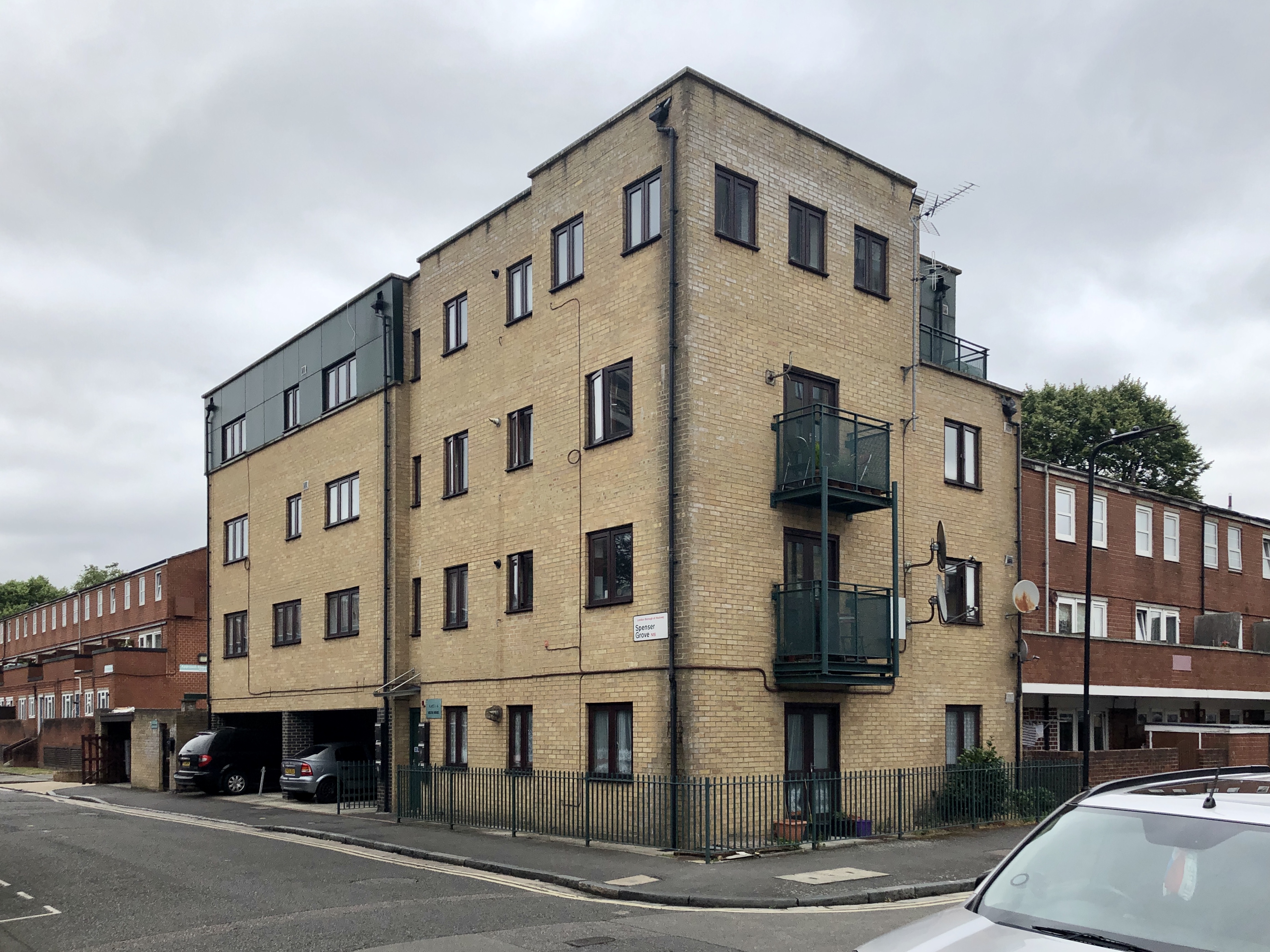
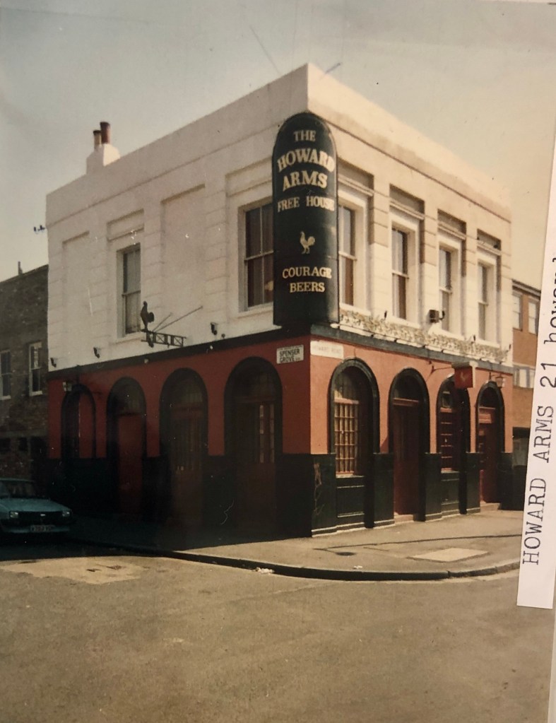
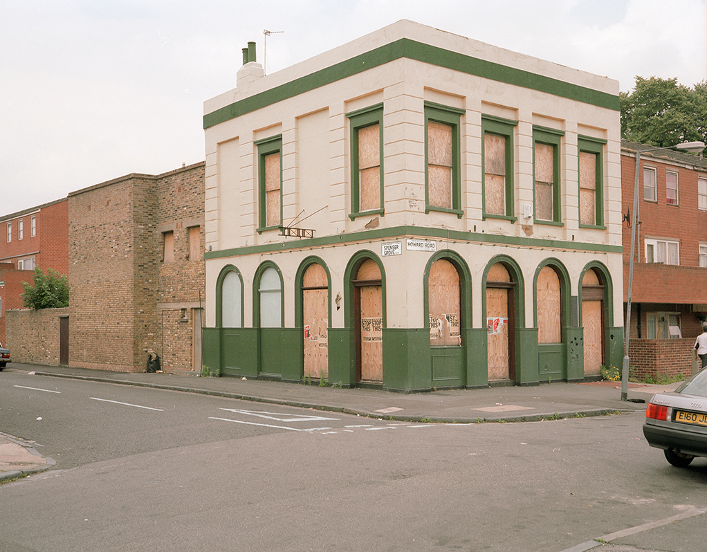
The Howard Arms, 21 Howard Road
Years active: By 1861-at least 1984. Demolished.
Howard Road had a number of pubs and Beer Houses as they aren’t marked as a Public House in Ordnance Survey Maps, though neither are some Victorian pubs that were definitely a Public House, so it’s a point I’m trying to clarify.
A Beer House was a type of public house created by the 1830 Beerhouse Act, legally defined as a place “where beer is sold to be consumed on the premises”. A Beer House wasn’t purpose built like a Public House and was in a residential property as long as the occupier paid rates they could apply to have a Beer House and was only allowed to sell beer and cider and no spirits. They were created due to the proliferation of of gin palaces (gin houses), which caused a lot of alcoholism.
We begin our stroll up Howard Road with the Howard Arms, which stood on the corner of Spenser Grove and was demolished so flats could be built on the site. The pubs along Howard Road, as those along Allen Road, which we saw earlier, served a large population that lived in Albert Town; the 1850s development between Matthias Road and Allen Road that included Milton Grove (formerly Road), Shakspeare Walk (formerly Shakespeare Road), Spenser Road and Cowper Road. In typical fashion, there was literally a pub in every street corner along Howard Road.
Let’s continue: 60m to the Freeholders Arms, 28 Howard Road
17. Continue along Howard Road
Freeholders Arms (Beer House), 28 Howard Road
Years active: By 1866-at least 1908. Demolished.
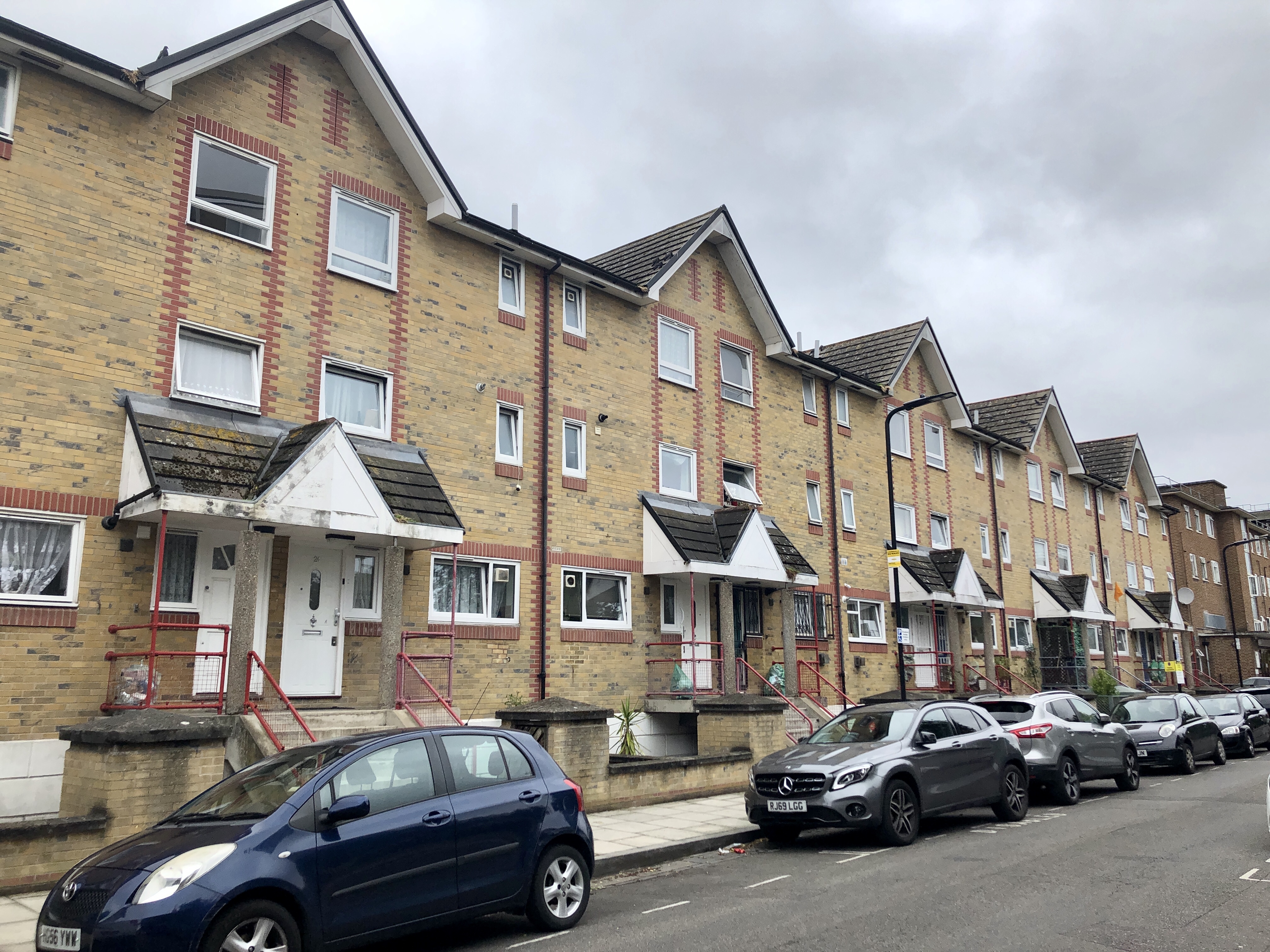
The Freeholders Arms was a Beer House. There are no photos that I’m aware of showing the Freeholders Arms, which stood roughly where this row of houses is now.
Let’s continue: 14m to the Captain Cook, 37 Howard Road
The Captain Cook, 37 Howard Road
Years active: By 1874-at least 1954. Demolished.
The Captain Cook may have also been a Beer House. There are also no photos of either on the corner of Shakespeare Road (Now Shakspeare Walk) or very close to it.
Let’s continue: 65m to the Freemasons Tavern, 61 Howard Road
The Freemasons Tavern, 61 Howard Road
Years active: 1866-c1959. Demolished 1959
The Freemasons Tavern stood on the corner of Howard Road and Milton Grove (formerly Milton Road). Luckily there are a couple of photos of the pub in its heyday and there’s no doubt it was a Public House.


Let’s continue: 80m to the Ebor Arms, 75 Howard Road
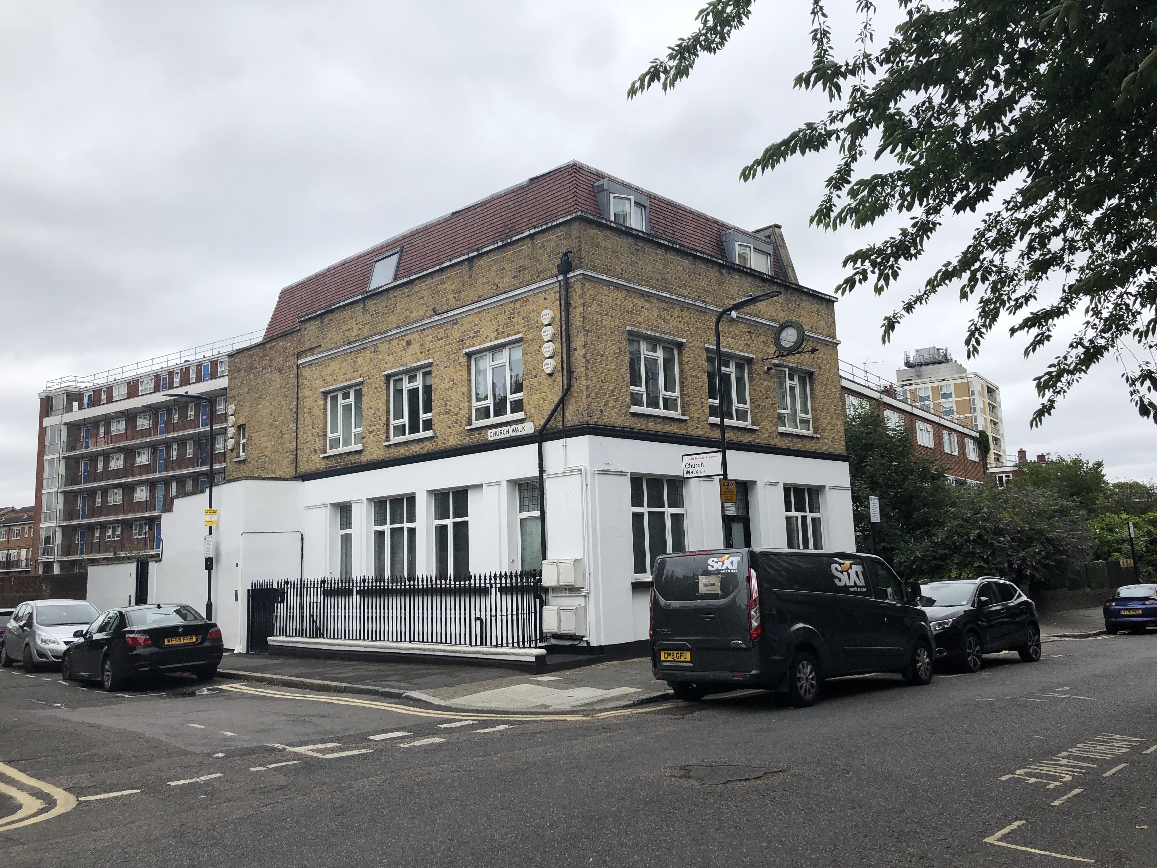
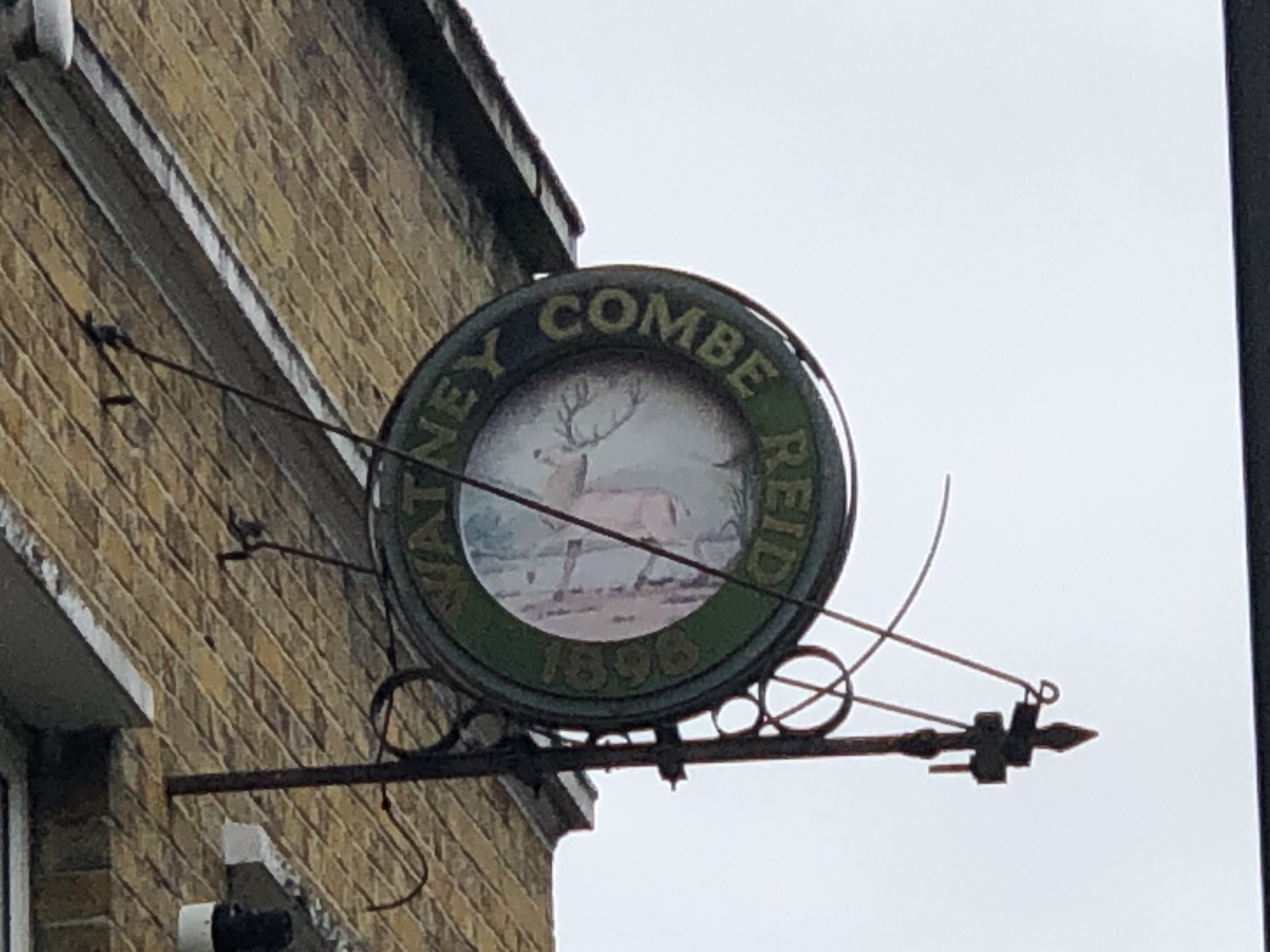
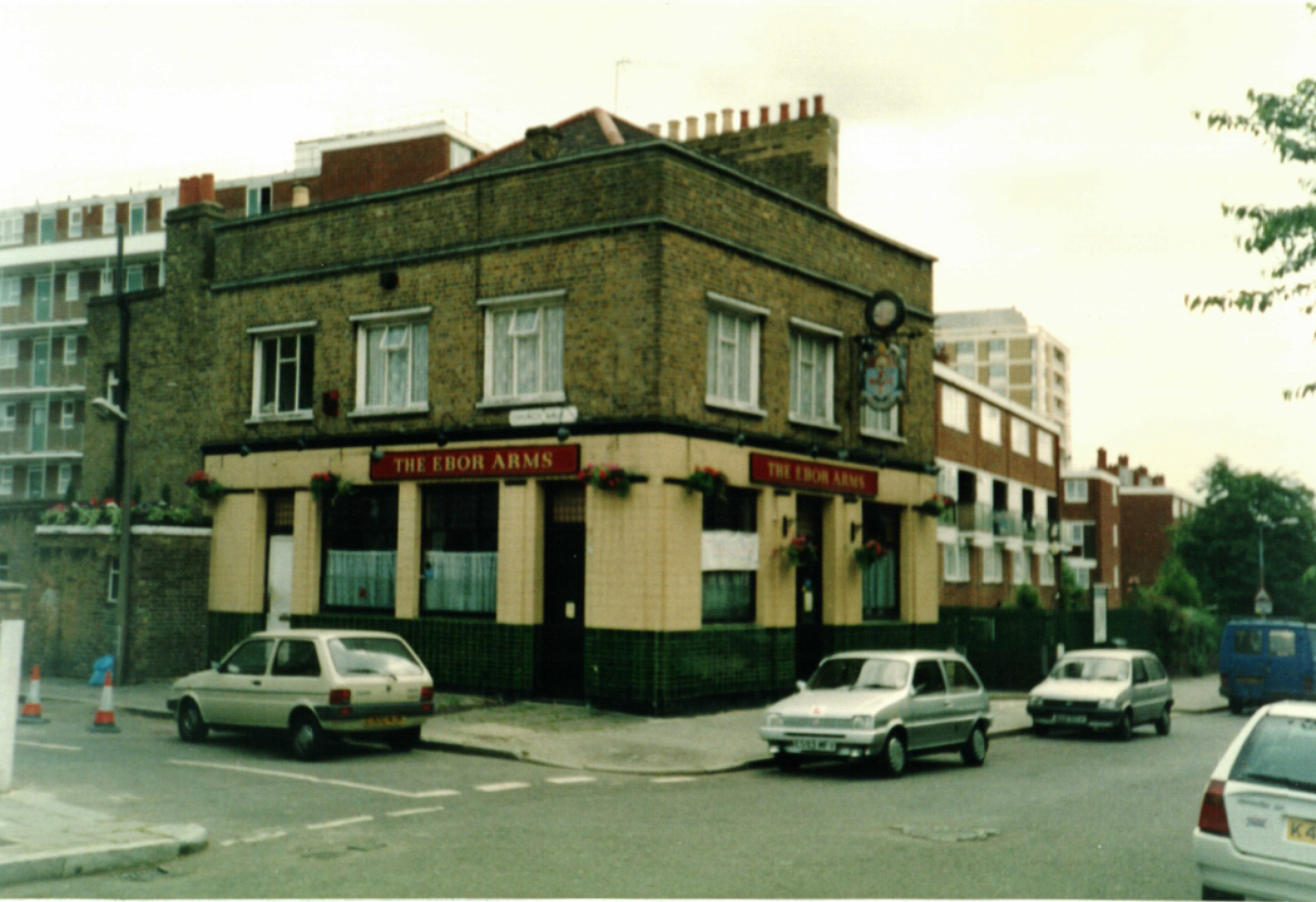
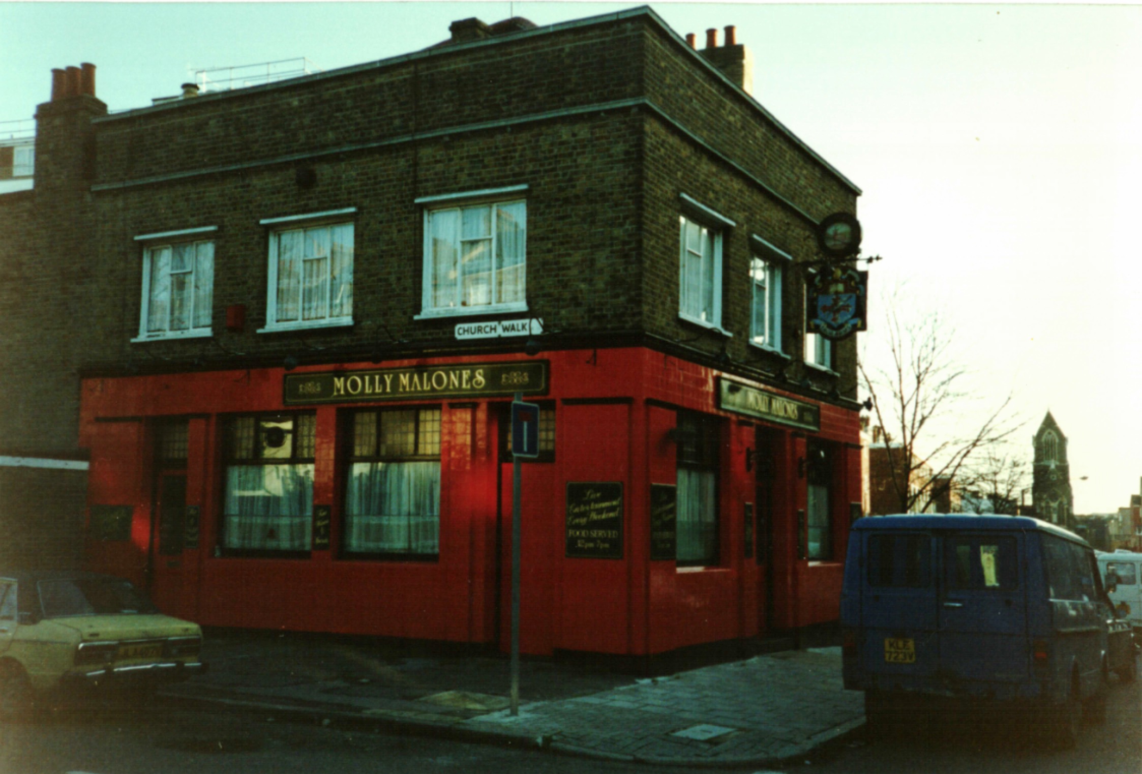
Ebor Arms, 75 Howard Road
Years active: By 1866-at least 1992.Converted to residential use. Other names: Molly Malone’s.
The former Ebor Arms near Albion Road is the only surviving pub building in Howard Road. The brewery sign (Watney Combe Reid 1898) is a sole remnant of the building’s history.
Let’s continue: 380m to the Atlas, 25 Winston Road
18. Turn left into Albion Road
19. Turn right towards Green Lanes
20. Turn right into Winston Road
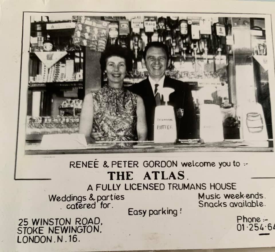
The Atlas, 25 Winston Road
Years active: By 1878-at least 1984. Converted to residential use.
An interesting quote about the pub I came across: “In 1967 my mum and dad, Betty and Dennis were publican’s of this pub, I remember snippets of living there.. The Krays used the room upstairs to hold their meetings.” (Carol Kirby)
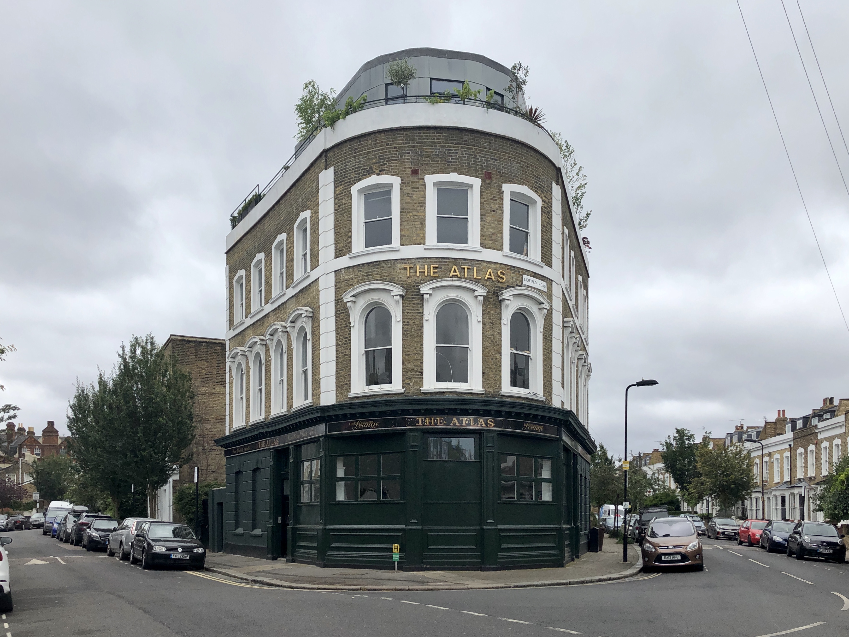
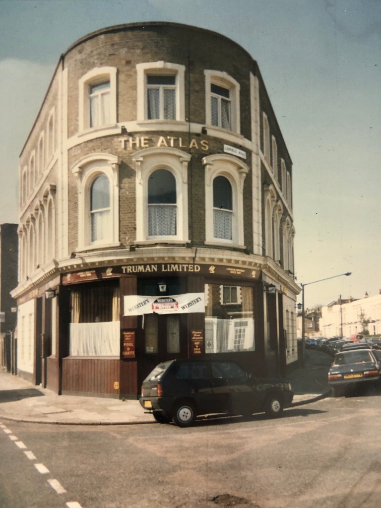
Renee and Peter Gordon were the publicans at one point. I assume by the photo this was in the 1950s.
Let’s continue: 350m to the Pegasus, 109 Green Lanes
21. Turn left into Lidfield Road
Lidfield Road is one of only two Stoke Newington streets that are numbered consecutively, the other one being Allerton Road which you’ll walk pass later on your way to the Happy Man.
22. Turn right into Green Lanes
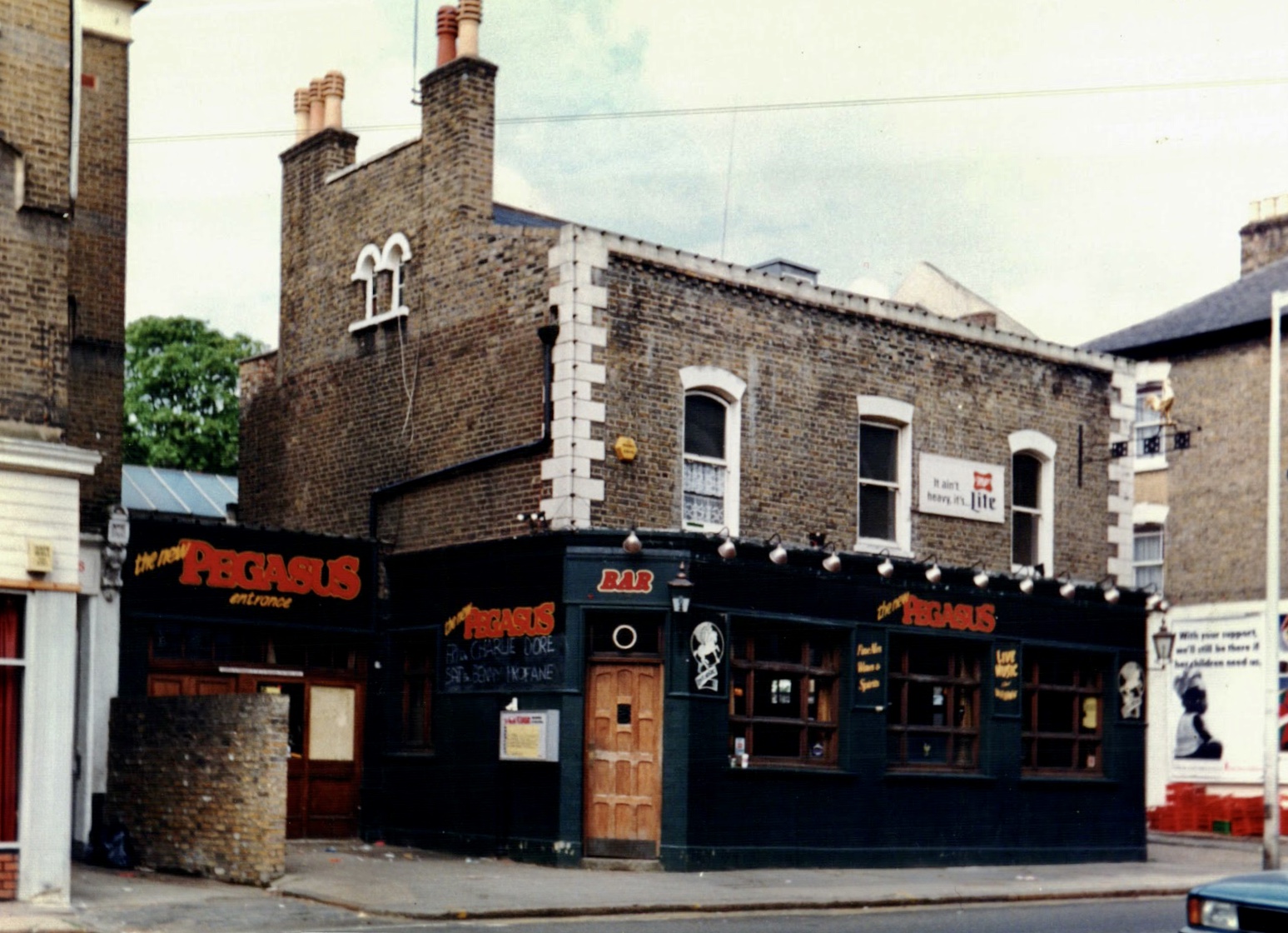
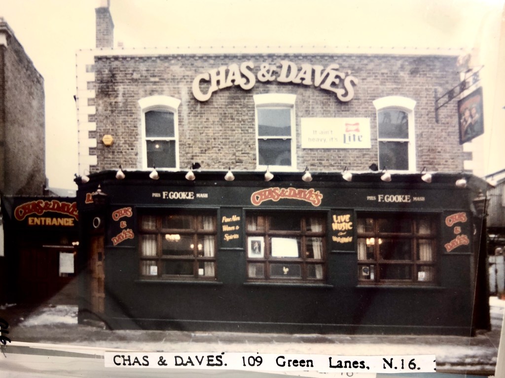
The Pegasus, 109 Green Lanes
Years active: By 1851-c2004. Converted to a Turkish Social Club. Other names: Chas ‘n’ Dave’s, New Pegasus.
A popular music venue, it was owned by Chas & Dave at one point. John Lydon got badly hurt during a fight outside after the Sex Pistols recorded in Wessex Sound Studios at 106a Highbury New Park nearby. Other acts who recorded in Wessex Sound Studios by the way (closed 2003) included Queen, King Crimson, The Clash, XTC, the Rolling Stones, Pete Townshend and The Damned.
Let’s continue: 550m to the Albion, 2 Clissold Road
23. Make U-turn and turn left into Springdale Road
24. Turn right into Clissold Crescent
25. Turn left into Albion Road
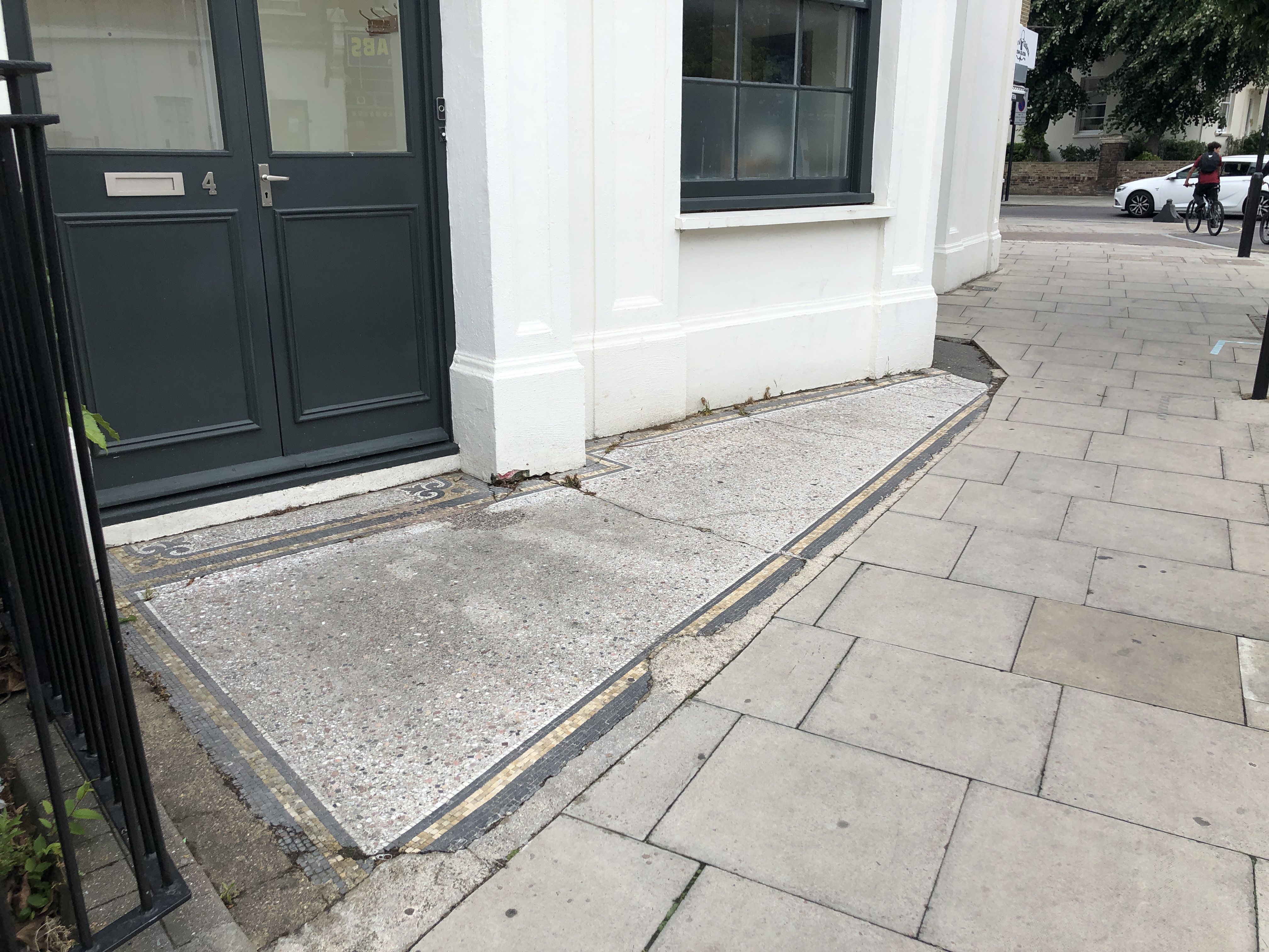
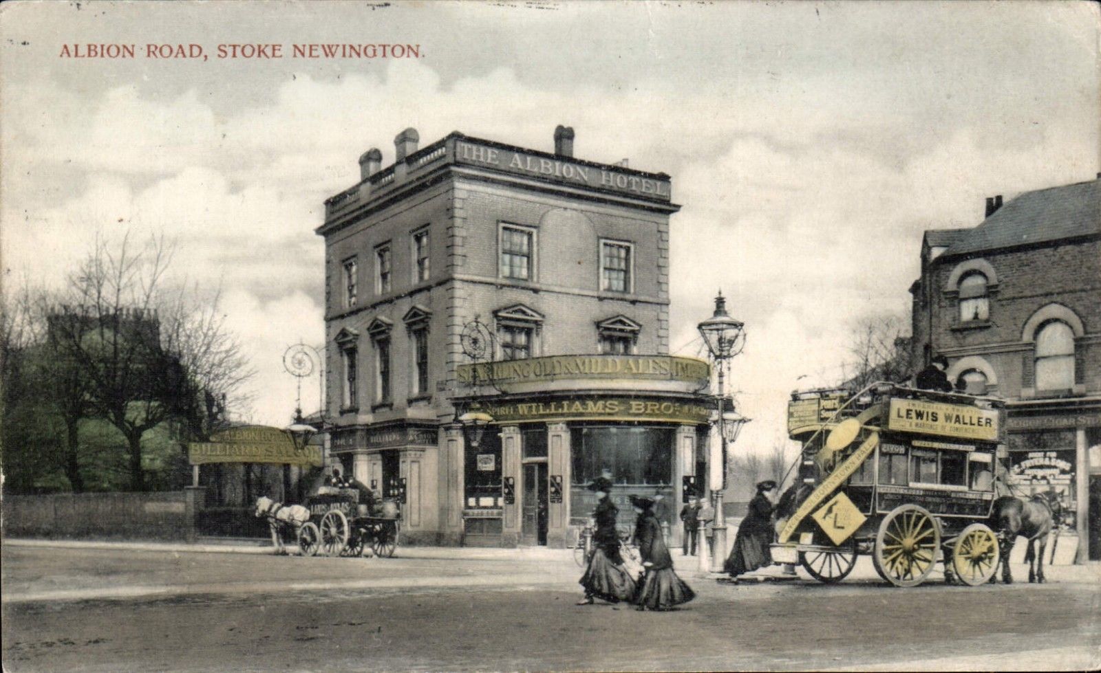
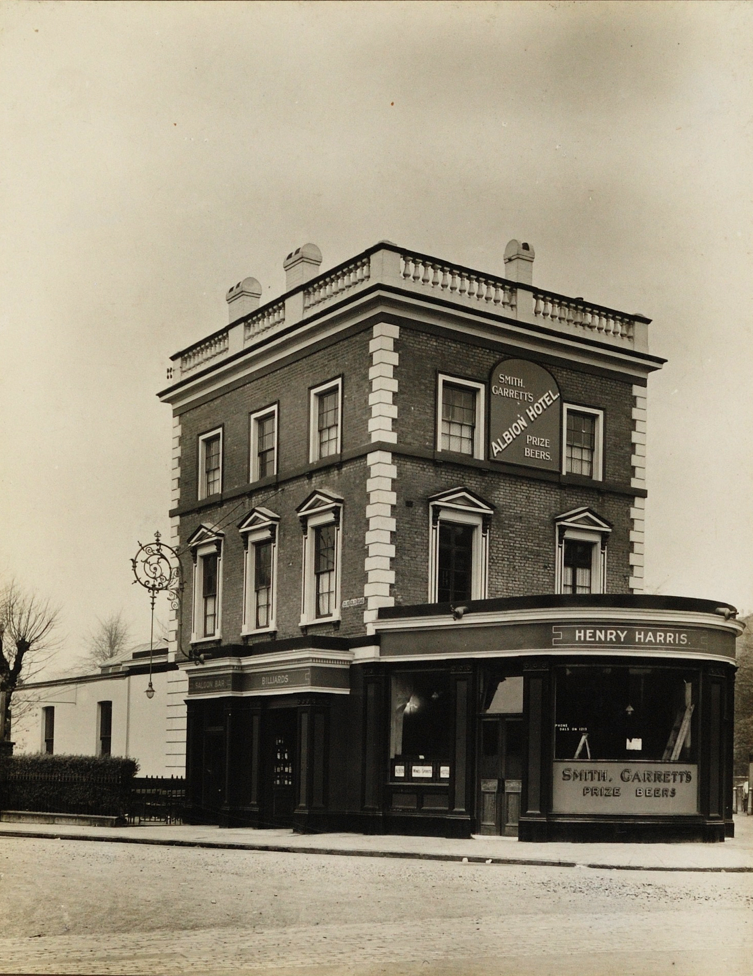
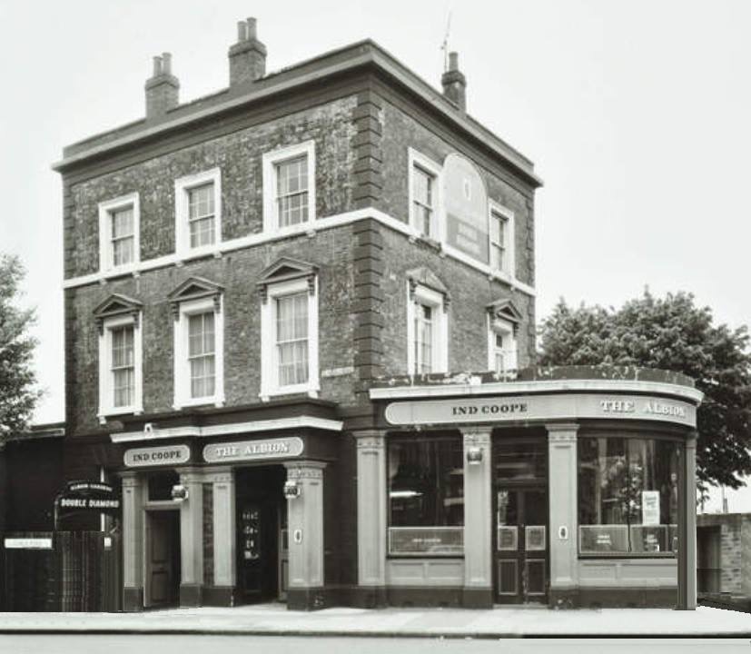
The Albion, 2 Clissold Road
Years active: By 1855-at least 1997. Converted to residential use. Other names: Golden Lady, Albion Hotel, Albion Tavern.
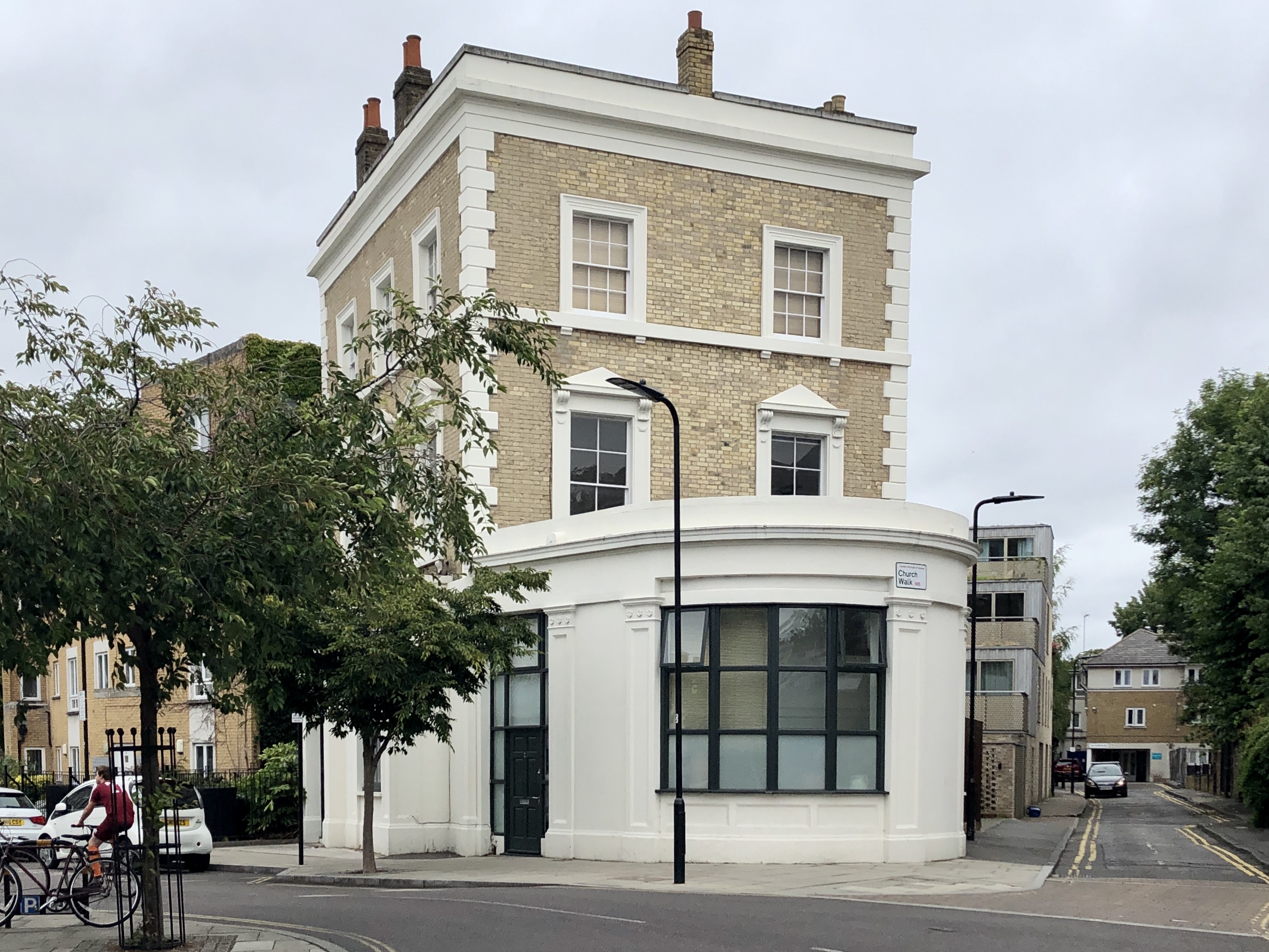
The original pavement mosaic outside one of the entrances to the pub is still there.
Let’s continue: 650m to the Falcon, 151 Stoke Newington Church Street
26. Continue north along Albion Road towards Stoke Newington Church Street
37. Turn right into Stoke Newington Church Street
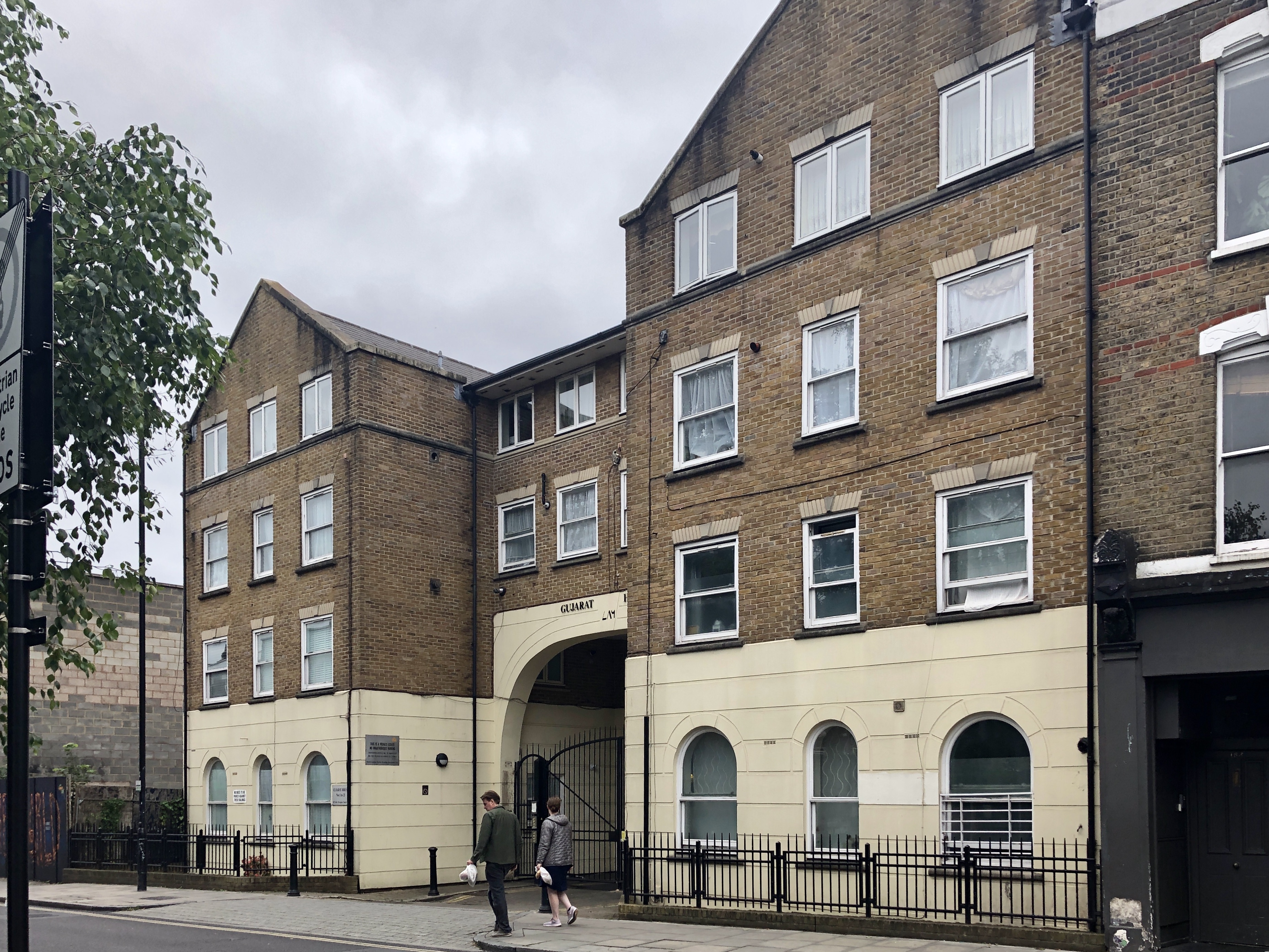
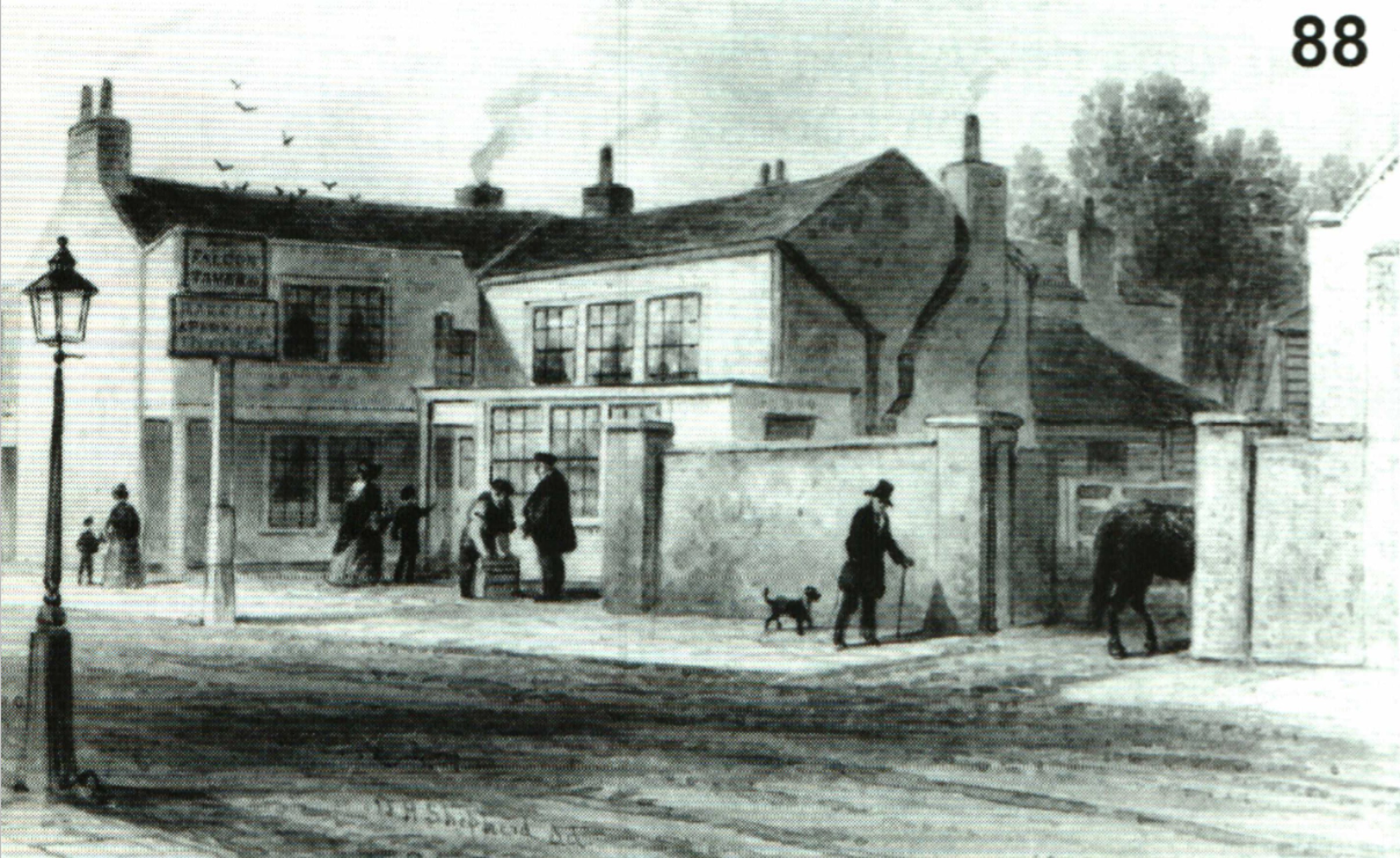
The Falcon, 151 Stoke Newington Church Street
Years active: By 1826-at least 1919. Demolished.
The Falcon, originally a tavern, stood were Gujarat House is now. Many pubs on main roads began their life as an Inn but by the mid-late 19th century as once rural villages were transformed into Victorian London suburbs, the old Inns were rebuilt as grand pub buildings for growing population that inhabited terraced houses.
The Falcon Tavern in the 1840s.
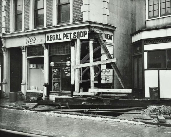
The Falcon was rebuilt, probably in the 1880s. It was converted to two shops seen in this photo from 1958 documenting significant subsidence in Church Street.
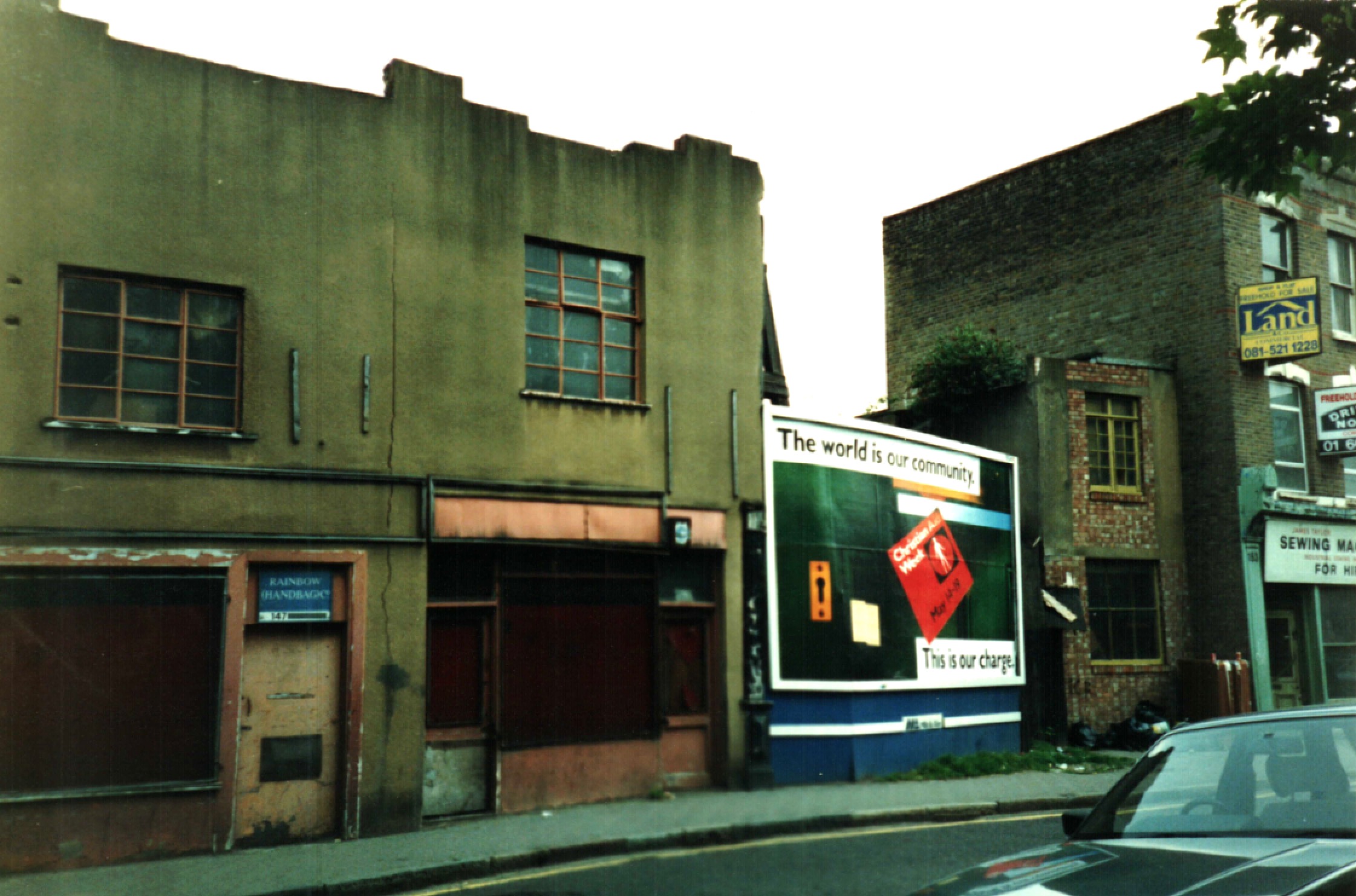
The Victorian pub building was demolished and in its place a 2-storey building was built, seen here on the left in 1990 (Photo by Derek Baker).
Let’s continue: 110m to the Free Trade, 17 Edwards Lane
28. U-Turn and then right into Edward’s Lane
Section 2 of 2: The Northern Division (2.4km)
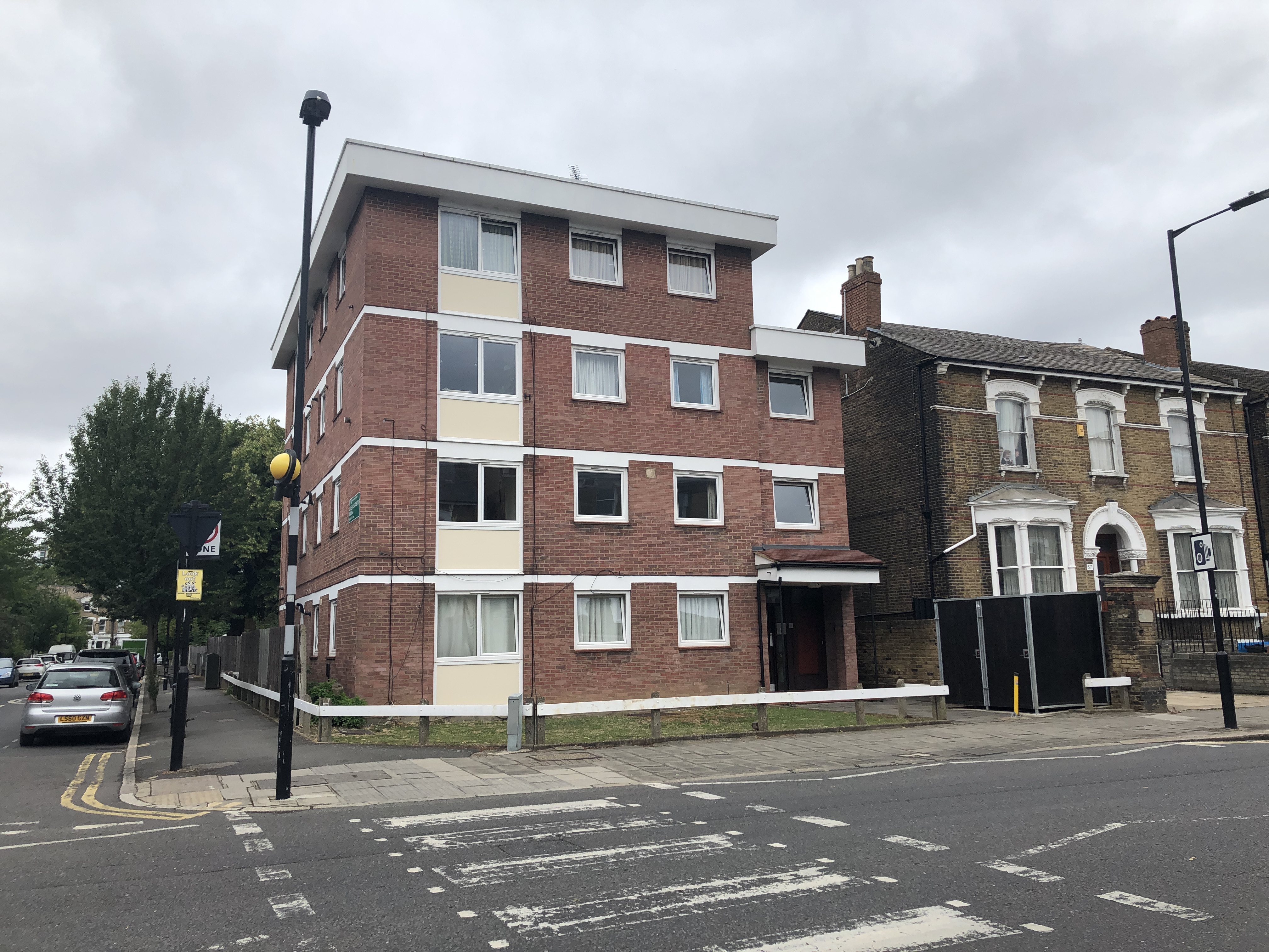
Free Trade (Beer House), 17 Edward’s Lane
Years active: By 1851-at least 1905. Converted for residential use.
The Free Trade was a Beer House and it was converted to residential use. You can tell it wasn’t a purpose-built pub and looking at it you can almost see how the owner may have sold beer through the window or the front room.
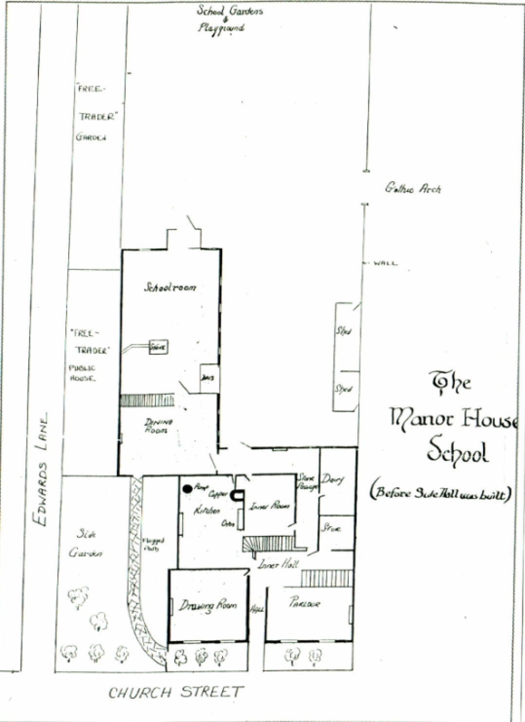
The only place where I’ve seen the Free Trade mentioned is this plan of what was the adjacent Manor House School, which was attended by a young Edgar Allan Poe. It refers to it as the Free TRADER, rather than Trade, though all the references I found online have it as the Free Trade. The map also shows that where there’s a row of terraced houses now, there was the Free Trade garden.
Let’s continue: 620m to the Lordship Park Tavern, Lordship Park/Queen Elizabeth’s Walk
29. Continue straight on Edward’s Lane
30. Turn left into Lordship Terrace
31. Turn right into Queen Elizabeth’s Walk
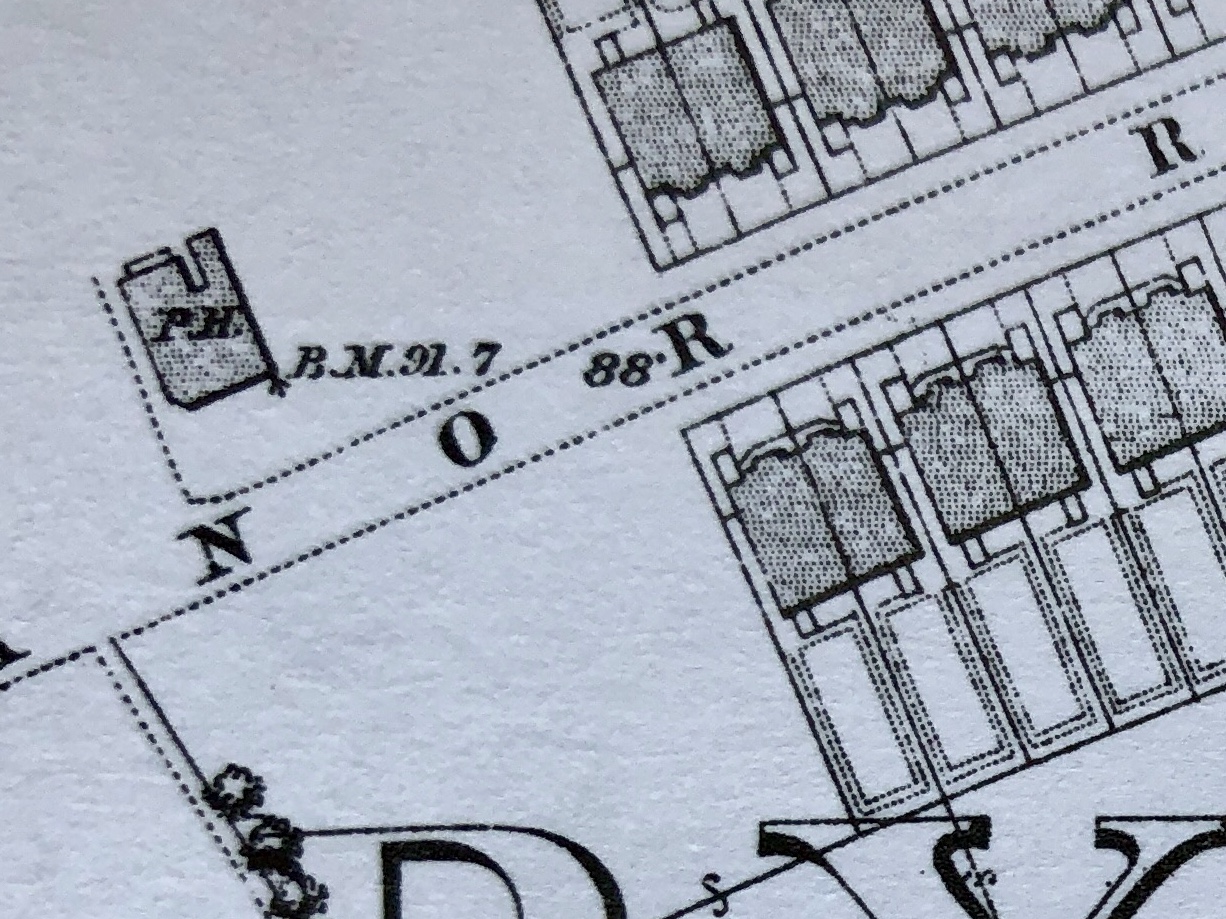
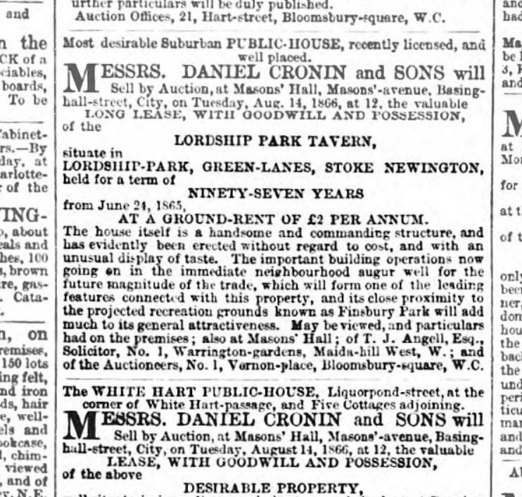
The Lordship Park Tavern, Lordship Park/Queen Elizabeth’s Walk
Years active: c.1865-c. 1894. Demolished.
The short-lived Lordship Park Tavern appears in an 1868 Ordnance Survey map and is the only Victorian pub in the Northern Division apart from The Finsbury at 336 Green Lanes, just north of Manor House. Lordship Road was built in 1865 and the pub may have been there till the early 1890s when space between the two groups of 16 4-storey grand houses at each end was filled with 2-storey houses. It’s unusual to see there was a pub in this leafy, residential and more affluent part of Stoke Newington.
Queen Elizabeth’s Walk wasn’t built beyond Lordship Road in 1868 but the pub’s location puts it roughly where the corner is now.
This news cutting is the only place I’ve so far where the pub is mentioned by name.
Let’s continue: 910m to the Happy Man, 89 Woodberry Grove
32. Turn right into Queen Elizabeth’s Walk
33. Turn left into Lordship Road
34. Continue straight towards Woodberry Grove
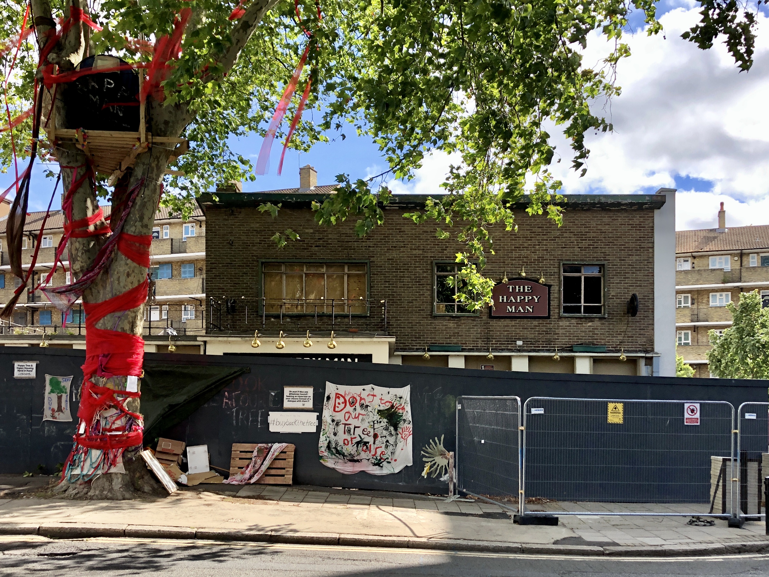
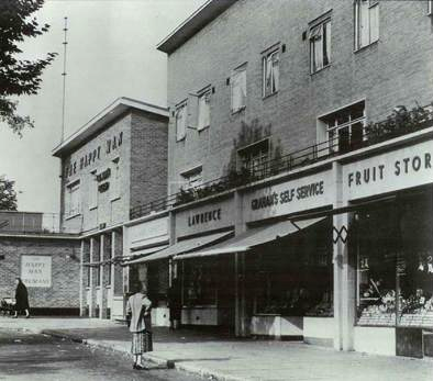
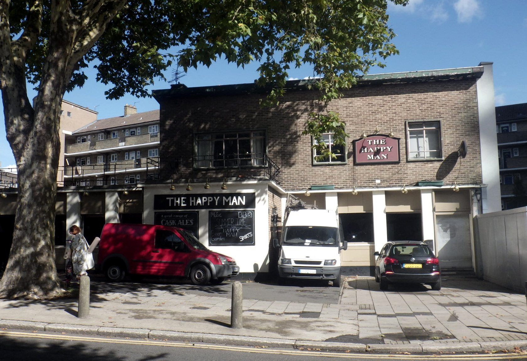
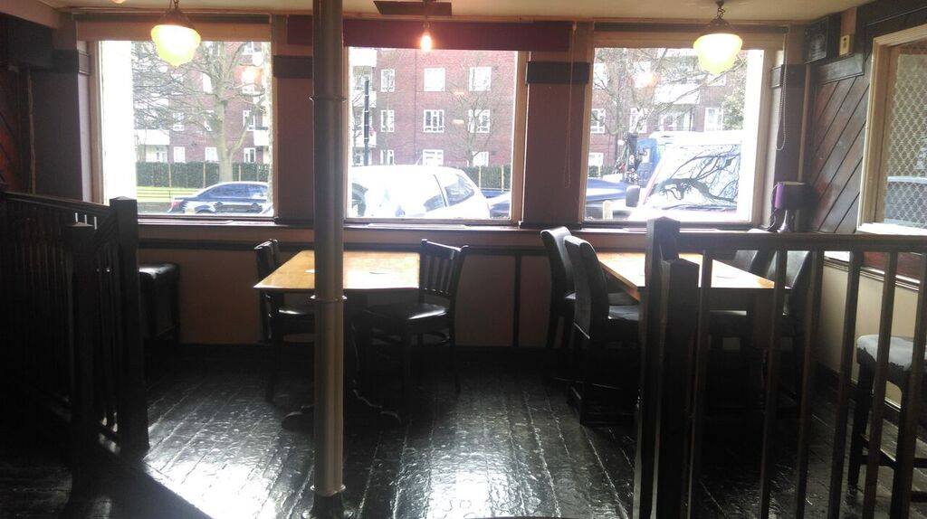
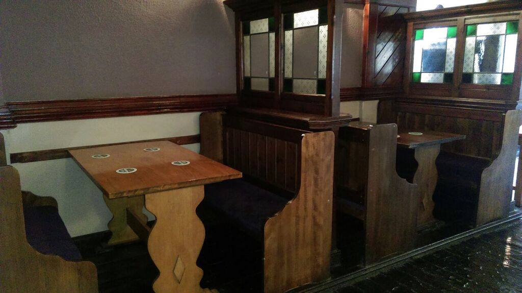
The Happy Man, 89 Woodberry Grove
Years active: 1957-2019. Demolished. Other names: Becher’s, Blarney Stone.
The Happy Man, was demolished in late July 2020 to make way for a housing development that’ll include a ‘modern’ pub. It was built in 1957 and was the only pub within the extensive Woodberry Down Estate. The Estate was built by the London County Council between 1948-1962 and included 57 housing blocks. The area is being transformed again and a long-term redevelopment is due to be completed in 2035(!).
There’s currently a campaign to save the 150 year old tree that is in front of the pub.
The Happy Man in happier times
This is the only pub on the walk that I’ve managed to find photos of the interior.
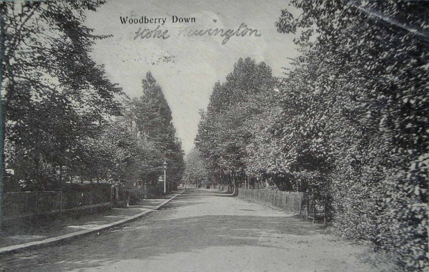
Woodberry Down was originally semi-rural with a few large Victorian villas with large back gardens that bordered the New River Reservoirs. It’s unrecognisable in these photos from 1905.
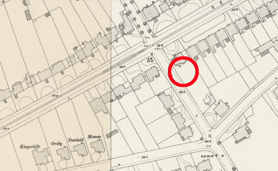
The location of the pub on a map from the late 19th century, when the area was thinly populated.
Let’s continue: 470m to the Manor House Tavern, 316 Green Lanes
35. Continue to the junction
36. Turn left into Seven Sisters Road
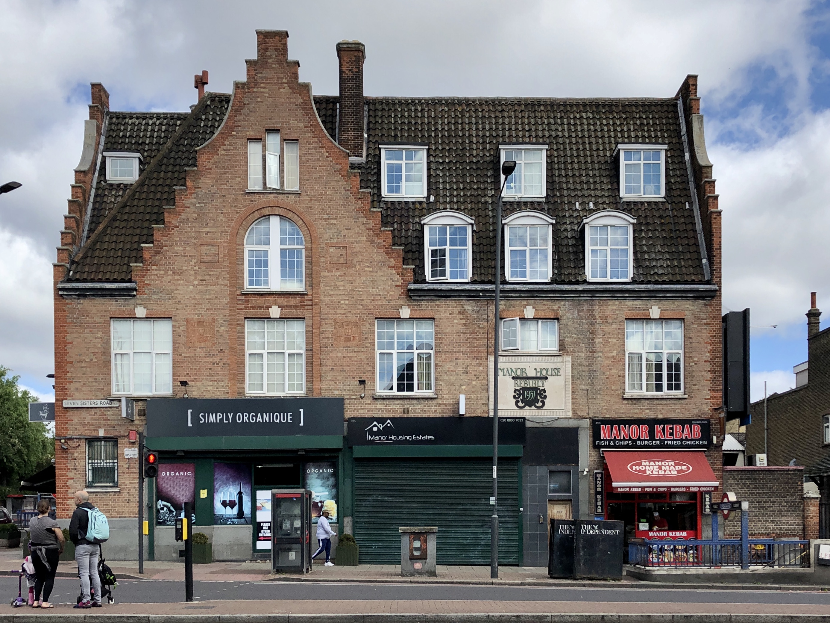
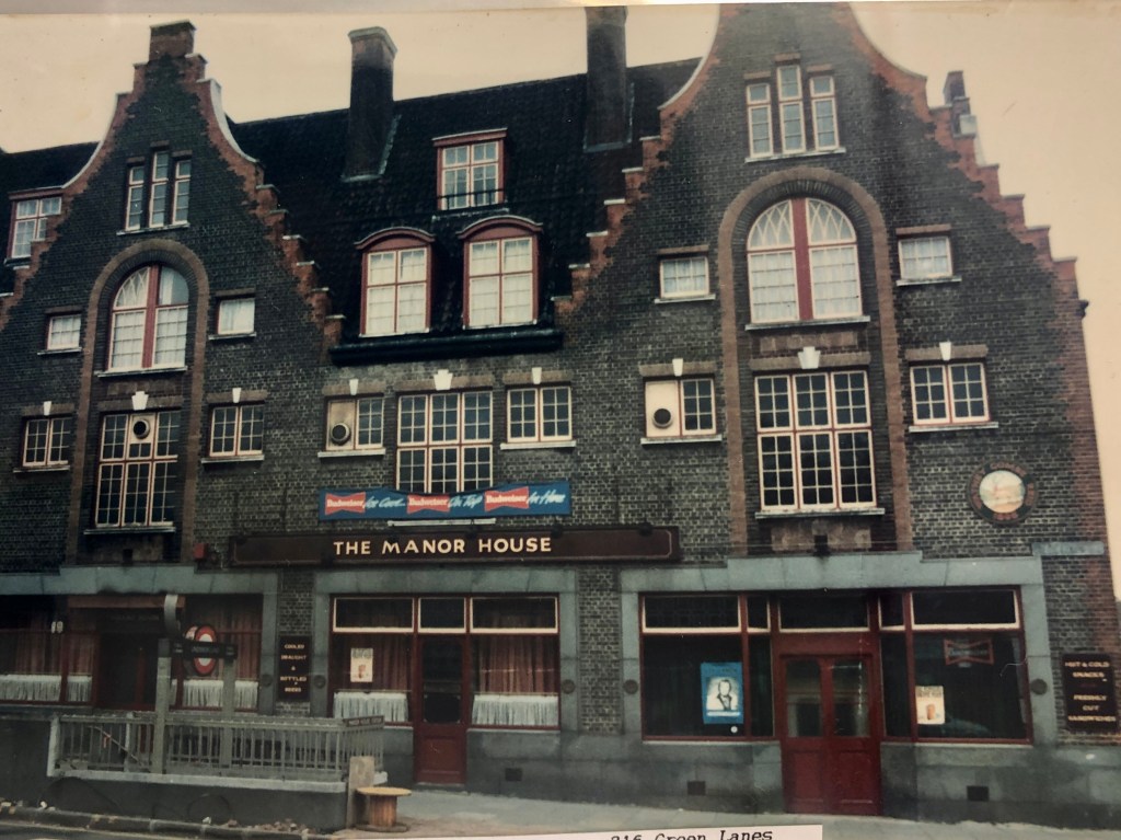
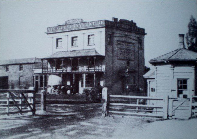
The Manor House Tavern, 316 Green Lanes
Years active: c. 1832-Rebuilt 1931. Closed c. 1995. It was extensively re-built and converted to retail use in 2004.
From Wikipedia: The tavern was the source of the name of the tube station and consequently the immediate vicinity. The first tavern on the site was built by Stoke Newington builder Thomas Widdows between 1830 and 1834 next to the turnpike on Green Lanes. Prior to this date a cottage had existed on the site, but in 1829 an Act of Parliament was passed to permit the building of the Seven Sisters Road. In 1930 the imminent arrival of the Piccadilly Line led to the widening of the road, the demolition of the old tavern and the erection of current building.
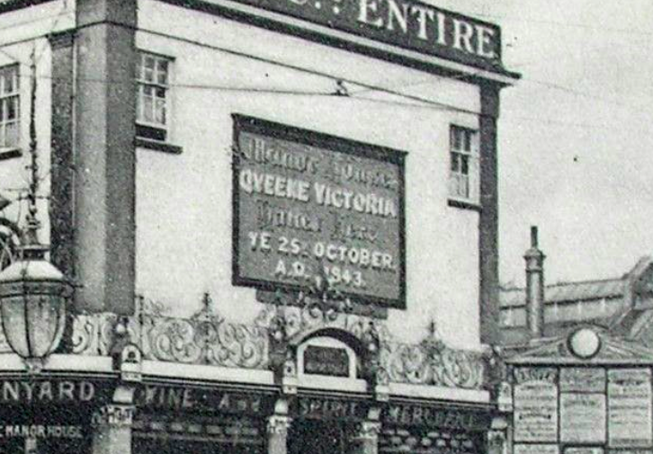
On 25 October 1843 Queen Victoria and Prince Albert ‘visited’ the pub when they were travelling by carriage from Windsor to Cambridge. The route included the still relatively new Seven Sisters Road and a stop was made at the Manor House Tavern for the first change of horses. A tablet with the following inscription was placed on the side of the pub.
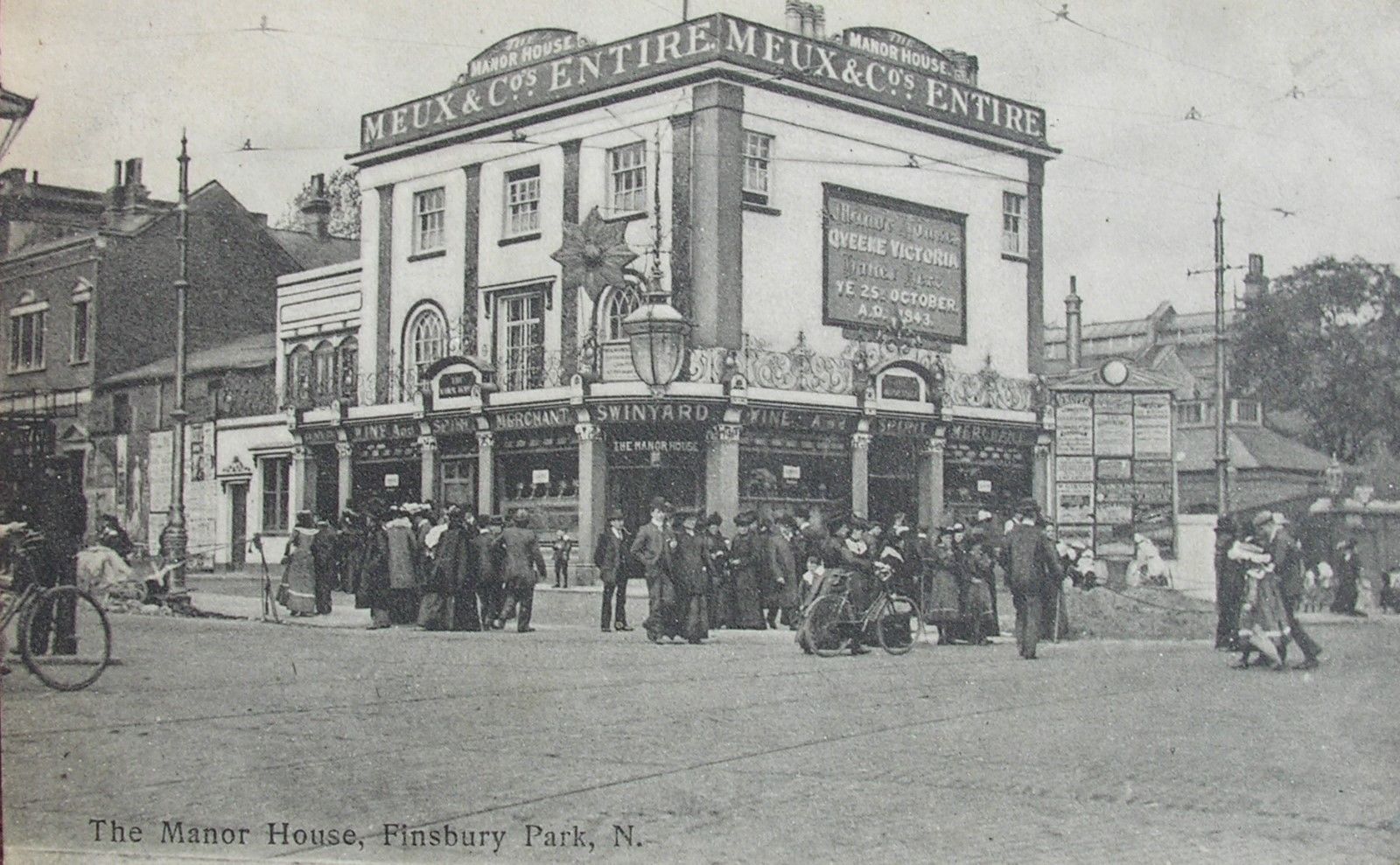
It’s a shame that the large plate that was on the 19th century pub building wasn’t preserved and incorporated in the 1931 rebuild.
This view shows what I believe is the turnpike with the turnpike cottage on the right.
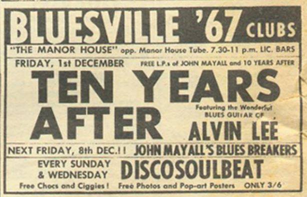
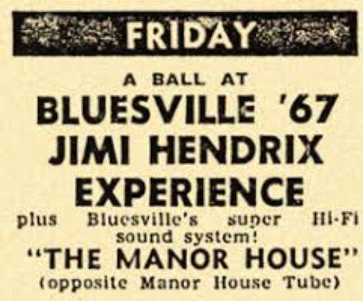
In the 1960s there was a popular club upstairs called the Bluesville R.& B. Club, hosting artists including Cream, Fleetwood Mac, Jimi Hendrix, The Rolling Stones, the Yardbirds, the Animals and the Spencer Davis Group. In the 1950 it was a popular Jazz club called the Downbeat Club.
Let’s continue: 370m to the Hornsey Wood Tavern, 376 Seven Sisters Road
37. Cross the road and continue along Seven Sisters Road walking the length of Finsbury Park
The Hornsey Wood Tavern, 376 Seven Sisters Road
Years active: Hornsey Wood House in 1835. Rebuilt c. 1880. Closed 2007 and was demolished c.2008

Similar to the Manor House Tavern, the Hornsey Wood Tavern was also a popular music venue, and it seems that by 1969 the Bluesville Club migrated there and hosted an upcoming new band called Led Zeppelin. 54 years after a German Zeppelin bombed a house two doors down from the Nevill in Nevill Road, a different kind of Zeppelin appeared in Stoke Newington.

