

Historical context
The Metropolitan Borough of Stoke Newington was created in 1900. It was abolished in 1965 following the London Government Act 1963, which created a new local government structure for London and resulted in small boroughs like Stoke Newington being merged to form fewer and larger London boroughs. The Metropolitan Boroughs of Stoke Newington, Shoreditch and Hackney became the London Borough of Hackney. The name Kingsland was considered for the new borough but at the end it was decided to name it Hackney.

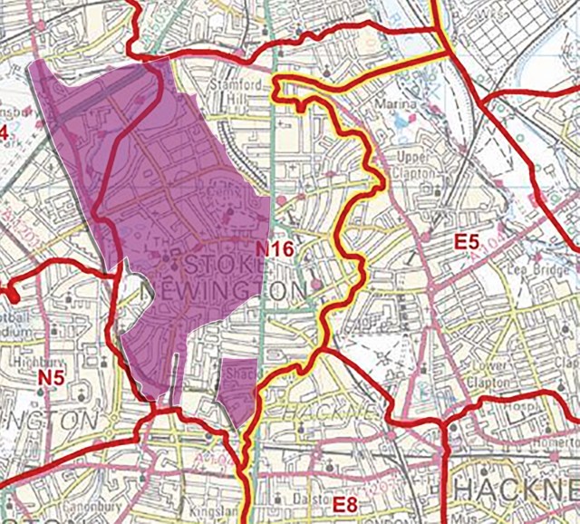
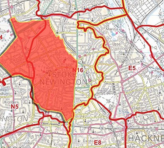
The boundaries of the Metropolitan Borough of Stoke Newington were largely those of the ancient parish of Stoke Newington with additional four sections that were part of the parish of Hornsey (Brownswood Park, West side of Clissold Park and two detached sections bordering the southern half of the parish). Those sections were administered independently as a local government district by the South Hornsey Local Board from 1865 till 1900 when the district was abolished and incorporated into the newly formed Borough of Stoke Newington.
My talk ‘
Beating the Bounds
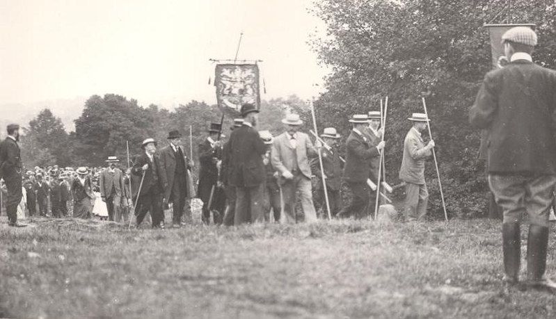
A parish boundary walk, known as ‘Beating the Bounds‘, is an ancient parochial practice where a group of prominent citizens from the community walk the geographic boundaries of their locality, for the purpose of maintaining the memory of the precise location of these boundaries. Beating the Bounds are still held today, though I don’t know when the last one took place in Stoke Newington. In that sense, you can take pride and joy knowing you are resurrecting locally a tradition that dates back to Anglo-Saxon times.
About the walk
The walk is roughly 9km/5.6mi/12,000 steps. It takes me 2 hours without stopping and I’m a fast walker, so if you aren’t a fast walker and plan to have a few stops along the way you should plan for at least 3 hours. The majority of the walk is along residential and main roads. The only exceptions are Allens Gardens (Public garden) and Eade Road, which for the first 400m has an industrial estate on one side and the New River on the other.
I love taking this walk as it takes you to the four corners of Stoke Newington and the first time you do it you may likely discover new streets and areas and learn just how big, or how small, depending on your perspective, the Borough of Stoke Newington was.
During the walk I point out parish and borough boundary markers and a number of various big and small landmarks and objects.
The walk is divided into five sections:
- The North Eastern Boundary (1.47km/0.9mi)
- Start – Manor Road
- Bethune Road
- Allens Gardens
- Sanford Court
- Dunsmure Road
- Bethune Road
- The Northern Boundary (2.53km/1.57mi)
- Amhurst Park
- Eade Road
- Hermitage Road
- Green Lanes
- Seven Sisters Road
- The Western Boundary (2.3km/1.83mi)
- Blackstock Road
- Mountgrove Road
- Riversdale Road
- Green Lanes
- Petherton Road
- Leconfield Road
- Green Lanes
- The Southern Boundary (880m/0.54mi)
- Newington Green
- Matthias Road
- Boleyn Road
- Crossway
- The Eastern Boundary (1.5km/0.93mi)
- Stoke Newington Road
- Stoke Newington High Street
- Finish – Abney Park Cemetery
Let’s go!
Testimonials
Finally did the Stoke Newington Boundary Walk today and what a great experience it was. Saw lots of bits of the borough that we knew bits and pieces about and quite a few that we’d never seen before. Directions are easy to follow and once you get a sniff of the boundary marker themselves, it gets a bit like doing a treasure hunt, let alone the old street signs and other bits and pieces of interest. Well worth a couple of hours of your time. We were really happy with discovering what the perimeter of our home for the last 20 years looked like and where it extended to, which might surprise you.
The walk was excellent – great fun hunting the markers, and linking up the sections of the borough I tend to visit separately. Although I knew most of the route already, I enjoyed discovering Eade Road – I’ve only ever seen it from the New River path. It took around 2 hours as you suggested. Printing out the shorter version worked well in tandem with being able to quickly look at the pics in the longer one for reference on my phone, which I had to do a few times.
I did part of the boundary walk today – as far as Leconfield Road. Really good! Had never been to Eade Road before. And had never noticed until today how Green Lanes gently rises and falls as it crosses the New River by the Methodist Church. I printed them out A4 landscape with two pages per side, which worked well. Will finish the walk later in the week. Was very enjoyable!
Did the Stoke Newington boundary walk earlier today. Recommended, if you’re local. Nice landmarks & quirks along the way: great for kids to find (mine loved it). Interesting to see that some property developers respect history; some don’t!
We did the walk. It was great. Really easy to follow, one of us map read and another read out the facts. Thoroughly enjoyed by us all. All in all fab! Thank you.
Amir’s Boundary walk is a real delight. We printed out the walk and it was so easy to follow. I loved the walk…down many roads that I wouldn’t normally have seen. So fascinating and well researched! Just a great way to spend 3-4 hours.
