Holland House, 42 Newington Green. Demolished in 1961. At one time it had become the OXO factory. The present building was built in the 1990s.
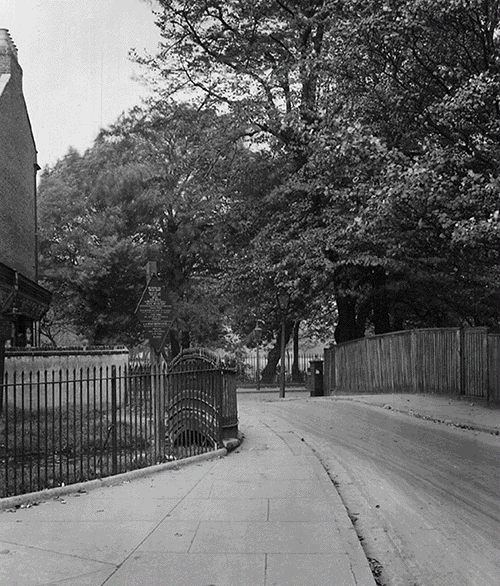
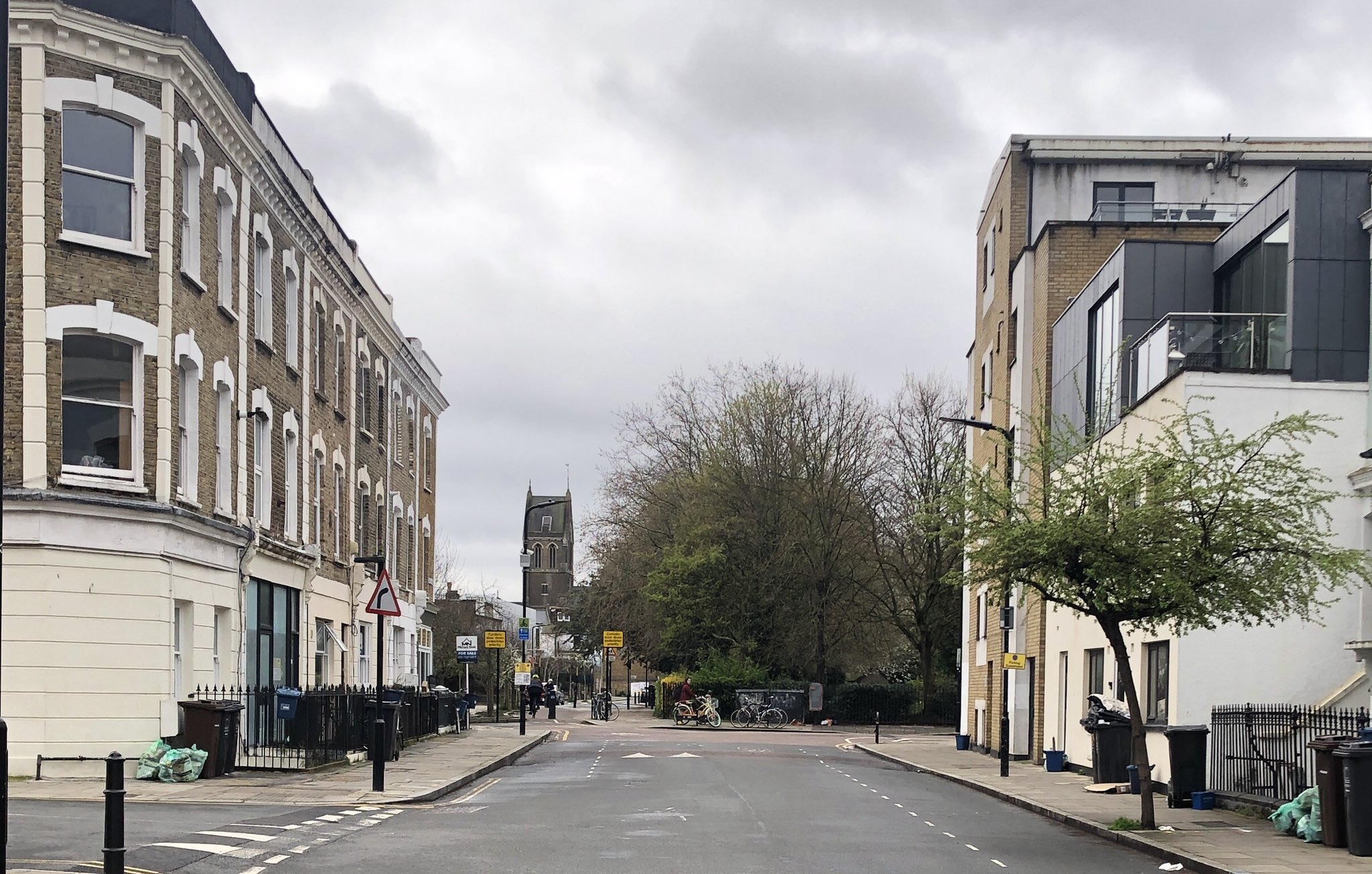
2. Victorian Road
Victorian Road looking west towards Nevill Road before Yorkshire South Estate was built on the site. The Prince Albert pub on the right.
3. Newington Green
The Stoke Newington side of Newington Green. The Georgian houses on the left were pulled down when Albion Road was widened and a bank was built on the site. The former Barclays Bank building is now flats.
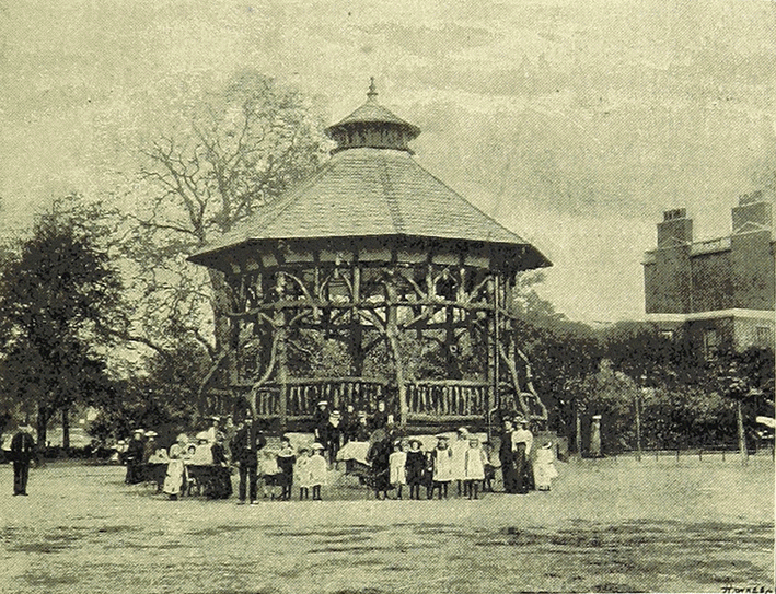
4. Clissold Park Bandstand
The Clissold Park bandstand. The ‘rustic’ bandstand was erected in 1893 next to Clissold House, four years after the park opened. It was altered in 1912. It was removed in 1965.
5. Kennaway Hall
Kennaway Hall (formerly The Willows), Paradise Row, Church Street. Built for George William Alexander; A Quaker and founding treasurer of the British and Foreign Anti-Slavery Society in 1839. It was demolished in 1953.
6. Clissold Road Swimming Bath
The Public Swimming Bath in Clissold Road. Designed by Hobden and Porri who also designed the Simpsons factory in Stoke Newington Road (now Beyond Retro), the Wordsworth Road Electricity Substation and the Church St WW1 Memorial Hall. Opened in 1930. Demolished in 1997.
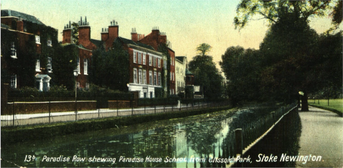
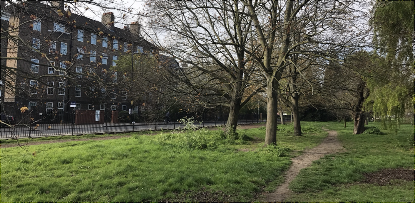
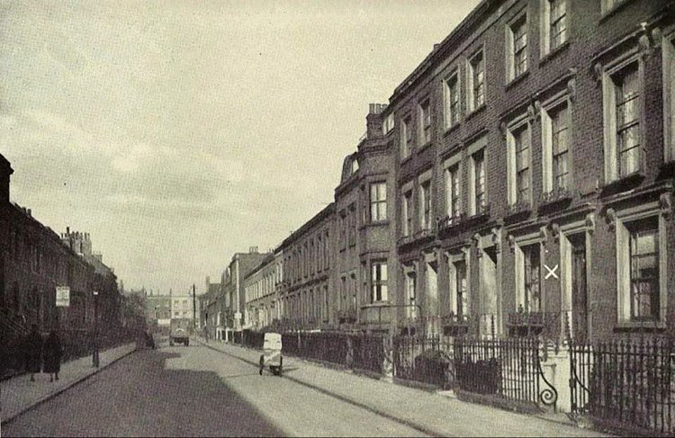
7. Paradise Row
The grand houses of Paradise Row in Church Street overlooking the New River and Clissold Park. This once affluent part of SN changed drastically by the 1950s. This section of the New River was filled in in 1958. It now end in the East Reservoir.
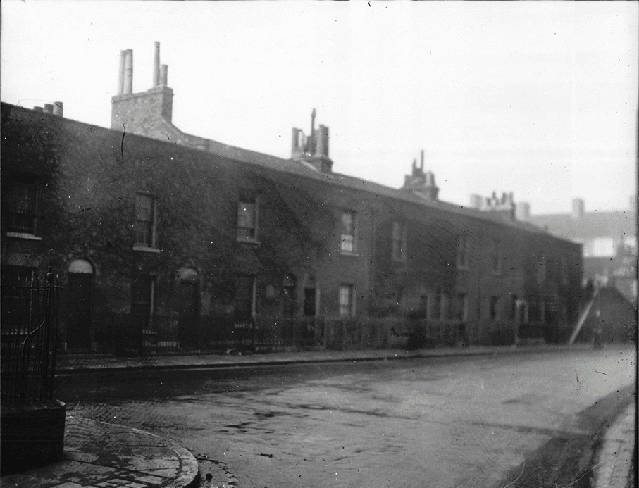
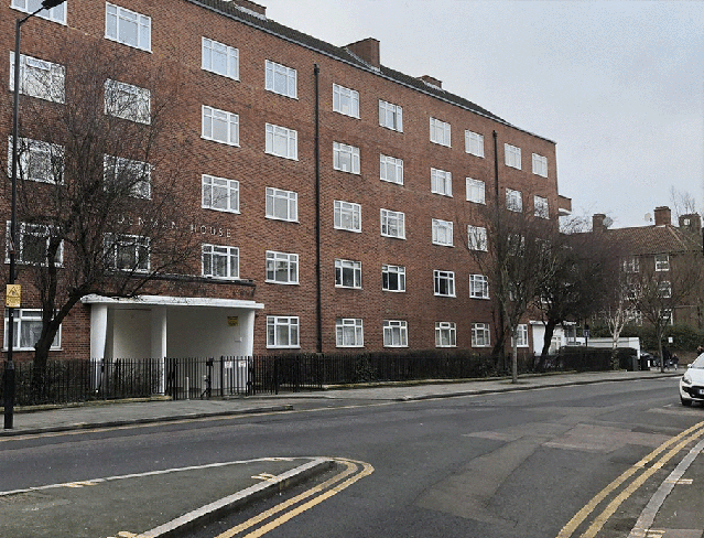
8. Denman House
Denman House was built in 1937 on the site of small houses in Barn Street, Lordship Terrace and Lordship Road that were declared a ‘Slum Clearance Area’. There were 7 such slum clearance areas in Stoke Newington.
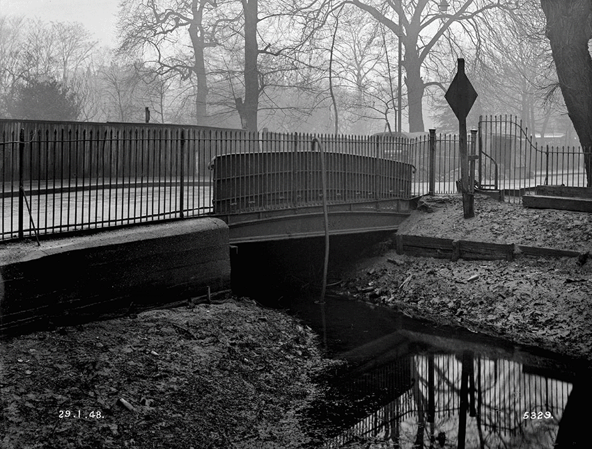
9. Paradise Bridge
Paradise Bridge in Stoke Newington Church St in 1948 just before it was demolished. This is where the New River exited Clissold Park towards Aden Terrace, Petherton Rd towards Islington. It now ends in the East Reservoir.
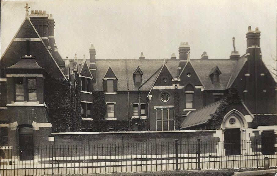
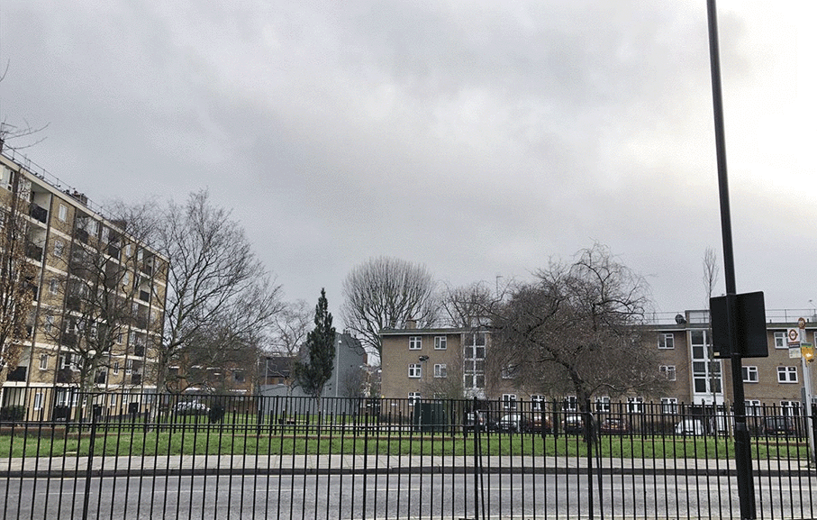
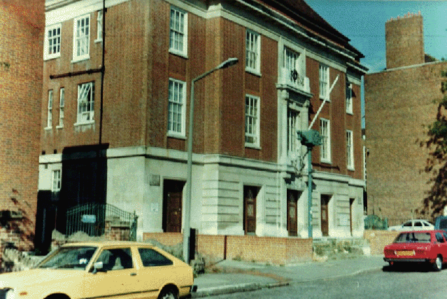
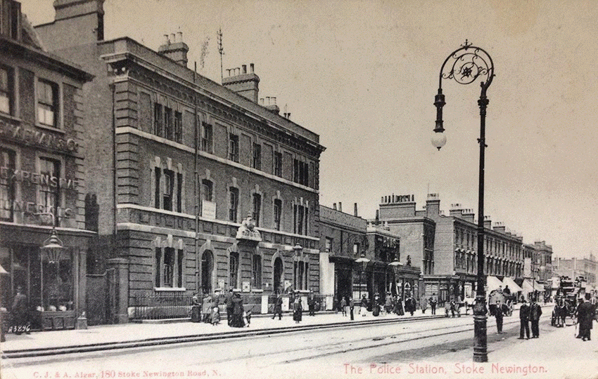
10. Stoke Newington Police Station
Stoke Newington’s Victorian Police Station (built 1868) next to the Victoria pub (1866-1996). The Police Station was rebuilt and enlarged in 1990.
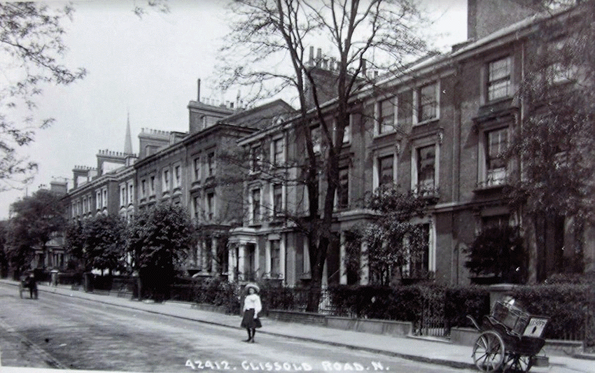
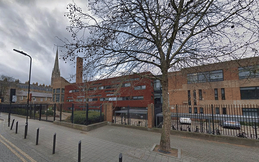
11. Clissold Road
Clissold Road. Built in the 1850s. The houses on the left were demolished in the late 1960’s to make way for Clissold Park School which is now known as Stoke Newington School & Sixth Form.
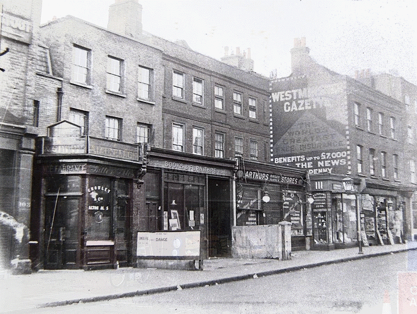
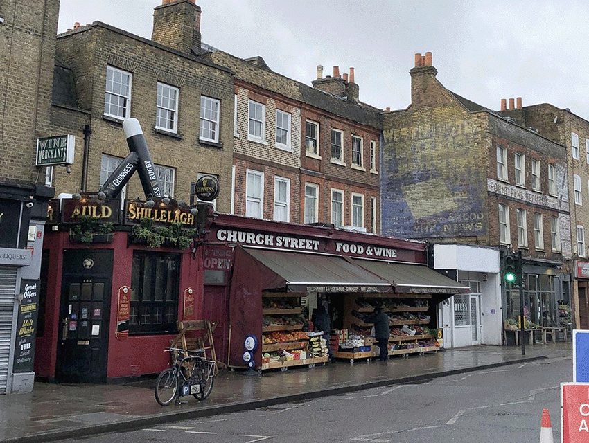
12. Stoke Newington Church Street
105-113 Stoke Newington Church St c.1920. William Ernest Farrance took over the beer shop at no. 105, which by the mid-1950s became a pub called The Horse and Groom. That was the name of the beer shop in the 1870s. Auld Shillelagh since 1991.
13. 109 Stoke Newington Church Street
109 Stoke Newington Church Street. The ground floor was converted to shops in the mid 19th century.
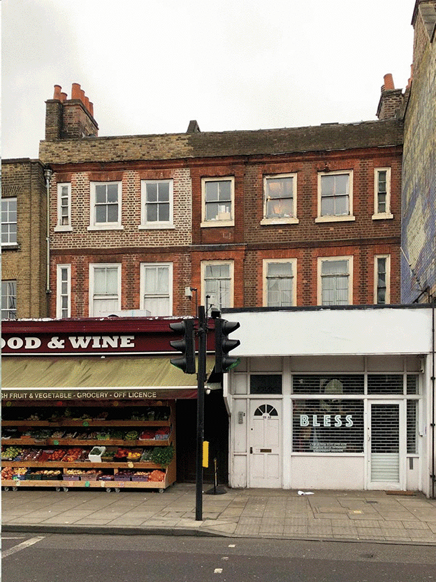
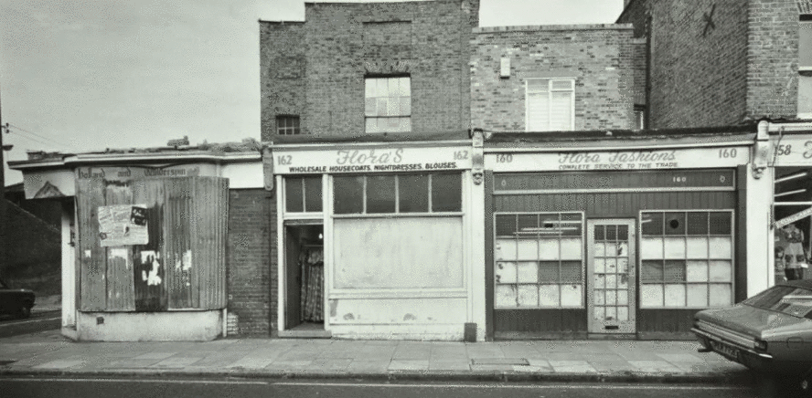
14. Stoke Newington Church Street
158-64 Stoke Newington Church St in 1973.
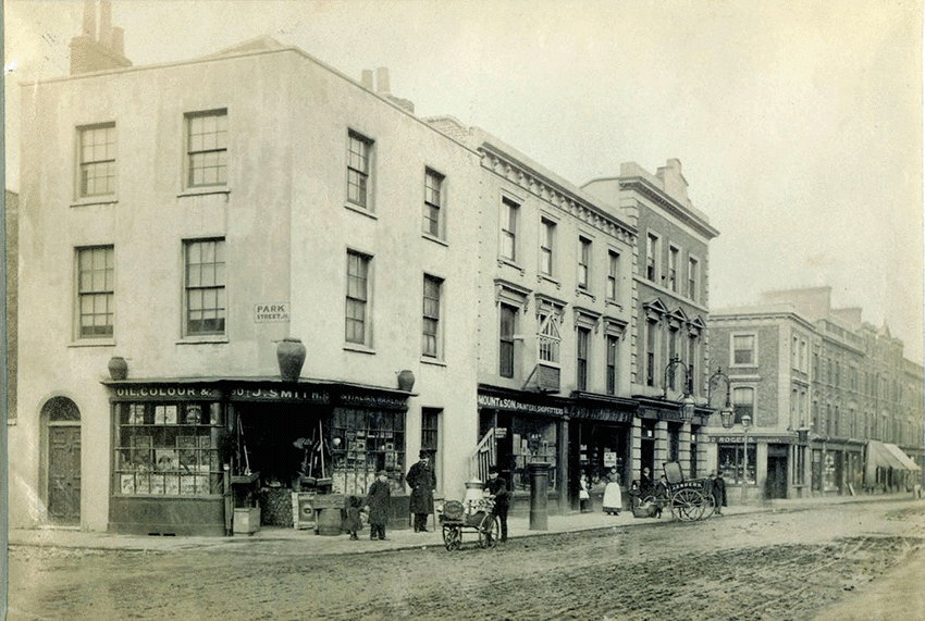
15. Stoke Newington Church Street
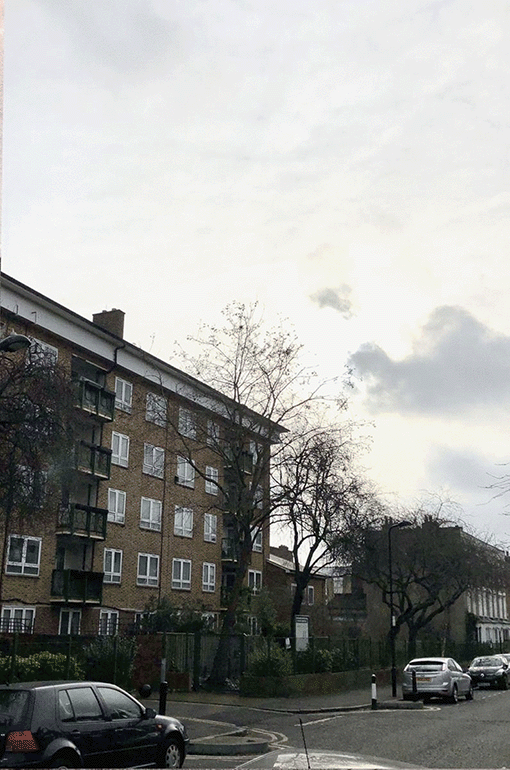
Stoke Newington Church St corner of Yoakley Road (formerly Park Street).
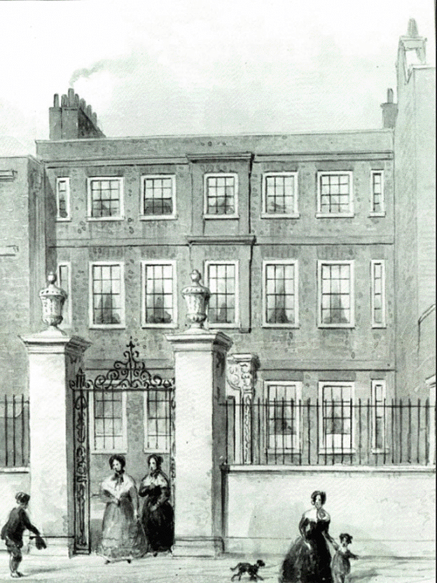
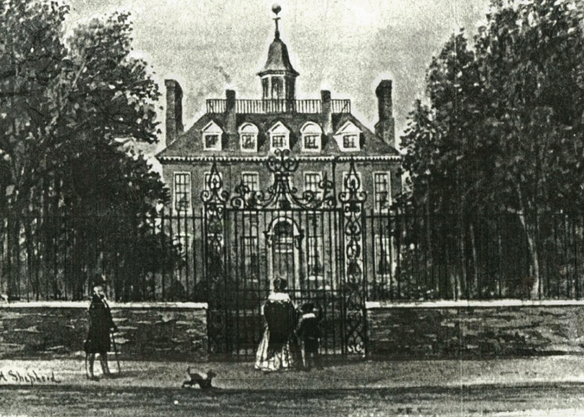
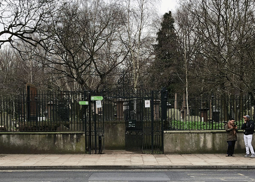
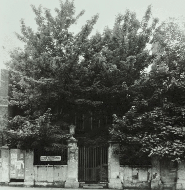
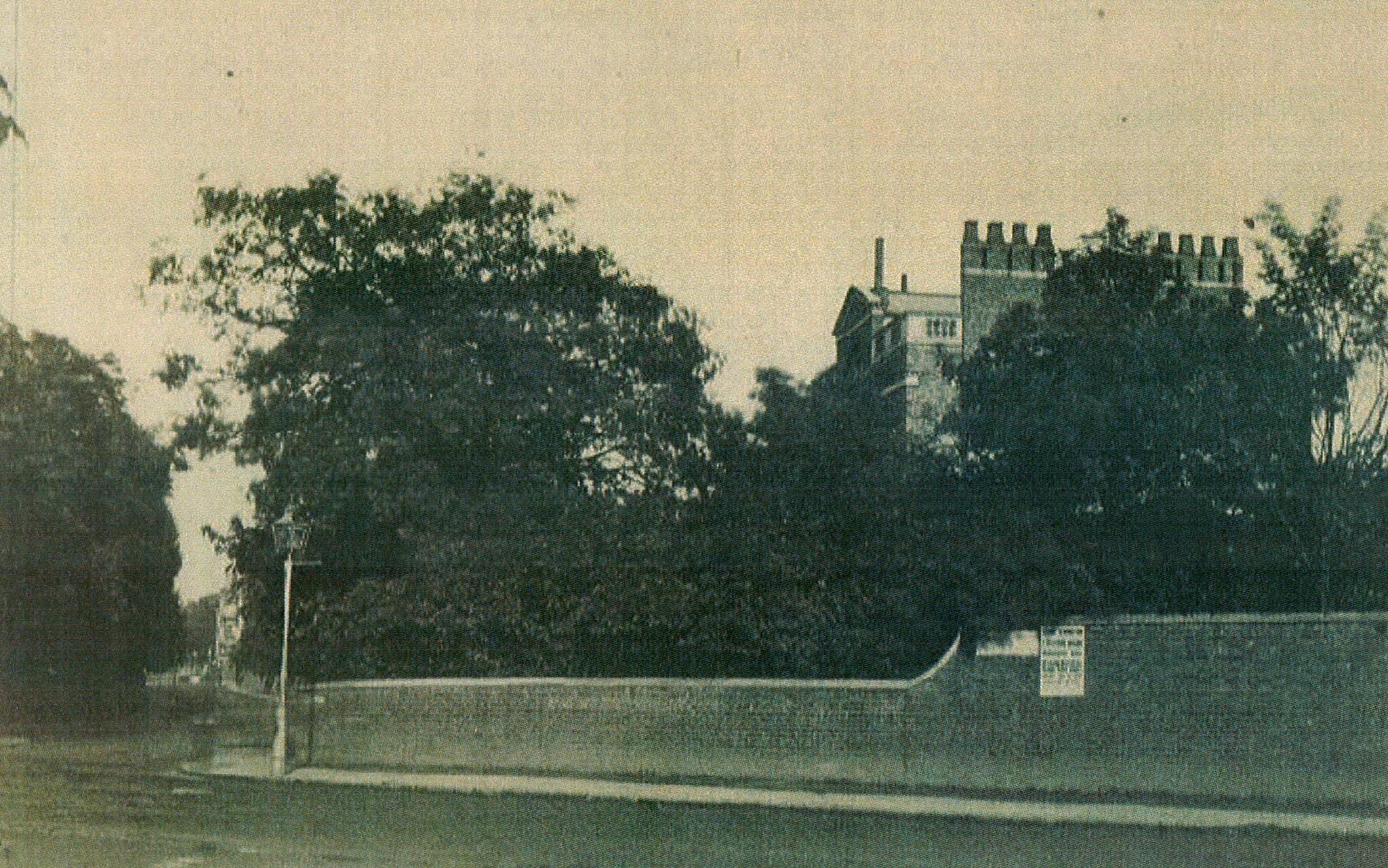
16. Abney House
An iron gateway is all that remains of Abney House (1700-1843). Once the grand manorial estate and home of Sir Thomas and Mary Lady Abney. It’s now the Church St entrance to Abney Park Cemetery.
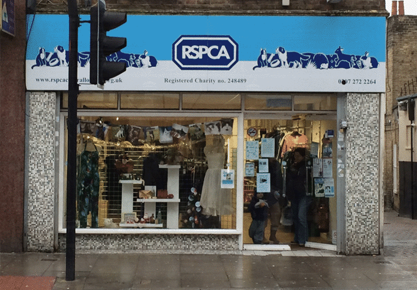
17. 180 Stoke Newington High Street
180 Stoke Newington High Street.
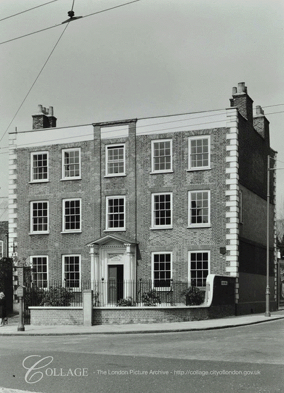
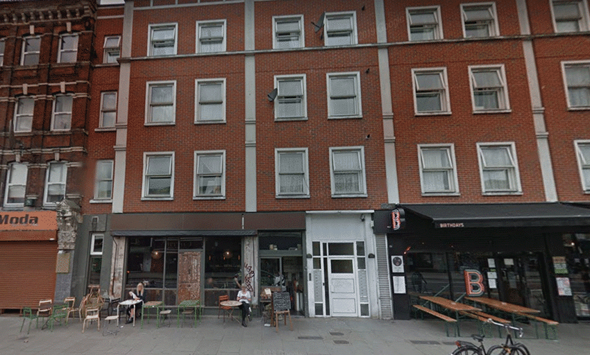
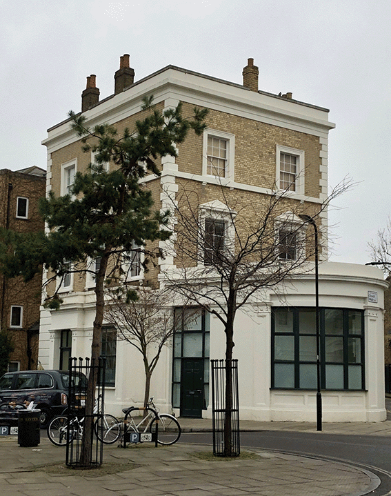
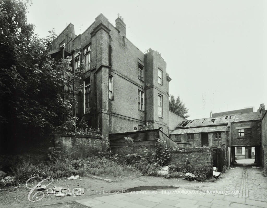
18. 187 Stoke Newington High Street
187 Stoke Newington High Street, built in 1714. It survived an attempt to demolish it in 1961 and stood derelict for 20 years before it was eventually demolished despite a local campaign to save it. It was rebuilt in 1983 with only the original facade surviving.
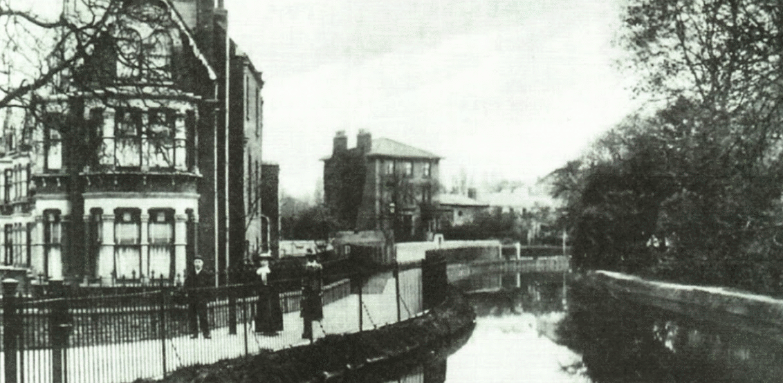
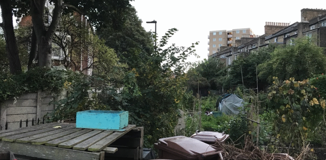
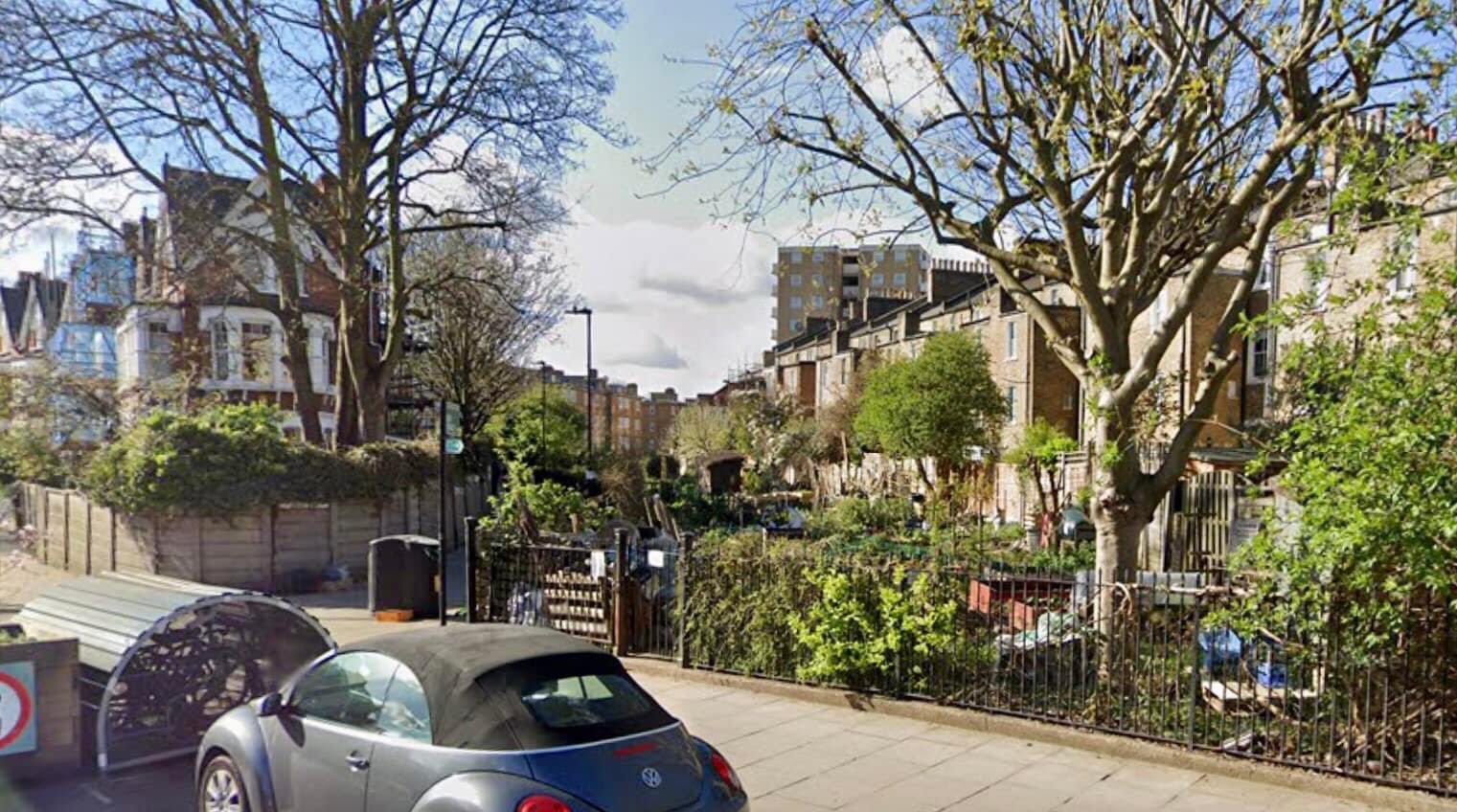
19. Aden Terrace
A view of Aden Terrace and the New River from Park Lane Bridge in Park Lane (later renamed Clissold Crescent). The bridge was demolished in 1931 when the road was widened. This section of the New River was filled in in 1947. The allotments were created that same year.
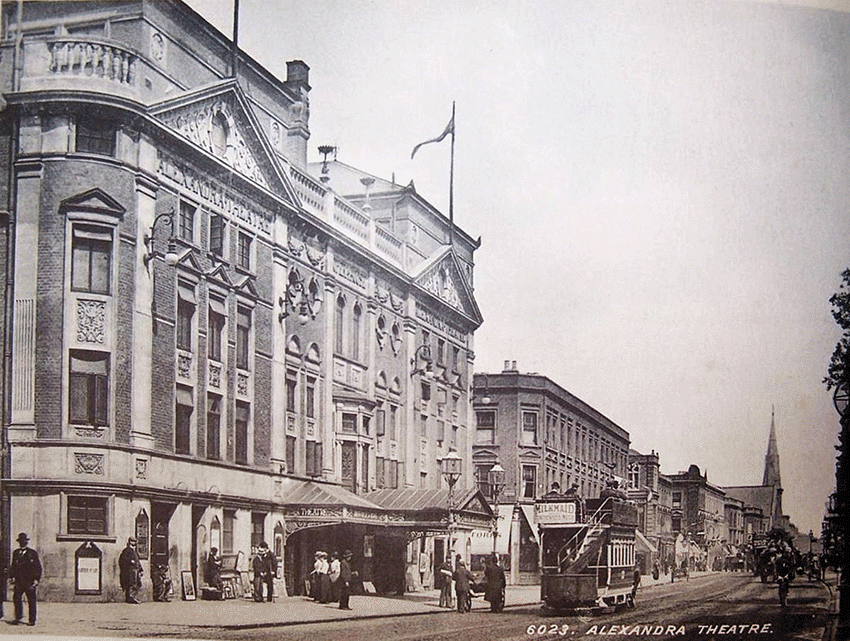
20. The Alexandra Theatre
The Alexandra Theatre, 65-7 Stoke Newington Rd. Designed by Frank Matcham (1854-1920). Built in 1897, closed in 1950, derelict till the early 1960s when it was pulled down and Alexandra Court housing block was built on the site.
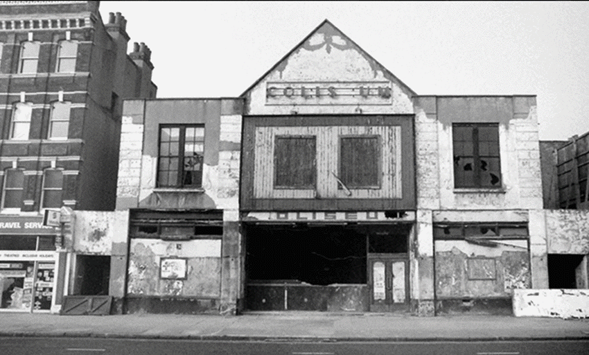
21. Coliseum Cinema
The Coliseum Cinema, 31 Stoke Newington Road. Opened 1913, closed 1972. Damaged by fire in 1992. Pulled down in 2001.
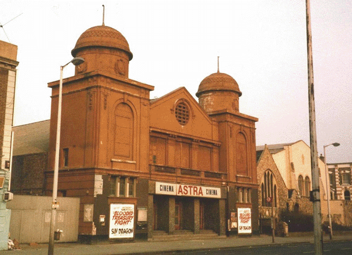
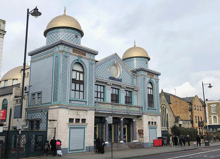
22. Astra Cinema
The former Astra Cinema (formerly Apollo Picture House, The Ambassador), 117 Stoke Newington Road. Opened 1913 closed 1983. Now Aziziye Mosque and Community Centre.
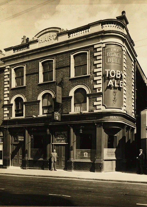
23. The Black Bull
The Black Bull pub, 192 Stoke Newington High Street.
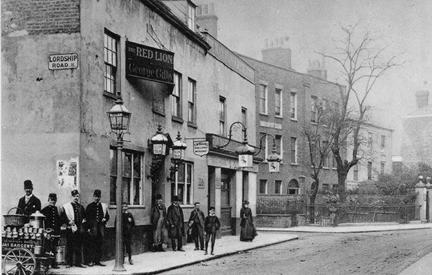
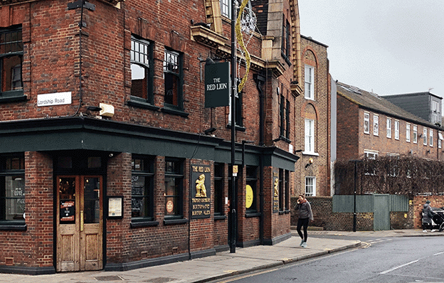
24. The Red Lion
The Red Lion in 1890. Originally two separate houses, the pub was first recorded in 1697. It was pulled down in 1924 and rebuilt when Lordship Road was widened.
25. The Albion
The Albion pub, 2 Clissold Road. Converted to residential property.
26. Church Row
Church Row (1695-1935), Stoke Newington Church Street. Built on the site of the Tudor Manor House, this row of 8 (originally 9) grand houses was pulled down in 1935 to make way for a new Town Hall and Reference Library. Stoke Newington’s 1st Town Hall was in Milton Grove.
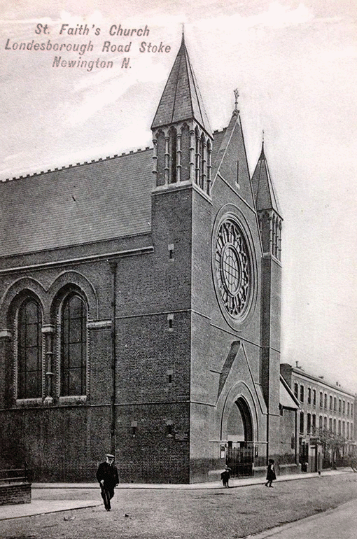
27. St. Faith’s Church
St Faith’s Church on the corner of Londesborough Rd and Knebworth Rd. It was severely damaged in WW2 and never rebuilt. St Faith Parish was merged with St Matthias in the 1950s along with All Saints Parish.
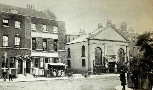
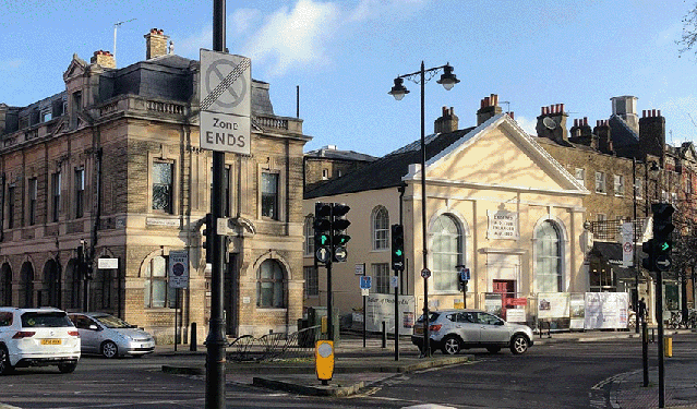
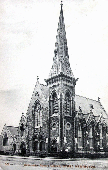
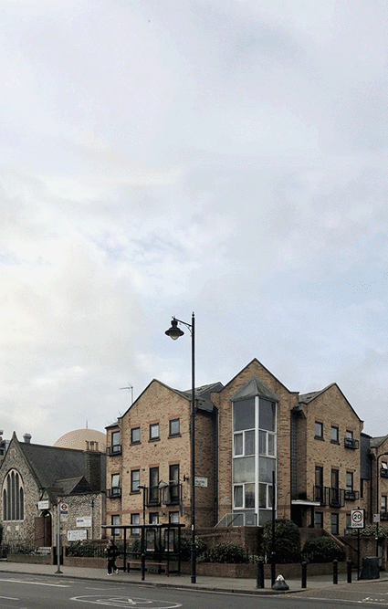
28. Devonshire Square Church
Devonshire Square Baptist Church, Stoke Newington Rd/Walford Rd. Damaged during WW2. The building was restored, though without the spire. New church was built and later demolished. Only the small section on the left remains today. Devonshire House was built on the main site.
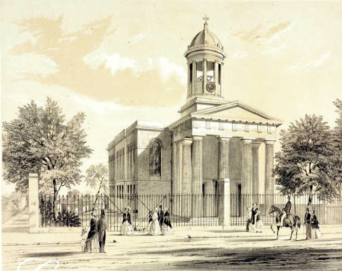
29. West Hackney Church
West Hackney Church, Stoke Newington Road/Amhurst Road. Built in 1824, this grand church was hit with high explosive bombs on 18/19th Sep 1940. A new church was built on the site c.1960.
30. Abney Chapel
Abney Church (originally Abney Independent/Congregational Chapel) was severely damaged in WW2. A new church building was built and in 2000 flats were built on the site.
31. Stoke Newington Road
Stoke Newington Road looking north. The Hare & Hounds pub on the left. Wellington Road on the right was cleared following bomb damage and Somerford Estate was built on the site.
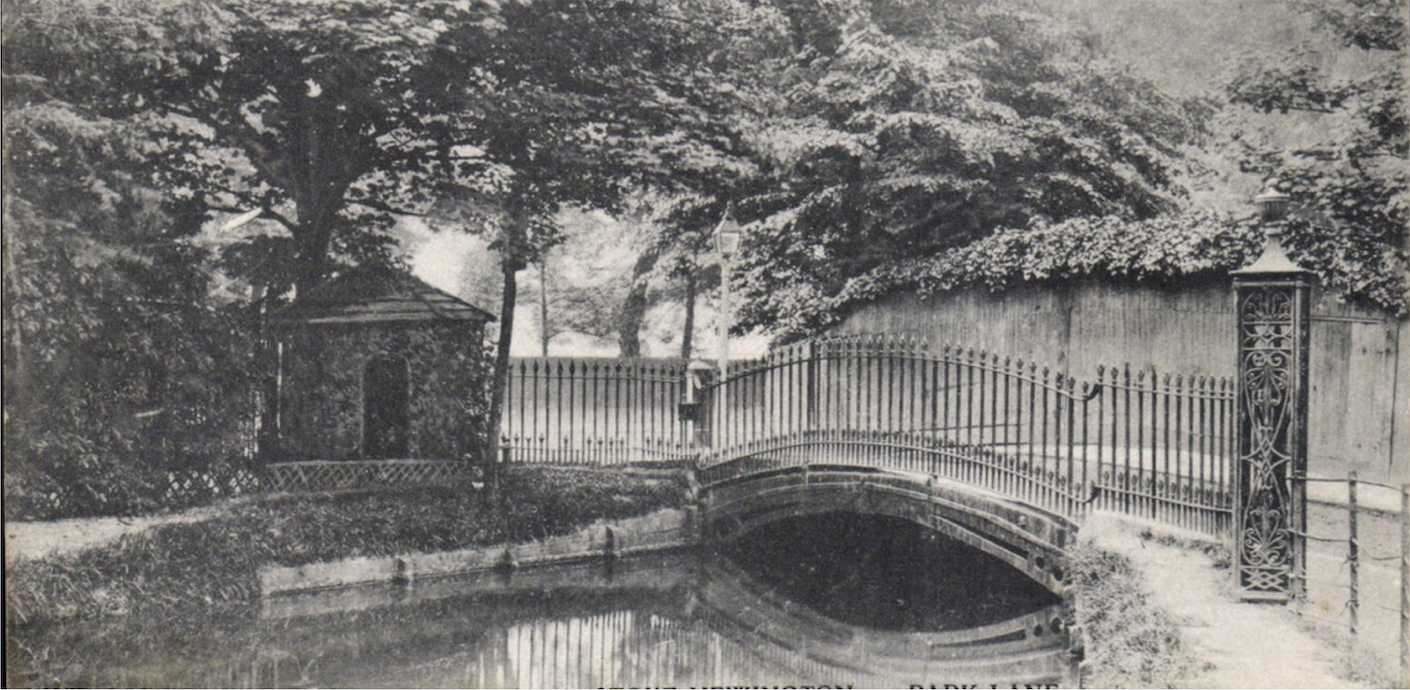
32. Park Lane Bridge
Park Lane Bridge over the New River. Now Clissold Crescent. The bridge was demolished in 1931 when the road was widened. The allotments were created in 1947 and then the man-made waterway (opened 1613) terminated in the park opposite Clissold Crescent. In 1958 it was drained and since then terminates in the East Reservoir.
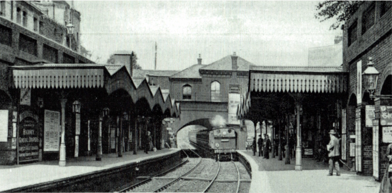
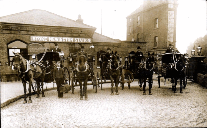
33. Stoke Newington Station
Stoke Newington Station. Opened 1872. The Victorian Ticket Office was demolished in 1975 and replaced with a D7 glass prefab model like many other stations across the country in the 1970s.
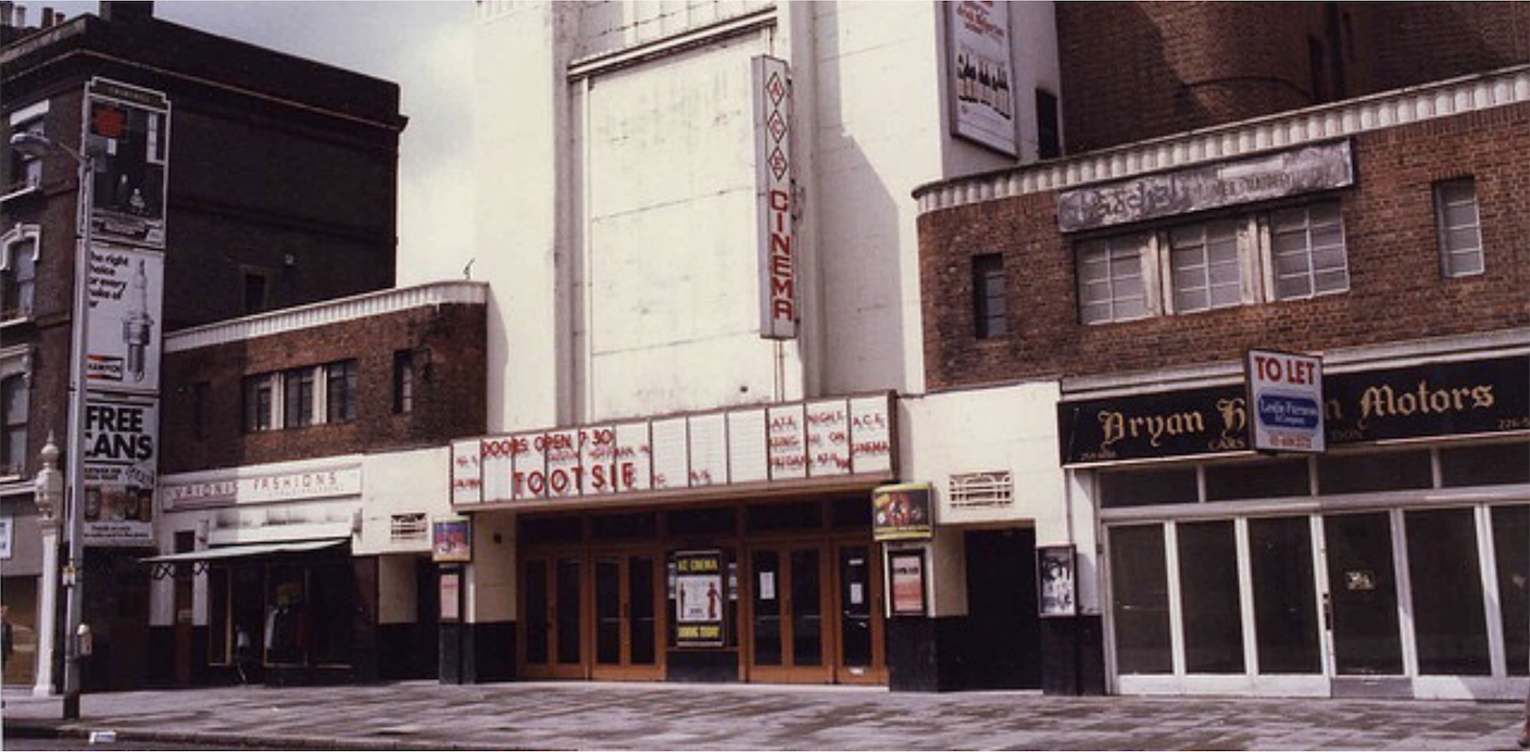
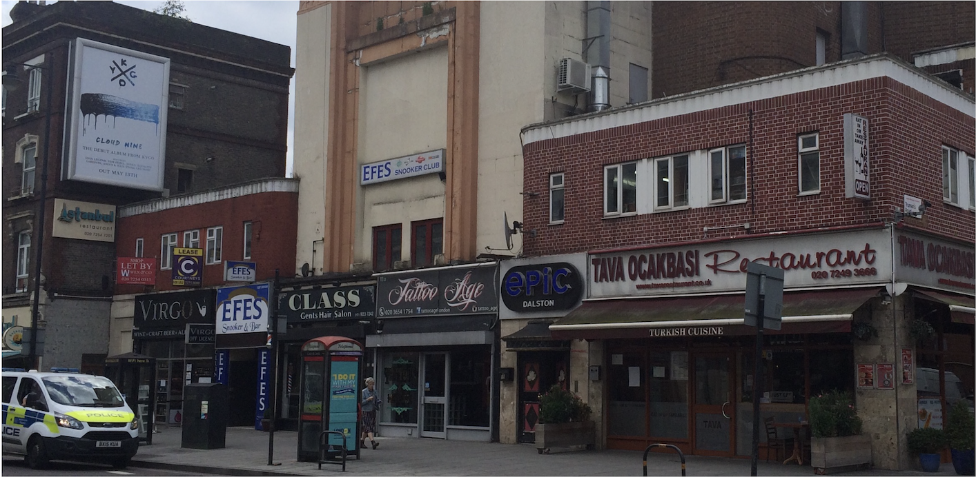
34. Savoy Cinema
Savoy Cinema (later ABC Cinema), 15 Stoke Newington Road. Years active 1936-84. Now EartH (Evolutionary Arts Hackney); ‘a multi-arts space’.
35. Wordsworth Road
Wordsworth Road in the 1970s. The buildings were demolished as part of the development of Butterfield Green in the late 70s-early 80s.
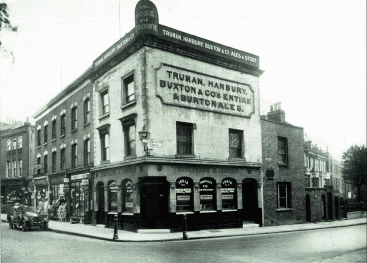
36. The Rose & Crown
The Rose & Crown, Stoke Newington Church Street. It was rebuilt across the street in 1931 when the junction was widened.
37. Stoke Newington Station
Stoke Newington Station. Opened 1872. The Victorian Ticket Office was demolished in 1975 and replaced with a D7 glass prefab model like many other stations across the country in the 1970s.
38. Park Lane Bridge
Park Lane Bridge over the New River. Now Clissold Crescent. The bridge was demolished in 1931 when the road was widened. The allotments were created in 1947 and then the man-made waterway (opened 1613) terminated in the park opposite Clissold Crescent. In 1958 it was drained and since then terminates in the East Reservoir.
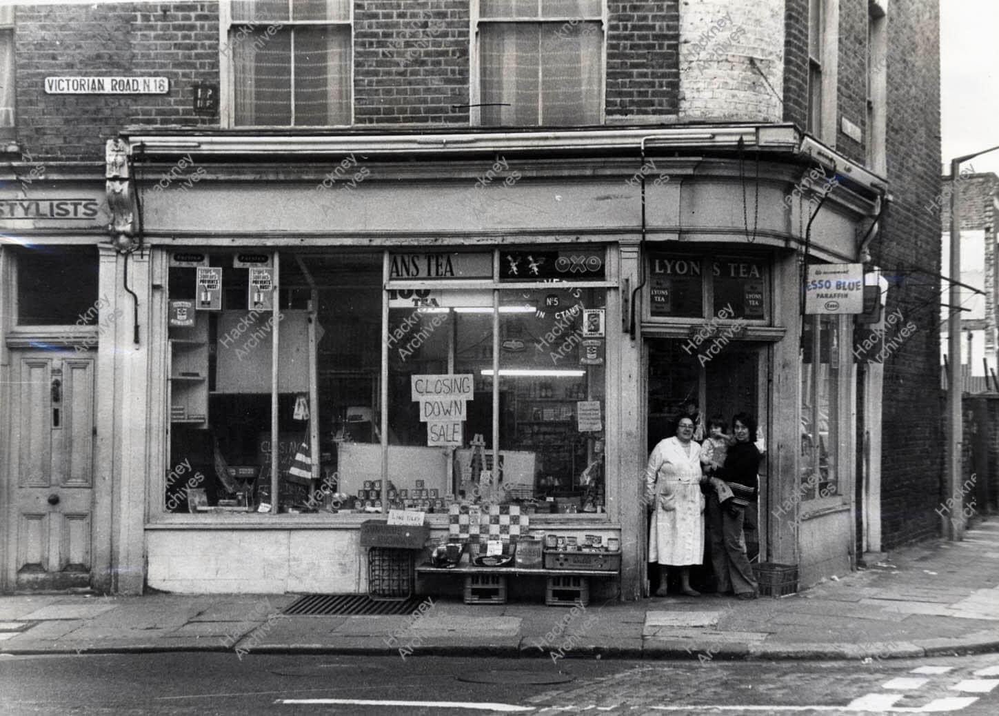
39. Victorian Road
Victorian Road (now Victorian Grove) corner of Nevill Road. The area was redeveloped in the 70s and Yorkshire Grove Estate was built on the site of streets that were cleared using Compulsory Purchase Orders.
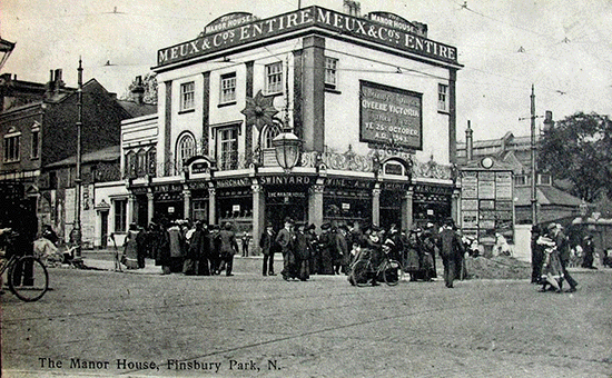
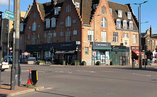
40. The Manor House Tavern
The Manor House Tavern in Green Lanes/Seven Sisters Road, Stoke Newington. It was rebuilt in 1931 (present building which was converted to shops and flats after the pub closed). In the 1960s acts including Cream, Fleetwood Mac, Jimi Hendrix, The Rolling Stones, the Yardbirds, the Animals and the Spencer Davis Group played upstairs in the Down Beat Club.
41. Manor House School
The Manor House School, which occupied the site where 176-82 Stoke Newington Church St are now. The school was run by Rev. John Bransby and attended by a young Edgar Allan Poe. It was pulled down in 1880.
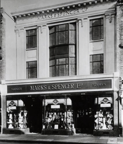
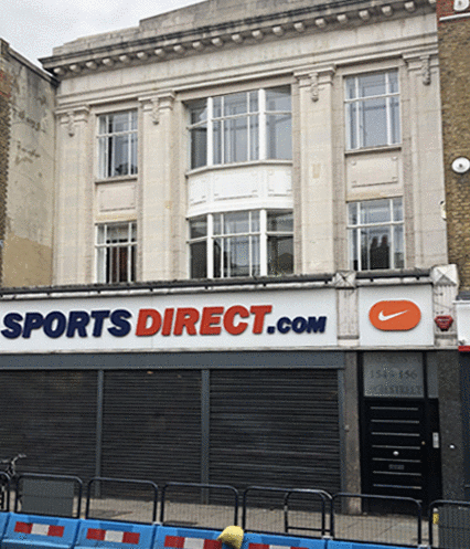
42. Marks & Spencer
Marks & Spencer, 156 Stoke Newington High St (1914-1972). Now Sports Direct.
43. Stoke Newington Church Street
Glebe Place, four semi-detached houses, numbered 1 to 4, stood on Church Street near Clissold Road facing the park. Their back gardens reached Clissold Swimming Bath, where the Leisure Centre is now. Clissold Estate was built on the site in the 30s by the London County Council.
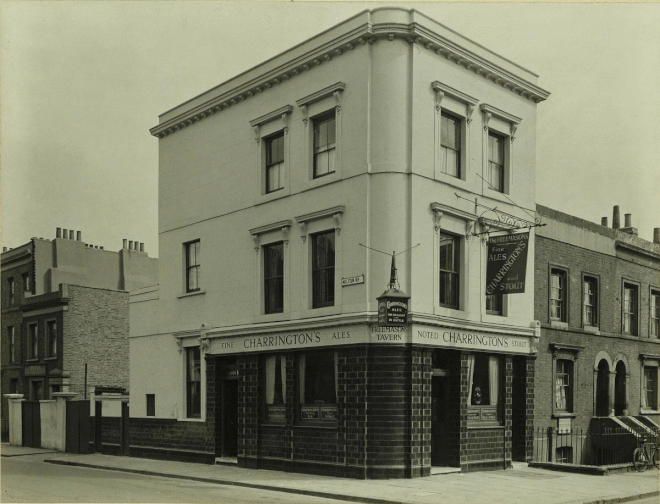
44. The Freemasons Tavern
The Freemasons Tavern at 61 Howard Road/Milton Grove. One of 4 Public Houses in the street together with the Howard Arms (no. 21), Ebor Arms (no. 75), Freeholders Arms (no. 28). There was also the Captain Cook Beerhouse at no. 37.
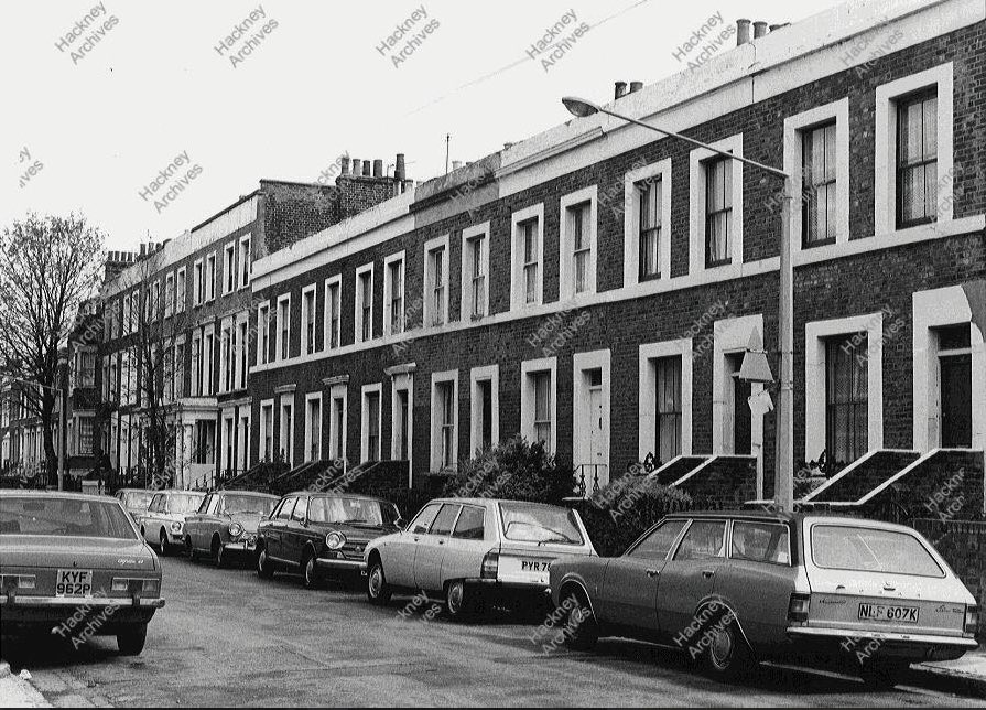
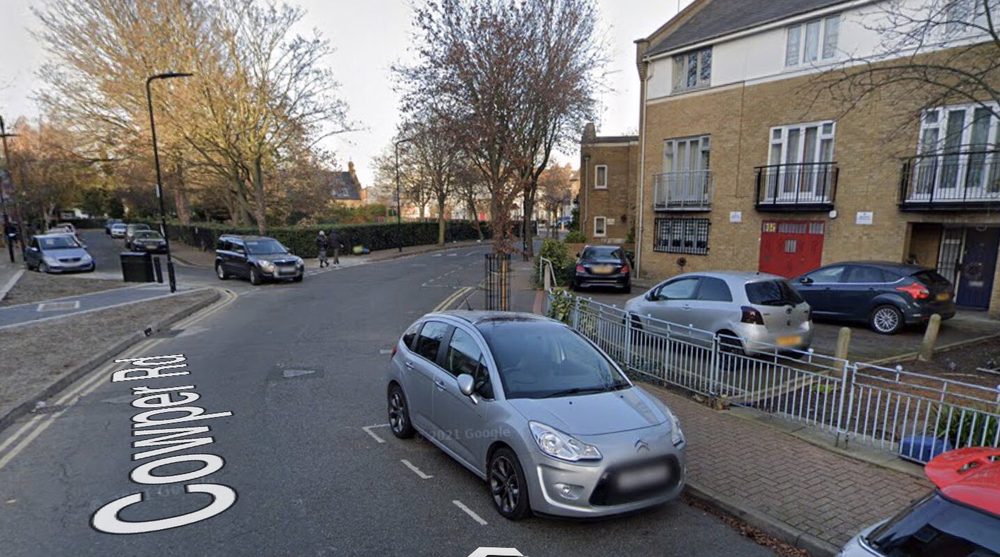
45. Cowper Road
Cowper Rd, built in the 1850s as part of the Albert Town development in Hornsey Detached in south Stoke Newington. It used to connect Allen Rd and Matthias Rd. The west side (left) redeveloped circa 1970 and the east side circa 1980 when Butterfield Green was created.
46. 185-187 Stoke Newington High Street
Rear elevation of 185-187 Stoke Newington High St in the late 1970s. The site was redeveloped in 1983.
47. Wordsworth Road
Wordsworth Terrace (1-7, 8-14 Wordsworth Road) where Butterfield Green Playground is today. Built c. 1850. Demolished c. 1980 along with close to 300 houses in the nearby streets to make way for a new public park.
48. Cowper Road
East side of Cowper Road. It was demolished in the late 70s and early 80s as part of the development of Butterfield Green, which also resulted in the creation of Bennett Road; a very short stretch that connected Cowper Rd and Wordsworth Rd.
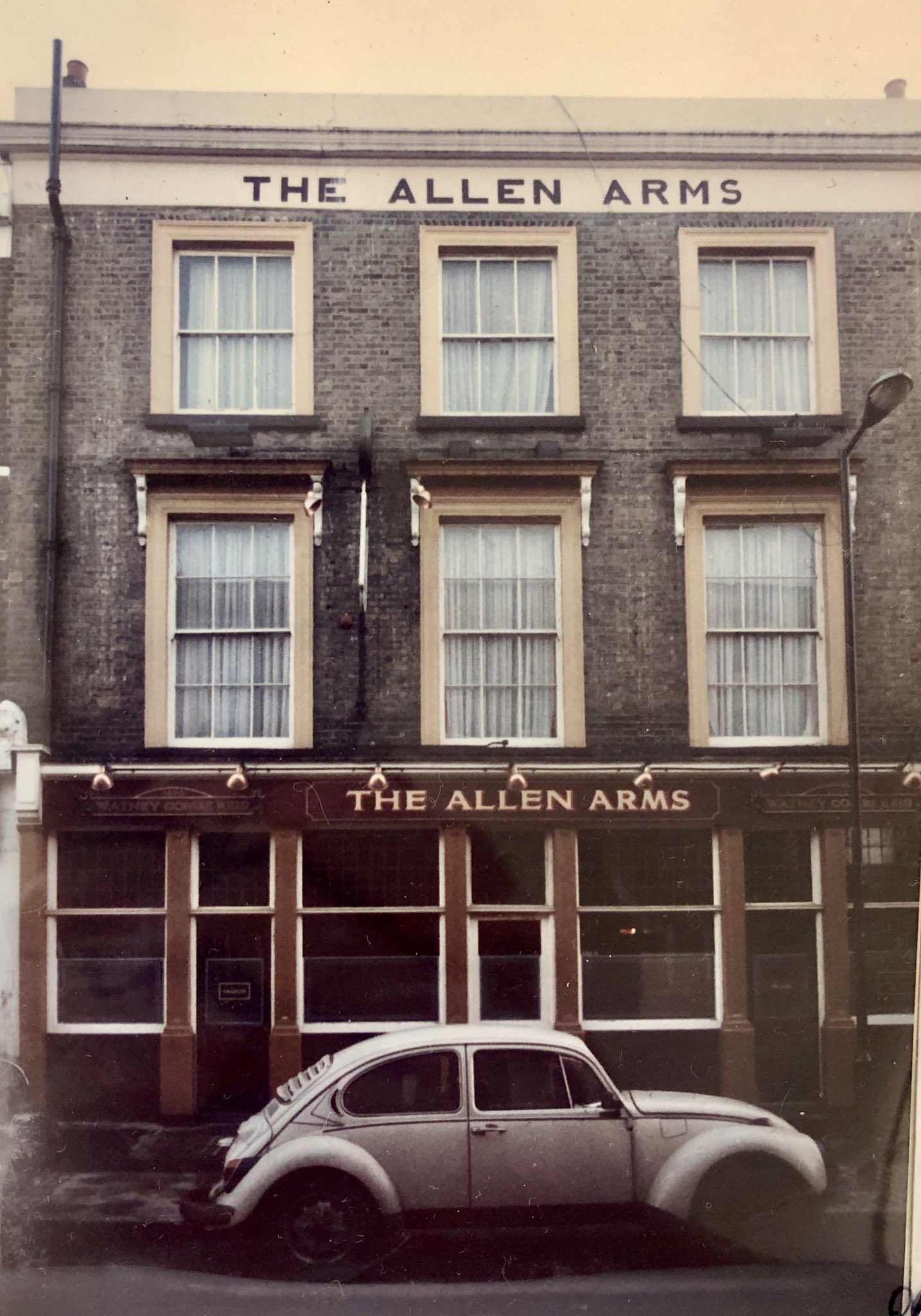
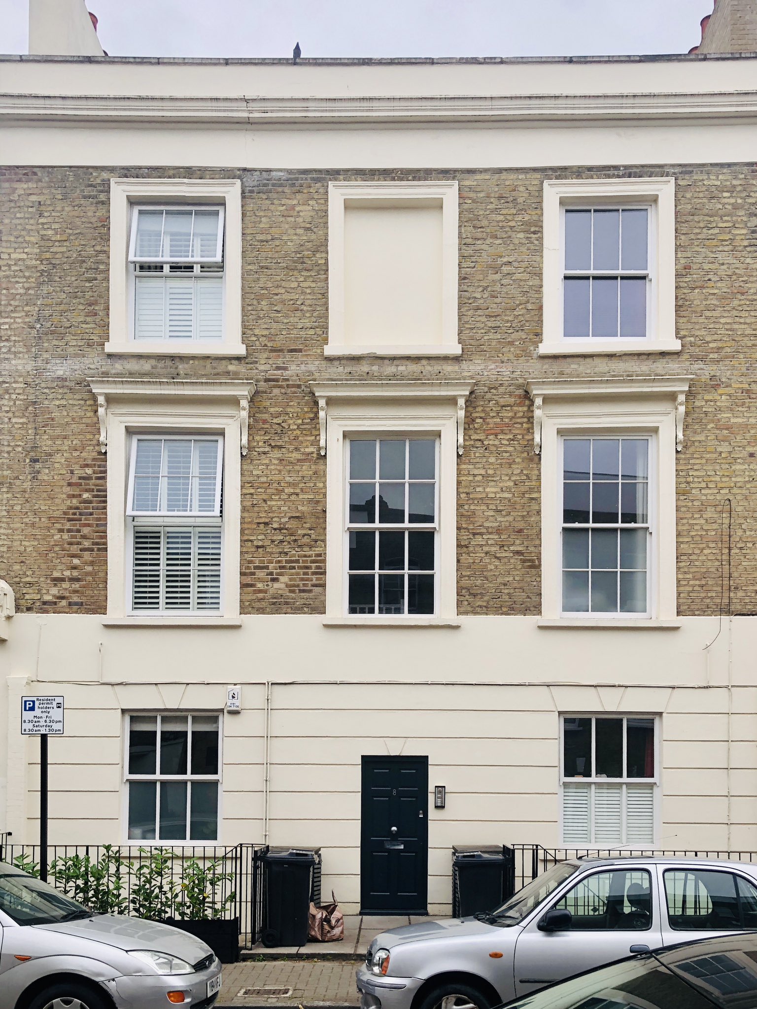
49. The Allen Arms
The Allen Arms, 8 Allen Road next to Butterfield Green. Converted to residential property.
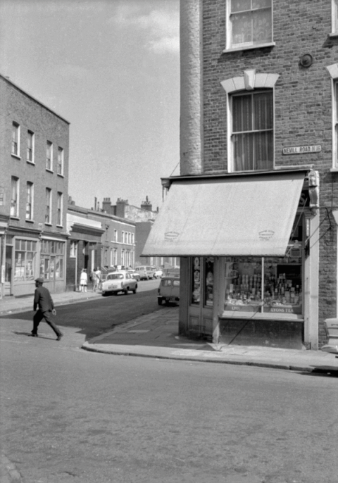
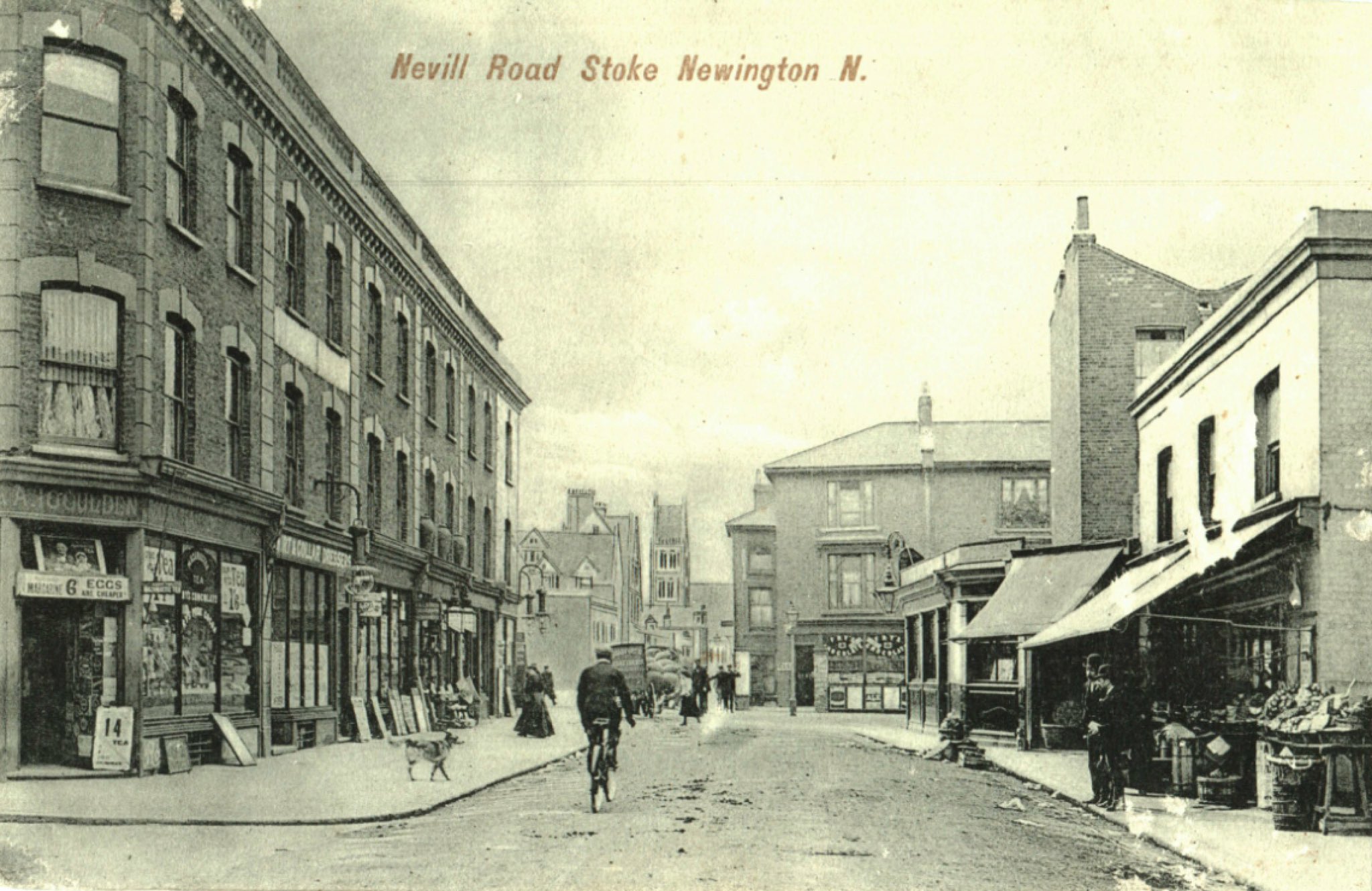
50. Nevill Road
Nevill Road/Brighton Road
51. Victorian Road
Victorian Road (now Victorian Grove) corner of Nevill Road. The area was redeveloped in the 70s and Yorkshire Grove Estate was built on the site of streets that were cleared using Compulsory Purchase Orders.
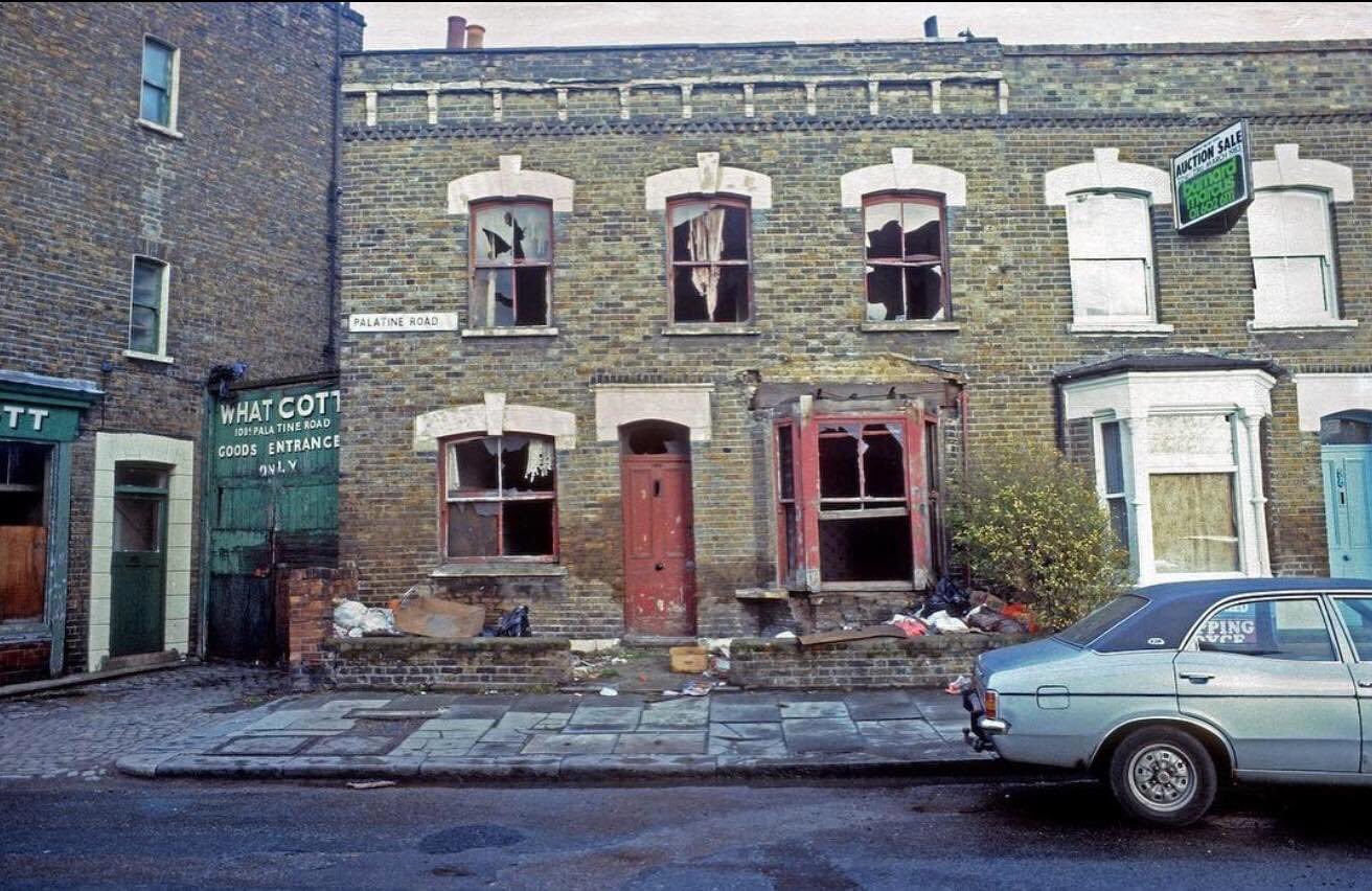
52. Palatine Road
Palatine Road/Nevill Road
53. Aden Terrace
A view from Clissold Crescent of Aden Terrace. The house on the left still stands. The road was widened from one lane in 1931, resulting in the demolition of Park Lane Bridge. This section of the New River was drained in 1946. The allotments opened the following year.
54. Newington Hall
Newington Hall (1821-75) in Stoke Newington Church St/Green Lanes. The grand detached house was demolished to build Statham Grove and two terraces in Church St and Green Lanes, originally named Clissold Park Villas and Newington Hall Villas.
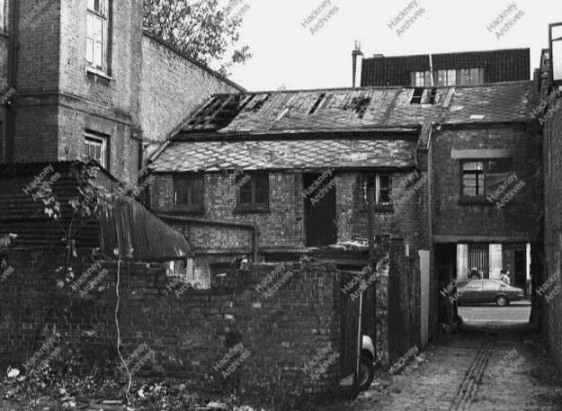
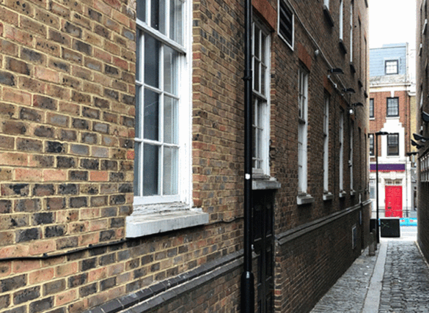
55. 185-187 Stoke Newington High Street
Rear elevation of 187 Stoke Newington High St with the narrow driveway to Aldam Place; a cul-de-sac of 9 small cottages where the carpark is today. The original no. 187 was built in 1712 and demolished in 1983 after it was derelict.
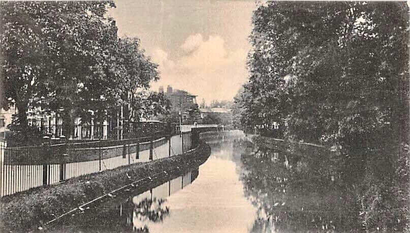
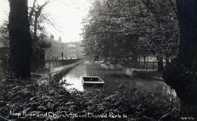
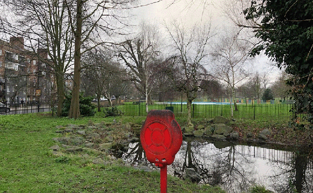
56. The New River
The New River in Clissold Park running along Church Street towards Islington all the way from Hertfordshire. This section was filled in in 1958. It now ends in the East Reservoir. The section in the park is now an ornamental crescent pond.
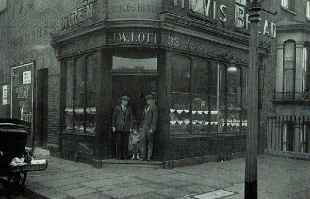
57. Nevill Road
1929 – John Wesley Lotts bakery, 33 Nevill Road. One of 20 shops along the street that were converted to flats over the years.
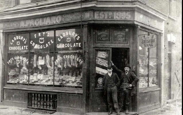
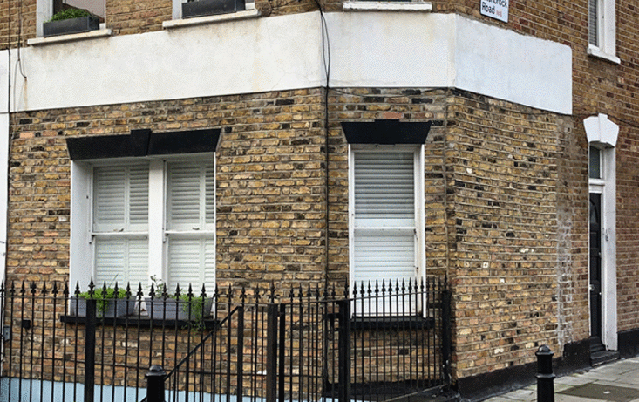
58. Nevill Road
A. Pagliaro 11 Nevill Road. One of 20 shops along the street that were converted to flats over the years.
59. Shakspeare Walk
Shakspeare Walk in the 1970s before the development of Butterfield Green in the late 1970s and early 1980s